 |
|
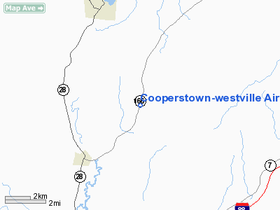
Cooperstown-westville Airport |
| Cooperstown-Westville Airport |
| IATA: COP – ICAO: none – FAA LID: K23 |
| Summary |
| Airport type |
Public |
| Owner |
Rick Williams |
| Serves |
Cooperstown, New York |
| Elevation AMSL |
1,260 ft / 384 m |
| Coordinates |
42°37′45″N 074°53′28″W / 42.62917°N 74.89111°W / 42.62917; -74.89111 |
| Runways |
| Direction |
Length |
Surface |
| ft |
m |
| 2/20 |
2,337 |
712 |
Turf |
| Statistics (2008) |
| Aircraft operations |
11,470 |
| Based aircraft |
22 |
| Source: Federal Aviation Administration |
Cooperstown-Westville Airport (IATA: COP, FAA LID: K23) is a privately-owned, public-use airport located four nautical miles (7 km) southeast of the central business district of Cooperstown, in Otsego County, New York, United States. This article does not refer to the Cooperstown airport with two paved strips 1.5 miles northwest of Cooperstown proper that closed in the 1960s.
Facilities and aircraft
Cooperstown-Westville Airport covers an area of 15 acres (6 ha) at an elevation of 1,260 feet (384 m) above mean sea level. It has one runway designated 2/20 with a 2,337 by 125 ft (712 x 38 m) turf surface.
For the 12-month period ending February 23, 2008, the airport had 11,470 aircraft operations, an average of 31 per day: 98% general aviation and 2% military. At that time there were 22 aircraft based at this airport: 95% single-engine and 5% multi-engine.
The above content comes from Wikipedia and is published under free licenses – click here to read more.
Location & QuickFacts
| FAA Information Effective: | 2008-09-25 |
| Airport Identifier: | K23 |
| Airport Status: | Operational |
| Longitude/Latitude: | 074-53-27.5560W/42-37-45.2730N
-74.890988/42.629242 (Estimated) |
| Elevation: | 1260 ft / 384.05 m (Estimated) |
| Land: | 15 acres |
| From nearest city: | 4 nautical miles SE of Cooperstown, NY |
| Location: | Otsego County, NY |
| Magnetic Variation: | 13W (1985) |
Owner & Manager
| Ownership: | Privately owned |
| Owner: | Rick Williams |
| Address: | Bodee Aviation, Llc, Po Box 1285
Murphys, CA 95247 |
| Phone number: | 209-728-3767
209-728-5563. |
| Manager: | Rick Williams |
| Address: | Bodee Aviation, Llc, Po Box 1285
Murphys, CA 95247 |
| Phone number: | 209-728-3767
209-728-5563. |
Airport Operations and Facilities
| Airport Use: | Open to public |
| Wind indicator: | Yes |
| Segmented Circle: | No |
| Control Tower: | No |
| Lighting Schedule: | RDO-CTL
ACTVT MIRL RY 02/20 - CTAF. |
| Landing fee charge: | No |
| Sectional chart: | New York |
| Region: | AEA - Eastern |
| Traffic Pattern Alt: | 805 ft |
| Boundary ARTCC: | ZBW - Boston |
| Tie-in FSS: | BUF - Buffalo |
| FSS on Airport: | No |
| FSS Toll Free: | 1-800-WX-BRIEF |
| NOTAMs Facility: | BUF (NOTAM-d service avaliable) |
Airport Communications
| CTAF: | 122.800 |
| Unicom: | 122.800 |
Airport Services
| Fuel available: | 100LL
87 OCTANE ALSO AVBL. SELF SERVICE FUELING AVBL. |
| Airframe Repair: | MAJOR |
| Power Plant Repair: | MAJOR |
| Bottled Oxygen: | NONE |
| Bulk Oxygen: | NONE |
Runway Information
Runway 02/20
| Dimension: | 2337 x 125 ft / 712.3 x 38.1 m
RUNWAY EDGE DENOTED BY WHITE TIRES AROUND EDGE LIGHTS |
| Surface: | TURF, Good Condition |
| Edge Lights: | Non-standard lighting system
NSTD MIRL; SPACING; 2 THLD LGTS EACH SIDE. |
| |
Runway 02 |
Runway 20 |
| Traffic Pattern: | Right | Left |
| VASI: | tri-color on left side | tri-color on left side |
| Obstruction: | 9 ft brush, 130 ft right of centerline | 86 ft tree, 1540.0 ft from runway, 295 ft right of centerline, 17:1 slope to clear |
|
Radio Navigation Aids
| ID |
Type |
Name |
Ch |
Freq |
Var |
Dist |
| CJY | NDB | Clay | | 275.00 | 12W | 30.3 nm |
| JJH | NDB | Johnstown | | 523.00 | 14W | 33.2 nm |
| BK | NDB | Plein | | 329.00 | 12W | 44.2 nm |
| HEU | NDB | Hunter | | 356.00 | 14W | 44.3 nm |
| GSS | TACAN | Griffiss | 057X | | 12W | 42.8 nm |
| RKA | VOR/DME | Rockdale | 073X | 112.60 | 11W | 18.3 nm |
| DNY | VOR/DME | De Lancey | 058X | 112.10 | 11W | 27.3 nm |
| HNK | VOR/DME | Hancock | 115X | 116.80 | 11W | 38.9 nm |
| UCA | VORTAC | Utica | 049X | 111.20 | 12W | 26.8 nm |
| GGT | VORTAC | Georgetown | 125X | 117.80 | 11W | 42.4 nm |
| ALB | VORTAC | Albany | 100X | 115.30 | 13W | 48.6 nm |
| ALB | VOT | Albany County | | 108.20 | | 47.7 nm |
Remarks
- RWY PROFILE FLAT EXCEPT FOR NORTHERN MOST 200' PLUS & RISES AT +2%.
Images and information placed above are from
http://www.airport-data.com/airport/K23/
We thank them for the data!
| General Info
|
| Country |
United States
|
| State |
NEW YORK
|
| FAA ID |
K23
|
| Latitude |
42-37-45.273N
|
| Longitude |
074-53-27.556W
|
| Elevation |
1260 feet
|
| Near City |
COOPERSTOWN
|
We don't guarantee the information is fresh and accurate. The data may
be wrong or outdated.
For more up-to-date information please refer to other sources.
|
|


