 |
|
| Columbia County Airport |
| IATA: HCC – ICAO: none – FAA LID: 1B1 |
| Summary |
| Airport type |
Public |
| Owner |
County of Columbia |
| Serves |
Hudson, New York |
| Elevation AMSL |
198 ft / 60 m |
| Coordinates |
42°17′29″N 073°42′37″W / 42.29139°N 73.71028°W / 42.29139; -73.71028 |
| Runways |
| Direction |
Length |
Surface |
| ft |
m |
| 3/21 |
5,350 |
1,631 |
Asphalt |
| Statistics (2007) |
| Aircraft operations |
19,200 |
| Based aircraft |
32 |
| Source: Federal Aviation Administration |
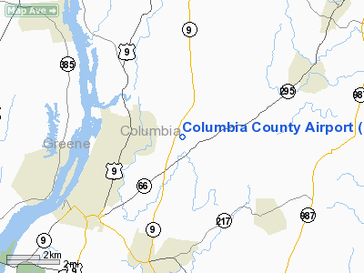
Columbia County Airport (IATA: HCC, FAA LID: 1B1) is a county-owned public use airport in Columbia County, New York, United States. The airport is located four nautical miles (7 km) northeast of the central business district of Hudson, New York. It is a small un-towered general aviation airport in the Hudson Valley.
Facilities and aircraft
Columbia County Airport covers an area of 260 acres (105 ha) at an elevation of 198 feet (60 m) above mean sea level. It has one asphalt paved runway designated 3/21 which measures 5,350 by 100 feet (1,631 x 30 m).
Final approach for runway for runway 21 is directly over a golf course immediately to the north, and pilots should take on arrival and departure to avoid golfers. There has been at least one incident of a golfer intentionally hitting a landing aircraft with a golf ball. Departure path for runway 3 takes the pilot over homes. Pilots should be mindful of noise, especially at night. There is a police shooting range approximately 1 mile to the east, so gunshot sounds are not uncommon.
For the 12-month period ending June 29, 2007, the airport had 19,200 aircraft operations, an average of 52 per day: 78% general aviation, 21% air taxi and 1% military. At that time there were 32 aircraft based at this airport: 81% single-engine, 16% multi-engine and 3% jet.
The above content comes from Wikipedia and is published under free licenses – click here to read more.
Location & QuickFacts
| FAA Information Effective: | 2008-09-25 |
| Airport Identifier: | 1B1 |
| Airport Status: | Operational |
| Longitude/Latitude: | 073-42-37.2000W/42-17-28.7000N
-73.710333/42.291306 (Estimated) |
| Elevation: | 198 ft / 60.35 m (Surveyed) |
| Land: | 260 acres |
| From nearest city: | 4 nautical miles NE of Hudson, NY |
| Location: | Columbia County, NY |
| Magnetic Variation: | 13W (1965) |
Owner & Manager
| Ownership: | Publicly owned |
| Owner: | County Of Columbia |
| Address: | Box 423
Hudson, NY 12534 |
| Phone number: | 518-828-9461 |
| Manager: | Anthony Orlich |
| Address: | Box 423
Hudson, NY 12534 |
| Phone number: | 518-828-0871 |
Airport Operations and Facilities
| Airport Use: | Open to public |
| Wind indicator: | Yes |
| Segmented Circle: | Yes |
| Control Tower: | No |
| Lighting Schedule: | DUSK-DAWN
ACTVT MIRL RY 03/21 & PAPI RY 03 - CTAF. |
| Beacon Color: | Clear-Green (lighted land airport) |
| Landing fee charge: | No |
| Sectional chart: | New York |
| Region: | AEA - Eastern |
| Boundary ARTCC: | ZBW - Boston |
| Tie-in FSS: | BTV - Burlington |
| FSS on Airport: | No |
| FSS Toll Free: | 1-800-WX-BRIEF |
| NOTAMs Facility: | BTV (NOTAM-d service avaliable) |
| Federal Agreements: | NGY |
Airport Communications
| CTAF: | 123.050 |
| Unicom: | 123.050 |
Airport Services
| Fuel available: | 100 A1+ |
| Airframe Repair: | MAJOR |
| Power Plant Repair: | MINOR |
| Bottled Oxygen: | HIGH |
| Bulk Oxygen: | HIGH |
Runway Information
Runway 03/21
| Dimension: | 5350 x 100 ft / 1630.7 x 30.5 m |
| Surface: | ASPH, Good Condition |
| Surface Treatment: | Saw-cut or plastic Grooved |
| Weight Limit: | Single wheel: 13000 lbs. |
| Edge Lights: | Medium |
| |
Runway 03 |
Runway 21 |
| Longitude: | 073-42-44.3149W | 073-42-30.0036W |
| Latitude: | 42-17-02.7795N | 42-17-54.5443N |
| Elevation: | 198.00 ft | 194.00 ft |
| Alignment: | 11 | 127 |
| Traffic Pattern: | Left | Left |
| Markings: | Non-precision instrument, Good Condition | Non-precision instrument, Good Condition |
| Crossing Height: | 44.00 ft | 0.00 ft |
| VASI: | 4-light PAPI on left side | |
| Visual Glide Angle: | 4.00° | 0.00° |
| Runway End Identifier: | Yes | No |
| Centerline Lights: | No | No |
| Touchdown Lights: | No | No |
| Obstruction: | 247 ft tree, 9200.0 ft from runway, 36:1 slope to clear | 66 ft tree, 429.0 ft from runway, 270 ft right of centerline, 3:1 slope to clear
+8 FT TREE 44 FT FM RY END & 140 FT L. |
|
Radio Navigation Aids
| ID |
Type |
Name |
Ch |
Freq |
Var |
Dist |
| GBR | FAN MARKER | Sheffield | | | 13W | 18.3 nm |
| PSF | FAN MARKER | Abyss | | | 13W | 24.2 nm |
| SKU | FAN MARKER | Stanwyck | | | 12W | 48.3 nm |
| PFH | NDB | Philmont | | 272.00 | 13W | 2.4 nm |
| GBR | NDB | Great Barrington | | 395.00 | 14W | 15.1 nm |
| DXT | NDB | Dalton | | 370.00 | 15W | 26.3 nm |
| HEU | NDB | Hunter | | 356.00 | 14W | 35.2 nm |
| PO | NDB | Meier | | 403.00 | 12W | 44.5 nm |
| SKU | NDB | Stanwyck | | 261.00 | 12W | 48.3 nm |
| PWL | VOR/DME | Pawling | 090X | 114.30 | 12W | 31.7 nm |
| CTR | VOR/DME | Chester | 098X | 115.10 | 13W | 33.8 nm |
| IGN | VOR/DME | Kingston | 123X | 117.60 | 12W | 37.9 nm |
| CAM | VOR/DME | Cambridge | 097X | 115.00 | 14W | 45.3 nm |
| ALB | VORTAC | Albany | 100X | 115.30 | 13W | 27.7 nm |
| BAF | VORTAC | Barnes | 077X | 113.00 | 14W | 44.9 nm |
| ALB | VOT | Albany County | | 108.20 | | 27.6 nm |
Images and information placed above are from
http://www.airport-data.com/airport/1B1/
We thank them for the data!
| General Info
|
| Country |
United States
|
| State |
NEW YORK
|
| FAA ID |
1B1
|
| Latitude |
42-17-28.700N
|
| Longitude |
073-42-37.200W
|
| Elevation |
198 feet
|
| Near City |
HUDSON
|
We don't guarantee the information is fresh and accurate. The data may
be wrong or outdated.
For more up-to-date information please refer to other sources.
|
|


