 |
|
| Clinton County Airport |
| IATA: PLB – ICAO: KPLB – FAA LID: PLB |
| Summary |
| Airport type |
Public |
| Operator |
Clinton County |
| Serves |
City of Plattsburgh, New York |
| Location |
Town of Plattsburgh, New York |
| Elevation AMSL |
371 ft / 113.1 m |
| Coordinates |
44°41′15″N 073°31′28″W / 44.6875°N 73.52444°W / 44.6875; -73.52444Coordinates: 44°41′15″N 073°31′28″W / 44.6875°N 73.52444°W / 44.6875; -73.52444 |
| Runways |
| Direction |
Length |
Surface |
| ft |
m |
| 1/19 |
5,000 |
1,524 |
Asphalt |
| 14/32 |
5,000 |
1,524 |
Asphalt |
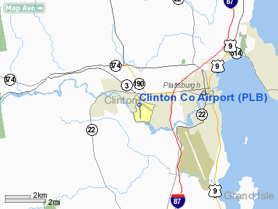
Clinton County Airport (IATA: PLB, ICAO: KPLB, FAA LID: PLB) is a public airport located in the Town of Plattsburgh, three miles (5 km) west of the central business district (CBD) of Plattsburgh, a city in Clinton County, New York, USA. It serves Plattsburgh and the western side of Lake Champlain. This county-owned airport covers 990 acres (401 ha) and has two runways.
The airport is now closed and all traffic transferred to KPBG, the former Plattsburgh Air Force Base.
As per Federal Aviation Administration records, the airport had 1,712 passenger boardings (enplanements) in calendar year 2004 and 1,747 enplanements in 2005. According to the FAA's National Plan of Integrated Airport Systems for 2007–2011, Clinton County is a general aviation airport because a commercial service classification requires at least 2,500 passenger boardings per year.
Clinton County transitioned to using the nearby Plattsburgh International Airport as the primary airport for the region on June 18, 2007, and Clinton Co. is now officially closed to itinerant aircraft, though it's still used for paradrops, and a few aircraft are still based there. Facilities
The primary instrument runway is runway 1-19. An instrument landing system is installed on the north-facing runway 1. Runway 1 is also equipped with a medium intensity approach lighting system. A VOR is located on the field and provides a non-precision instrument approach to runway 19. Both runway 1-19 and runway 14-32 are 5000 feet in length and 100 feet wide. The landing threshold to runway 19 is displaced 635 feet for landing due to trees north of the airport. A third runway oriented east-west existed during the 1980s, but it was abandoned.
The above content comes from Wikipedia and is published under free licenses – click here to read more.
Location & QuickFacts
| FAA Information Effective: | 2008-09-25 |
| Airport Identifier: | PLB |
| Airport Status: | Closed Permanently |
| Longitude/Latitude: | 073-31-28.2830W/44-41-15.0670N
-73.524523/44.687519 (Estimated) |
| Elevation: | 371 ft / 113.08 m (Surveyed) |
| Land: | 990 acres |
| From nearest city: | 3 nautical miles W of Plattsburgh, NY |
| Location: | Clinton County, NY |
| Magnetic Variation: | 15W (1980) |
Owner & Manager
| Ownership: | Publicly owned |
| Owner: | Clinton County |
| Address: | 137 Margaret St.
Plattsburgh, NY 12901 |
| Phone number: | 518-565-4600 |
| Manager: | Rodney L. Brown |
| Address: | 42 Airport Lane, Suite 201
Plattsburgh, NY 12901
AIRPORT MANAGER LOCATED AT PLATTSBURGH INT'L AIRPORT (PBG). |
| Phone number: | 518-565-4794 |
Airport Operations and Facilities
| Airport Use: | Open to public |
| Wind indicator: | Yes |
| Segmented Circle: | Yes |
| Control Tower: | No |
| Lighting Schedule: | DUSK-DAWN
ACTVT HIRL RY 01/19, MIRL RY 14/32, MALS RY 01, REIL RY 32, PAPI RY 32, & TWY LGTS - CTAF. |
| Beacon Color: | Clear-Green (lighted land airport) |
| Landing fee charge: | Yes |
| Sectional chart: | Montreal |
| Region: | AEA - Eastern |
| Boundary ARTCC: | ZBW - Boston |
| Tie-in FSS: | BTV - Burlington |
| FSS on Airport: | No |
| FSS Toll Free: | 1-800-WX-BRIEF |
| NOTAMs Facility: | PLB (NOTAM-d service avaliable) |
| Federal Agreements: | NGRY3 |
Airport Communications
| CTAF: | 122.700 |
| Unicom: | 122.700 |
Airport Services
| Fuel available: | 100LLA |
| Airframe Repair: | MAJOR |
| Power Plant Repair: | MAJOR |
| Bottled Oxygen: | NONE |
| Bulk Oxygen: | NONE |
Runway Information
Runway 01/19
| Dimension: | 5000 x 100 ft / 1524.0 x 30.5 m |
| Surface: | ASPH, Good Condition |
| Weight Limit: | Single wheel: 44000 lbs.
Dual wheel: 60000 lbs.
Dual tandem wheel: 88000 lbs. |
| Edge Lights: | High |
| |
Runway 01 |
Runway 19 |
| Longitude: | 073-31-32.9060W | 073-31-39.1230W |
| Latitude: | 44-40-47.7840N | 44-41-36.9550N |
| Elevation: | 346.00 ft | 366.00 ft |
| Alignment: | 127 | 127 |
| ILS Type: | ILS
| |
| Traffic Pattern: | Left | Right |
| Markings: | Precision instrument, Fair Condition | Precision instrument, Fair Condition |
| Crossing Height: | 0.00 ft | 63.00 ft |
| Displaced threshold: | 0.00 ft | 635.00 ft |
| VASI: | | 4-box on right side |
| Visual Glide Angle: | 0.00° | 3.50° |
| Approach lights: | MALS | |
| Obstruction: | 56 ft trees, 2662.0 ft from runway, 348 ft right of centerline, 43:1 slope to clear | 68 ft trees, 596.0 ft from runway, 348 ft right of centerline, 5:1 slope to clear
APCH RATIO 18:1 TO DSPLCD THLD.
RY 19 +3 FT GND 95 FT FM AER 425 FT RIGHT. |
| Decleard distances: | Take off run available 5000.00 ft
Take off distance available 5000.00 ft
Actual stop distance available 5000.00 ft
Landing distance available 5000.00 ft
| Take off run available 5000.00 ft
Take off distance available 5000.00 ft
Actual stop distance available 5000.00 ft
Landing distance available 4365.00 ft
|
|
Runway 14/32
| Dimension: | 5000 x 100 ft / 1524.0 x 30.5 m |
| Surface: | ASPH, Good Condition |
| Weight Limit: | Single wheel: 30000 lbs. |
| Edge Lights: | Medium |
| |
Runway 14 |
Runway 32 |
| Longitude: | 073-31-47.1360W | 073-30-53.9730W |
| Latitude: | 44-41-33.5680N | 44-41-01.9600N |
| Elevation: | 371.00 ft | 328.00 ft |
| Alignment: | 127 | 127 |
| Traffic Pattern: | Right | Left |
| Markings: | Non-precision instrument, Good Condition | Non-precision instrument, Good Condition |
| Crossing Height: | 0.00 ft | 33.00 ft |
| VASI: | | 4-light PAPI on left side |
| Visual Glide Angle: | 0.00° | 3.00° |
| Runway End Identifier: | | Yes |
| Obstruction: | 3 ft gnd, 215.0 ft from runway, 160 ft left of centerline, 5:1 slope to clear | 21 ft trees, 247.0 ft from runway, 215 ft right of centerline, 2:1 slope to clear |
| Decleard distances: | Take off run available 5000.00 ft
Take off distance available 5000.00 ft
Actual stop distance available 5000.00 ft
Landing distance available 5000.00 ft
| Take off run available 5000.00 ft
Take off distance available 5000.00 ft
Actual stop distance available 5000.00 ft
Landing distance available 5000.00 ft
|
|
Radio Navigation Aids
| ID |
Type |
Name |
Ch |
Freq |
Var |
Dist |
| MPV | FAN MARKER | Brook | | | | 43.3 nm |
| VKN | NDB | Mount Mansfield | | 268.00 | 16W | 39.9 nm |
| JRV | NDB | Morrisville/stowe | | 375.00 | 16W | 40.6 nm |
| JL | NDB | Cote St Luc | | 370.00 | 16W | 47.2 nm |
| U | NDB | Uniform | | 201.00 | 15W | 47.3 nm |
| UL | NDB | Montreal | | 248.00 | 16W | 48.4 nm |
| SLK | VOR/DME | Saranac Lake | 029X | 109.20 | 14W | 34.4 nm |
| PLB | VORTAC | Plattsburgh | 116X | 116.90 | 15W | 0.2 nm |
| BTV | VORTAC | Burlington | 122X | 117.50 | 15W | 22.8 nm |
| YJN | VORTAC | St Jean | 105X | 115.80 | 16W | 35.2 nm |
| BTV | VOT | Burlington Intl | | 109.00 | | 20.8 nm |
Remarks
- TPA FOR LIGHT ACFT 800 FT AGL. TPA FOR TURBINE POWERED ACFT 1500 FT AGL.
- RY 19 - 5 DEG APCH SLOPE REQUIRED TO CLEAR TREES TO LANDING THR.
- DURG PERIODS OF SNOW REMOVAL OPNS NOV 1 - MAY 1 ACFT MUST CTC ARPT ON 122.7 10 MINS PRIOR TO LNDG.
- ARPT CLSD TO ACR & TSNT ACFT.
- ACFT PROHIBITED FM TAXIING ON VEHICLE ACCESS ROAD INTERSECTING WITH RY 14/32 E OF TWY C.
- (ARPT STATUS) ARPT CLSD PERMLY.
Images and information placed above are from
http://www.airport-data.com/airport/PLB/
We thank them for the data!
| General Info
|
| Country |
United States
|
| State |
NEW YORK
|
| FAA ID |
PLB
|
| Latitude |
44-41-15.067N
|
| Longitude |
073-31-28.283W
|
| Elevation |
371 feet
|
| Near City |
PLATTSBURGH
|
We don't guarantee the information is fresh and accurate. The data may
be wrong or outdated.
For more up-to-date information please refer to other sources.
|
|


