 |
|
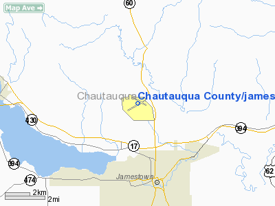
Chautauqua County/jamestown Airport |
| Chautauqua County-Jamestown Airport |
| IATA: JHW – ICAO: KJHW |
| Summary |
| Airport type |
Public |
| Operator |
Chautauqua County |
| Location |
1,723 |
| Elevation AMSL |
525.2 ft / m |
| Coordinates |
42°09′12″N 079°15′29″W / 42.15333°N 79.25806°W / 42.15333; -79.25806Coordinates: 42°09′12″N 079°15′29″W / 42.15333°N 79.25806°W / 42.15333; -79.25806 |
| Runways |
| Direction |
Length |
Surface |
| ft |
m |
| 7/25 |
5,299 |
1,615 |
Asphalt |
| 13/31 |
4,500 |
1,372 |
Asphalt |
Chautauqua County/Jamestown Airport (IATA: JHW, ICAO: KJHW) is a public airport located three statute miles (5 km) north of the central business district (CBD) of Jamestown, a city in Chautauqua County, New York, USA. This county-owned airport covers 788 acres (319 ha) and has two runways. It is served by one commercial airline, subsidized by the Essential Air Service program.
As per Federal Aviation Administration records, the airport had 11,276 passenger boardings (enplanements) in calendar year 2004 and 7,086 enplanements in 2005. According to the FAA's National Plan of Integrated Airport Systems for 2007–2011, Chautauqua County/Jamestown Airport is classified as commercial service - primary. Airlines and destinations
| Airlines |
Destinations |
| Continental Connection operated by Gulfstream International Airlines |
Bradford, Cleveland |
Cargo
The above content comes from Wikipedia and is published under free licenses – click here to read more.
Location & QuickFacts
| FAA Information Effective: | 2008-09-25 |
| Airport Identifier: | JHW |
| Airport Status: | Operational |
| Longitude/Latitude: | 079-15-28.9000W/42-09-12.2000N
-79.258028/42.153389 (Estimated) |
| Elevation: | 1723 ft / 525.17 m (Surveyed) |
| Land: | 788 acres |
| From nearest city: | 3 nautical miles N of Jamestown, NY |
| Location: | Chautauqua County, NY |
| Magnetic Variation: | 10W (2000) |
Owner & Manager
| Ownership: | Publicly owned |
| Owner: | Chautauqua County |
| Address: | County Office Bldgs
Mayville, NY 14757 |
| Phone number: | 716-753-4000 |
| Manager: | David Sanctuary |
| Address: | 3163 Airport Dr
Jamestown, NY 14701 |
| Phone number: | 716-484-0204
OR 716-664-3806 OR FAX 716-487-1322. |
Airport Operations and Facilities
| Airport Use: | Open to public |
| Wind indicator: | Yes |
| Control Tower: | No |
| Lighting Schedule: | DUSK-DAWN
ACTVT HIRL RY 07/25, MIRL RY 13/31, VASI RY 07, PAPI RY 13 & 31, MALSR RY 25, & TWY LGTS - CTAF. |
| Beacon Color: | Clear-Green (lighted land airport) |
| Landing fee charge: | Yes
LNDG FEE MULTI-ENGINE ACFT ONLY. |
| Sectional chart: | Detroit |
| Region: | AEA - Eastern |
| Boundary ARTCC: | ZOB - Cleveland |
| Tie-in FSS: | BUF - Buffalo |
| FSS on Airport: | No |
| FSS Toll Free: | 1-800-WX-BRIEF |
| NOTAMs Facility: | JHW (NOTAM-d service avaliable) |
| Certification type/date: | I A S 05/1973
PPR FOR SERVICES AFTER HRS; CALL AMGR 716-484-0204 OR FBO AT 716-665-4800. |
| Federal Agreements: | NGHPY |
Airport Communications
| CTAF: | 122.700 |
| Unicom: | 122.700 |
Airport Services
| Fuel available: | 100LLA |
| Airframe Repair: | MAJOR |
| Power Plant Repair: | MAJOR |
| Bottled Oxygen: | NONE |
| Bulk Oxygen: | NONE |
Runway Information
Runway 07/25
| Dimension: | 5299 x 100 ft / 1615.1 x 30.5 m |
| Surface: | ASPH, Good Condition |
| Surface Treatment: | Saw-cut or plastic Grooved |
| Weight Limit: | Single wheel: 50000 lbs.
Dual wheel: 75000 lbs.
Dual tandem wheel: 125000 lbs. |
| Edge Lights: | High |
| |
Runway 07 |
Runway 25 |
| Longitude: | 079-16-05.2152W | 079-15-04.9536W |
| Latitude: | 42-08-53.3552N | 42-09-20.3523N |
| Elevation: | 1721.00 ft | 1719.00 ft |
| Alignment: | 59 | 127 |
| ILS Type: | | ILS
|
| Traffic Pattern: | Left | Left |
| Markings: | Non-precision instrument, Good Condition | Precision instrument, Good Condition |
| Crossing Height: | 52.00 ft | 0.00 ft |
| VASI: | 4-box on left side | |
| Visual Glide Angle: | 3.00° | 0.00° |
| Approach lights: | | MALSR |
| Obstruction: | 13 ft ant, 450.0 ft from runway, 300 ft right of centerline, 19:1 slope to clear | , 0.0 ft from runway, 50:1 slope to clear |
|
Runway 13/31
| Dimension: | 4500 x 100 ft / 1371.6 x 30.5 m |
| Surface: | ASPH, Good Condition |
| Weight Limit: | Single wheel: 15000 lbs.
Dual wheel: 30000 lbs. |
| Edge Lights: | Medium |
| |
Runway 13 |
Runway 31 |
| Longitude: | 079-15-47.7212W | 079-14-55.4415W |
| Latitude: | 42-09-29.2905N | 42-09-07.7774N |
| Elevation: | 1723.00 ft | 1707.00 ft |
| Alignment: | 119 | 127 |
| Traffic Pattern: | Left | Left |
| Markings: | Non-precision instrument, Good Condition | Non-precision instrument, Good Condition |
| Crossing Height: | 45.00 ft | 51.00 ft |
| VASI: | 4-light PAPI on left side | 4-light PAPI on left side |
| Visual Glide Angle: | 3.00° | 3.00° |
| Runway End Identifier: | | Yes |
| Obstruction: | 69 ft tree, 1400.0 ft from runway, 240 ft left of centerline, 17:1 slope to clear | 61 ft bldg, 1200.0 ft from runway, 300 ft left of centerline, 16:1 slope to clear |
|
Radio Navigation Aids
| ID |
Type |
Name |
Ch |
Freq |
Var |
Dist |
| ORJ | NDB | Corry | | 258.00 | 09W | 22.7 nm |
| CQD | NDB | Cascade | | 372.00 | 08W | 37.8 nm |
| LYS | NDB | Olean | | 360.00 | 09W | 41.8 nm |
| JHW | VOR/DME | Jamestown | 094X | 114.70 | 07W | 6.4 nm |
| BFD | VOR/DME | Bradford | 113X | 116.60 | 07W | 36.1 nm |
| DKK | VORTAC | Dunkirk | 109X | 116.20 | 07W | 20.3 nm |
| TDT | VORTAC | Tidioute | 123X | 117.60 | 09W | 27.4 nm |
| ERI | VORTAC | Erie | 031X | 109.40 | 06W | 46.9 nm |
Remarks
- DEER AND BIRDS ON & INVOF ARPT.
- NO SNOW REMOVAL AVBL 2300-0600.
- CLEARANCE DELIVERY THRU ERI APCH 126.05. WHEN WRI APCH CLSD, THRU BUF AFSS 800-622-6640/716-631-1096.
- EXISTED PRIOR TO 1959.
Images and information placed above are from
http://www.airport-data.com/airport/JHW/
We thank them for the data!
| General Info
|
| Country |
United States
|
| State |
NEW YORK
|
| FAA ID |
JHW
|
| Latitude |
42-09-12.200N
|
| Longitude |
079-15-28.900W
|
| Elevation |
1723 feet
|
| Near City |
JAMESTOWN
|
We don't guarantee the information is fresh and accurate. The data may
be wrong or outdated.
For more up-to-date information please refer to other sources.
|
|


