 |
|
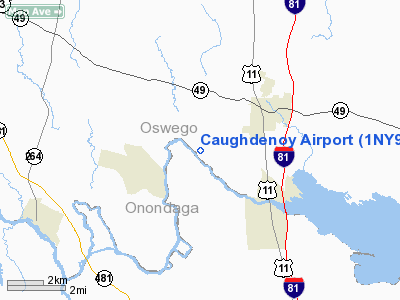
Location & QuickFacts
| FAA Information Effective: | 2008-09-25 |
| Airport Identifier: | 1NY9 |
| Airport Status: | Operational |
| Longitude/Latitude: | 076-11-16.7340W/43-15-57.2470N
-76.187982/43.265902 (Estimated) |
| Elevation: | 400 ft / 121.92 m (Estimated) |
| Land: | 5 acres |
| From nearest city: | 1 nautical miles E of Caughdenoy, NY |
| Location: | Oswego County, NY |
| Magnetic Variation: | 12W (1990) |
Owner & Manager
| Ownership: | Privately owned |
| Owner: | Bruce Rio |
| Address: | Box 554a Rd 1 County Rte 37
Central Square, NY 13036 |
| Phone number: | 315-676-2901 |
| Manager: | Bruce Rio |
| Address: | Box 554a Rd 1 County Rte 37
Central Square, NY 13036 |
| Phone number: | 315-676-2901 |
Airport Operations and Facilities
| Airport Use: | Private |
| Wind indicator: | Yes |
| Segmented Circle: | No |
| Control Tower: | No |
| Sectional chart: | New York |
| Region: | AEA - Eastern |
| Boundary ARTCC: | ZBW - Boston |
| Tie-in FSS: | BUF - Buffalo |
| FSS on Airport: | No |
| FSS Toll Free: | 1-800-WX-BRIEF |
Runway Information
Runway 18/36
| Dimension: | 1800 x 60 ft / 548.6 x 18.3 m |
| Surface: | TURF, |
| |
Runway 18 |
Runway 36 |
| Traffic Pattern: | Right | Left |
| Obstruction: | | 40 ft trees, 200.0 ft from runway |
|
Radio Navigation Aids
| ID |
Type |
Name |
Ch |
Freq |
Var |
Dist |
| BK | NDB | Plein | | 329.00 | 12W | 31.0 nm |
| CJY | NDB | Clay | | 275.00 | 12W | 42.5 nm |
| GSS | TACAN | Griffiss | 057X | | 12W | 34.1 nm |
| ITH | VOR/DME | Ithaca | 055X | 111.80 | 10W | 47.9 nm |
| SYR | VORTAC | Syracuse | 117X | 117.00 | 11W | 6.4 nm |
| GGT | VORTAC | Georgetown | 125X | 117.80 | 11W | 32.8 nm |
| ART | VORTAC | Watertown | 035X | 109.80 | 12W | 41.6 nm |
| UCA | VORTAC | Utica | 049X | 111.20 | 12W | 47.1 nm |
Remarks
- VFR; PVT USE ONLY; THR DSPLCD TO PRVD 20:1 APCH CLNC; LIMITED TO SINGLE ENGINE ACFT; AWARE OF PROCEDURES FOR OPERATING WITHIN SYRACUSE CLASS C AIRSPACE; APPLY PART 77 STANDARDS IN OPERATING AIRFIELD.
Images and information placed above are from
http://www.airport-data.com/airport/1NY9/
We thank them for the data!
| General Info
|
| Country |
United States
|
| State |
NEW YORK
|
| FAA ID |
1NY9
|
| Latitude |
43-15-57.247N
|
| Longitude |
076-11-16.734W
|
| Elevation |
400 feet
|
| Near City |
CAUGHDENOY
|
We don't guarantee the information is fresh and accurate. The data may
be wrong or outdated.
For more up-to-date information please refer to other sources.
|
|


