 |
|
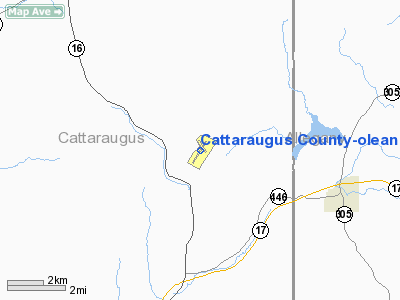
Cattaraugus County-olean Airport |
Location & QuickFacts
| FAA Information Effective: | 2008-09-25 |
| Airport Identifier: | OLE |
| Airport Status: | Operational |
| Longitude/Latitude: | 078-22-17.0000W/42-14-28.5000N
-78.371389/42.241250 (Estimated) |
| Elevation: | 2135 ft / 650.75 m (Surveyed) |
| Land: | 426 acres |
| From nearest city: | 10 nautical miles N of Olean, NY |
| Location: | Cattaraugus County, NY |
| Magnetic Variation: | 11W (2000) |
Owner & Manager
| Ownership: | Publicly owned |
| Owner: | City Of Olean |
| Address: | Mun Bldg
Olean, NY 14760 |
| Phone number: | 716-375-5650 |
| Manager: | Bruce Crandell |
| Address: | Airport Road(5420 Hindsdale Rd.)
Hinsdale, NY 14743 |
| Phone number: | 716-557-8800 |
Airport Operations and Facilities
| Airport Use: | Open to public |
| Wind indicator: | Yes
ACTIVATE LIGHT - CTAF |
| Segmented Circle: | No |
| Control Tower: | No |
| Lighting Schedule: | DUSK-DAWN
ACTVT HIRL RWY 04/22 & REIL & PAPI RWY 04 & 22 - CTAF. |
| Beacon Color: | Clear-Green (lighted land airport) |
| Landing fee charge: | No |
| Sectional chart: | Detroit |
| Region: | AEA - Eastern |
| Boundary ARTCC: | ZOB - Cleveland |
| Tie-in FSS: | BUF - Buffalo |
| FSS on Airport: | No |
| FSS Toll Free: | 1-800-WX-BRIEF |
| NOTAMs Facility: | OLE (NOTAM-d service avaliable) |
| Federal Agreements: | NGY |
Airport Communications
| CTAF: | 122.800 |
| Unicom: | 122.800 |
Airport Services
| Fuel available: | 100LLA |
| Bottled Oxygen: | NONE |
| Bulk Oxygen: | NONE |
Runway Information
Runway 04/22
| Dimension: | 4800 x 100 ft / 1463.0 x 30.5 m |
| Surface: | ASPH, Good Condition |
| Surface Treatment: | Saw-cut or plastic Grooved |
| Weight Limit: | Single wheel: 45000 lbs.
Dual wheel: 50000 lbs.
Dual tandem wheel: 46000 lbs. |
| Edge Lights: | High |
| |
Runway 04 |
Runway 22 |
| Longitude: | 078-22-34.7221W | 078-22-00.7149W |
| Latitude: | 42-14-04.9847N | 42-14-45.1102N |
| Elevation: | 2132.00 ft | 2112.00 ft |
| Alignment: | 32 | 127 |
| ILS Type: | | LOCALIZER
|
| Traffic Pattern: | Left | Left |
| Markings: | Non-precision instrument, Good Condition | Non-precision instrument, Good Condition |
| Crossing Height: | 40.00 ft | 40.00 ft |
| Displaced threshold: | 100.00 ft | 200.00 ft |
| VASI: | 4-light PAPI on left side | 4-light PAPI on left side |
| Visual Glide Angle: | 3.00° | 0.00° |
| Runway End Identifier: | Yes | Yes |
| Obstruction: | 2 ft , 200.0 ft from runway
RWY 04, APPROACH SLOPE 50:1 FROM DSPLCD THR.
+1 FT TERRAIN 150 FT OUT & CNTRLN. | 2 ft trees, 200.0 ft from runway, 51 ft left of centerline
RWY 22, +9' BRUSH, 152' FRM RWY, 128' R, 39:1 BASED ON DSPLCD THR
+1 FT TERRAIN 0 FT OUT AND 150 FT RIGHT. |
| Decleard distances: | Take off run available 4800.00 ft
Take off distance available 4800.00 ft
Actual stop distance available 4600.00 ft
Landing distance available 4500.00 ft
| Take off run available 4800.00 ft
Take off distance available 4800.00 ft
Actual stop distance available 4700.00 ft
Landing distance available 4500.00 ft
|
|
Runway 16/34
| Dimension: | 2135 x 100 ft / 650.7 x 30.5 m |
| Surface: | TURF, Fair Condition |
| |
Runway 16 |
Runway 34 |
| Longitude: | 078-22-22.3252W | 078-22-07.5027W |
| Latitude: | 42-14-44.8846N | 42-14-26.8949N |
| Alignment: | 127 | 127 |
| Traffic Pattern: | Left | Left |
| Obstruction: | 20 ft tree, 330.0 ft from runway, 120 ft left of centerline, 16:1 slope to clear | 117 ft tree, 3800.0 ft from runway, 32:1 slope to clear |
|
Radio Navigation Aids
| ID |
Type |
Name |
Ch |
Freq |
Var |
Dist |
| LYS | NDB | Olean | | 360.00 | 09W | 3.0 nm |
| EL | NDB | Halos | | 269.00 | 09W | 21.8 nm |
| BFD | VOR/DME | Bradford | 113X | 116.60 | 07W | 29.5 nm |
| JHW | VOR/DME | Jamestown | 094X | 114.70 | 07W | 33.5 nm |
| BUF | VOR/DME | Buffalo | 111X | 116.40 | 08W | 43.1 nm |
| GEE | VOR/DME | Geneseo | 019X | 108.20 | 09W | 45.5 nm |
| ELZ | VORTAC | Wellsville | 051X | 111.40 | 09W | 18.9 nm |
| DKK | VORTAC | Dunkirk | 109X | 116.20 | 07W | 42.8 nm |
| SLT | VORTAC | Slate Run | 086X | 113.90 | 08W | 47.3 nm |
| BUF | VOT | Buffalo | | 109.00 | | 44.9 nm |
Remarks
- DEER ON & INVOF ARPT.
- SNOW PLOWING & BRAKING ACTION & FIELD CONDITION REPORTS NOT AVBL WHEN ARPT IS NOT ATTENDED.
- AIRFIELD PAVEMENT RUTTING & CRACKING ON THE AIRPORT APRON AREAS.
- TERRAIN DROPS OFF ON ALL RY ENDS. RWY 4: 250' X 250' SAFETY AREA. RWY 22: 225' WIDE X 110' SAFETY AREA.
- RY 16/34 CLSD WINTER MONTHS; SOFT IN SPRING.
- EXISTED PRIOR TO 1959.
Images and information placed above are from
http://www.airport-data.com/airport/OLE/
We thank them for the data!
| General Info
|
| Country |
United States
|
| State |
NEW YORK
|
| FAA ID |
OLE
|
| Latitude |
42-14-28.500N
|
| Longitude |
078-22-17.000W
|
| Elevation |
2135 feet
|
| Near City |
OLEAN
|
We don't guarantee the information is fresh and accurate. The data may
be wrong or outdated.
For more up-to-date information please refer to other sources.
|
|


