 |
|
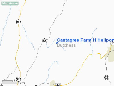
Cantagree Farm H Heliport |
Location & QuickFacts
| FAA Information Effective: | 2008-09-25 |
| Airport Identifier: | 7NK5 |
| Airport Status: | Operational |
| Longitude/Latitude: | 073-40-46.0000W/41-51-53.0000N
-73.679444/41.864722 (Estimated) |
| Elevation: | 650 ft / 198.12 m (Estimated) |
| Land: | 32 acres |
| From nearest city: | 1 nautical miles NW of Stanfordville, NY |
| Location: | Dutchess County, NY |
| Magnetic Variation: | 14W (1995) |
Owner & Manager
| Ownership: | Privately owned |
| Owner: | Fred Drasner |
| Address: | C/o N.y. Daily News, 450 West 33rd St
New York, NY 10017 |
| Phone number: | 212-210-2155 |
| Manager: | Gary Markowski |
| Address: | 111 Charles Lindberg Dr, Hangar 120
Teterboro, NJ 07608 |
| Phone number: | 201-229-0952 |
Airport Operations and Facilities
| Airport Use: | Private |
| Wind indicator: | Yes |
| Segmented Circle: | No |
| Control Tower: | No |
| Lighting Schedule: | RDO-CTL
ACTVT ROTG BCN - 123.05. |
| Beacon Color: | Clear-Green-Yellow (heliport) |
| Sectional chart: | New York |
| Region: | AEA - Eastern |
| Boundary ARTCC: | ZBW - Boston |
| Tie-in FSS: | ISP - New York |
| FSS Toll Free: | 1-800-WX-BRIEF |
Airport Communications
Runway Information
Helipad H1
| Dimension: | 50 x 50 ft / 15.2 x 15.2 m |
| Surface: | TURF, |
| |
Runway H1 |
Runway |
| Traffic Pattern: | Left | Left |
|
Radio Navigation Aids
| ID |
Type |
Name |
Ch |
Freq |
Var |
Dist |
| GBR | FAN MARKER | Sheffield | | | 13W | 21.2 nm |
| SKU | FAN MARKER | Stanwyck | | | 12W | 26.1 nm |
| PSF | FAN MARKER | Abyss | | | 13W | 41.1 nm |
| PO | NDB | Meier | | 403.00 | 12W | 21.6 nm |
| GBR | NDB | Great Barrington | | 395.00 | 14W | 22.7 nm |
| PFH | NDB | Philmont | | 272.00 | 13W | 23.4 nm |
| SKU | NDB | Stanwyck | | 261.00 | 12W | 26.1 nm |
| TBY | NDB | Waterbury | | 257.00 | 14W | 31.4 nm |
| SW | NDB | Neely | | 335.00 | 14W | 33.5 nm |
| DXT | NDB | Dalton | | 370.00 | 15W | 42.9 nm |
| MMK | NDB | Meriden | | 238.00 | 14W | 43.7 nm |
| HF | NDB | Lomis | | 244.00 | 15W | 49.2 nm |
| PWL | VOR/DME | Pawling | 090X | 114.30 | 12W | 6.7 nm |
| IGN | VOR/DME | Kingston | 123X | 117.60 | 12W | 13.6 nm |
| CMK | VOR/DME | Carmel | 113X | 116.60 | 12W | 35.4 nm |
| CTR | VOR/DME | Chester | 098X | 115.10 | 13W | 41.5 nm |
| BDR | VOR/DME | Bridgeport | 25X | 108.80 | 12W | 49.1 nm |
| HUO | VOR/DME | Huguenot | 108X | 116.10 | 11W | 49.3 nm |
| BDL | VORTAC | Bradley | 027X | 109.00 | 14W | 44.6 nm |
| BAF | VORTAC | Barnes | 077X | 113.00 | 14W | 46.6 nm |
| BDL | VOT | Bradley Intl | | 111.40 | | 44.8 nm |
| HFD | VOT | Hartford | | 108.20 | | 46.7 nm |
| BDR | VOT | Bridgeport | | 109.25 | | 49.1 nm |
Remarks
- PRVDD 8:1 SLOPE FOR CLEAR INGRESS/EGRESS, APPROPRIATE INGRESS/EGRESS MKGS & LGTD WINDSOCK, VEHICULAR TFC AROUND SITE CONTROLLED, & VFR OPNS ONLY.
Images and information placed above are from
http://www.airport-data.com/airport/7NK5/
We thank them for the data!
| General Info
|
| Country |
United States
|
| State |
NEW YORK
|
| FAA ID |
7NK5
|
| Latitude |
41-51-53.000N
|
| Longitude |
073-40-46.000W
|
| Elevation |
650 feet
|
| Near City |
STANFORDVILLE
|
We don't guarantee the information is fresh and accurate. The data may
be wrong or outdated.
For more up-to-date information please refer to other sources.
|
|


