 |
|
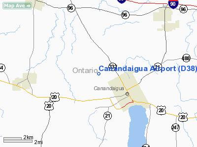
| Canandaigua Airport |
| IATA: none – ICAO: none – FAA LID: D38 |
| Summary |
| Airport type |
Public |
| Owner |
Ontario County IDA |
| Serves |
Canandaigua, New York |
| Elevation AMSL |
814 ft / 248 m |
| Coordinates |
42°54′25.87″N 077°19′17.855″W / 42.9071861°N 77.32162639°W / 42.9071861; -77.32162639 |
| Runways |
| Direction |
Length |
Surface |
| ft |
m |
| 13/31 |
3,200 |
975 |
Asphalt |
| Statistics (2007) |
| Aircraft operations |
21,600 |
| Based aircraft |
45 |
| Source: Federal Aviation Administration |
Canandaigua Airport is a public use airport in Ontario County, New York, United States. It is owned by the Ontario County IDA and is located three nautical mile (5.56 km) northwest of the central business district of the City of Canandaigua. According to the FAA's National Plan of Integrated Airport Systems for 2007-2011, it is categorized as a reliever airport.
Although most U.S. airports use the same three-letter location identifier for the FAA and IATA, this airport is assigned D38 by the FAA but has no designation from the IATA.
Facilities and aircraft
Canandaigua Airport covers an area of 46 acres (18.6 ha) at an elevation of 814 feet (248 m) above mean sea level. It has one runway designated 13/31 with an asphalt surface measuring 3,200 by 75 feet (975 x 23 m).
For the 12-month period ending October 20, 2007, the airport had 21,600 aircraft operations, an average of 59 per day: 95% general aviation, 5% air taxi and a few ultralights. At that time there were 45 aircraft based at this airport: 87% single-engine, 7% multi-engine and 7% ultralights.
The above content comes from Wikipedia and is published under free licenses – click here to read more.
Location & QuickFacts
| FAA Information Effective: | 2008-09-25 |
| Airport Identifier: | D38 |
| Airport Status: | Operational |
| Longitude/Latitude: | 077-19-17.8550W/42-54-25.8700N
-77.321626/42.907186 (Estimated) |
| Elevation: | 814 ft / 248.11 m (Surveyed) |
| Land: | 46 acres |
| From nearest city: | 3 nautical miles NW of Canandaigua, NY |
| Location: | Ontario County, NY |
| Magnetic Variation: | 12W (2000) |
Owner & Manager
| Ownership: | Publicly owned |
| Owner: | Ontario County Ida |
| Address: | 20 Ontario St
Canandaigua, NY 14425 |
| Phone number: | 585-396-4460 |
| Manager: | Michael Manikowski |
| Address: | 20 Ontario St
Canandaigua, NY 14425 |
| Phone number: | 585-615-3406 |
Airport Operations and Facilities
| Airport Use: | Open to public |
| Wind indicator: | Yes |
| Segmented Circle: | Yes |
| Control Tower: | No |
| Lighting Schedule: | DUSK-DAWN
ACTVT PAPI RYS 13 & 31, AND MIRL RY 13/31 - CTAF. REILS ACTIVATED ONLY WHEN RY LIGHTS ARE ON HIGH INTENSITY. |
| Beacon Color: | Clear-Green (lighted land airport) |
| Landing fee charge: | No |
| Sectional chart: | Detroit |
| Region: | AEA - Eastern |
| Boundary ARTCC: | ZOB - Cleveland |
| Tie-in FSS: | BUF - Buffalo |
| FSS on Airport: | No |
| FSS Toll Free: | 1-800-WX-BRIEF |
| NOTAMs Facility: | BUF (NOTAM-d service avaliable) |
| Federal Agreements: | N |
Airport Communications
| CTAF: | 122.800 |
| Unicom: | 122.800 |
Airport Services
| Fuel available: | 100LL |
| Airframe Repair: | MAJOR |
| Power Plant Repair: | MAJOR |
| Bottled Oxygen: | NONE |
| Bulk Oxygen: | NONE |
Runway Information
Runway 13/31
| Dimension: | 3200 x 75 ft / 975.4 x 22.9 m |
| Surface: | ASPH, Good Condition |
| Edge Lights: | Medium |
| |
Runway 13 |
Runway 31 |
| Longitude: | 077-19-35.8700W | 077-18-59.8400W |
| Latitude: | 42-54-34.4900N | 42-54-17.2500N |
| Elevation: | 800.00 ft | 812.00 ft |
| Alignment: | 123 | 127 |
| Traffic Pattern: | Left | Left |
| Markings: | Non-precision instrument, Fair Condition
MARKINGS FADED | Non-precision instrument, Fair Condition
MARKINGS FADED |
| Crossing Height: | 20.00 ft | 20.00 ft |
| VASI: | 2-light PAPI on left side | 2-light PAPI on right side |
| Visual Glide Angle: | 3.00° | 3.00° |
| Runway End Identifier: | Yes | Yes |
| Obstruction: | 8 ft brush, 360.0 ft from runway, 20:1 slope to clear | , 50:1 slope to clear |
|
Radio Navigation Aids
| ID |
Type |
Name |
Ch |
Freq |
Var |
Dist |
| PYA | NDB | Penn Yan | | 260.00 | 12W | 19.7 nm |
| AVN | NDB | Avon | | 344.00 | 09W | 20.6 nm |
| ALP | NDB | Alpine | | 245.00 | 12W | 47.2 nm |
| GEE | VOR/DME | Geneseo | 019X | 108.20 | 09W | 18.6 nm |
| ITH | VOR/DME | Ithaca | 055X | 111.80 | 10W | 45.4 nm |
| ROC | VORTAC | Rochester | 037X | 110.00 | 09W | 20.1 nm |
Remarks
- FOR ARPT CONDITIONS CALL 585-394-8651.
- EXISTED PRIOR TO 1959.
Images and information placed above are from
http://www.airport-data.com/airport/D38/
We thank them for the data!
| General Info
|
| Country |
United States
|
| State |
NEW YORK
|
| FAA ID |
D38
|
| Latitude |
42-54-25.870N
|
| Longitude |
077-19-17.855W
|
| Elevation |
814 feet
|
| Near City |
CANANDAIGUA
|
We don't guarantee the information is fresh and accurate. The data may
be wrong or outdated.
For more up-to-date information please refer to other sources.
|
|


