 |
|
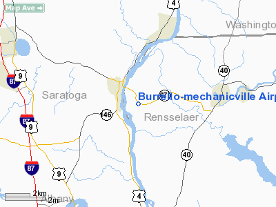
Burrello-mechanicville Airport |
Location & QuickFacts
| FAA Information Effective: | 2008-09-25 |
| Airport Identifier: | K27 |
| Airport Status: | Operational |
| Longitude/Latitude: | 073-40-06.4240W/42-53-35.2770N
-73.668451/42.893133 (Estimated) |
| Elevation: | 195 ft / 59.44 m (Estimated) |
| Land: | 27 acres |
| From nearest city: | 1 nautical miles SE of Mechanicville, NY |
| Location: | Rensselaer County, NY |
| Magnetic Variation: | 14W (1985) |
Owner & Manager
| Ownership: | Privately owned |
| Owner: | Stephen Burrello |
| Address: | Rd 2
Schaghitoke, NY |
| Phone number: | 518-423-7382 |
| Manager: | Gus Burrello |
| Address: | Box 455
Mechanicville, NY 12118 |
| Phone number: | 518-423-7382 |
Airport Operations and Facilities
| Airport Use: | Open to public |
| Wind indicator: | No |
| Segmented Circle: | No |
| Control Tower: | No |
| Landing fee charge: | No |
| Sectional chart: | New York |
| Region: | AEA - Eastern |
| Boundary ARTCC: | ZBW - Boston |
| Tie-in FSS: | BTV - Burlington |
| FSS on Airport: | No |
| FSS Toll Free: | 1-800-WX-BRIEF |
| NOTAMs Facility: | BTV (NOTAM-d service avaliable) |
Airport Communications
Airport Services
Runway Information
Runway 14/32
| Dimension: | 2600 x 21 ft / 792.5 x 6.4 m
SOUTHEAST 1800' ASPH; NORTHWEST 800' ALTERNATING GRAVEL, TURF AND GRAVEL. |
| Surface: | ASPH-GRVL, Poor Condition
RY 32 FIRST 500 FT EXCESSIVE GRASS IN CRACKS. |
| |
Runway 14 |
Runway 32 |
| Traffic Pattern: | Left | Left |
| Obstruction: | 65 ft tree, 10.0 ft from runway, 110 ft right of centerline | 32 ft tree, 44.0 ft from runway, 79L/ ft right of centerline
25 FT TREES 50 FT L FM THLD 0-200 FT OUT. |
|
Radio Navigation Aids
| ID |
Type |
Name |
Ch |
Freq |
Var |
Dist |
| PSF | FAN MARKER | Abyss | | | 13W | 33.1 nm |
| GBR | FAN MARKER | Sheffield | | | 13W | 47.9 nm |
| HEU | NDB | Hunter | | 356.00 | 14W | 12.0 nm |
| JJH | NDB | Johnstown | | 523.00 | 14W | 29.9 nm |
| DXT | NDB | Dalton | | 370.00 | 15W | 33.6 nm |
| VWD | NDB | Mount Snow | | 224.00 | 15W | 35.5 nm |
| PFH | NDB | Philmont | | 272.00 | 13W | 38.5 nm |
| GBR | NDB | Great Barrington | | 395.00 | 14W | 44.3 nm |
| CAM | VOR/DME | Cambridge | 097X | 115.00 | 14W | 15.5 nm |
| CTR | VOR/DME | Chester | 098X | 115.10 | 13W | 48.2 nm |
| RUT | VOR/DME | Rutland | 47X | 111.00 | 15W | 49.4 nm |
| ALB | VORTAC | Albany | 100X | 115.30 | 13W | 10.6 nm |
| GFL | VORTAC | Glens Falls | 039X | 110.20 | 14W | 27.1 nm |
| ALB | VOT | Albany County | | 108.20 | | 11.3 nm |
Remarks
- 40 FT DROPOFF 16 FT FM SE EDGE RY 32.
- +50 TREES WITHIN 50 FT OF RY 14/32 WESTEND.
- ULTRALGT ON & INVOF ARPT.
- FIRST 800 FT RY 14 GRVL.
- VFR WEATHER CONDS ONLY.
Images and information placed above are from
http://www.airport-data.com/airport/K27/
We thank them for the data!
| General Info
|
| Country |
United States
|
| State |
NEW YORK
|
| FAA ID |
K27
|
| Latitude |
42-53-35.277N
|
| Longitude |
073-40-06.424W
|
| Elevation |
195 feet
|
| Near City |
MECHANICVILLE
|
We don't guarantee the information is fresh and accurate. The data may
be wrong or outdated.
For more up-to-date information please refer to other sources.
|
|


