 |
|
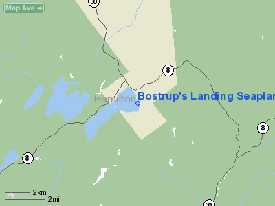
Bostrup's Landing Seaplane Base Airport |
Location & QuickFacts
| FAA Information Effective: | 2008-09-25 |
| Airport Identifier: | NK60 |
| Airport Status: | Operational |
| Longitude/Latitude: | 074-21-06.5140W/43-29-05.2420N
-74.351809/43.484789 (Estimated) |
| Elevation: | 1725 ft / 525.78 m (Estimated) |
| Land: | 0 acres |
| From nearest city: | 4 nautical miles E of Lake Pleasant, NY |
| Location: | Hamilton County, NY |
| Magnetic Variation: | 14W (1985) |
Owner & Manager
| Ownership: | Privately owned |
| Owner: | Earl W. Bostrup |
| Address: | Po Box 125
Purdys, NY 10578 |
| Phone number: | 914-277-5154 |
| Manager: | Earl W. Bostrup |
| Address: | Po Box 125
Purdys, NY 10578 |
| Phone number: | 518-548-6581 |
Airport Operations and Facilities
| Airport Use: | Private |
| Wind indicator: | Yes |
| Segmented Circle: | No |
| Control Tower: | No |
| Lighting Schedule: | NONE |
| Landing fee charge: | No |
| Sectional chart: | New York |
| Region: | AEA - Eastern |
| Boundary ARTCC: | ZBW - Boston |
| Tie-in FSS: | BUF - Buffalo |
| FSS on Airport: | No |
| FSS Toll Free: | 1-800-WX-BRIEF |
Runway Information
Runway 05/23
| Dimension: | 12100 x 1500 ft / 3688.1 x 457.2 m |
| Surface: | WATER, |
| |
Runway 05 |
Runway 23 |
| Traffic Pattern: | Left | Left |
|
Runway 13/31
| Dimension: | 4200 x 3000 ft / 1280.2 x 914.4 m |
| Surface: | WATER, |
| |
Runway 13 |
Runway 31 |
| Traffic Pattern: | Left | Left |
|
Radio Navigation Aids
| ID |
Type |
Name |
Ch |
Freq |
Var |
Dist |
| JJH | NDB | Johnstown | | 523.00 | 14W | 29.2 nm |
| HEU | NDB | Hunter | | 356.00 | 14W | 42.2 nm |
| CJY | NDB | Clay | | 275.00 | 12W | 47.6 nm |
| GSS | TACAN | Griffiss | 057X | | 12W | 48.7 nm |
| GFL | VORTAC | Glens Falls | 039X | 110.20 | 14W | 33.4 nm |
| UCA | VORTAC | Utica | 049X | 111.20 | 12W | 45.0 nm |
Images and information placed above are from
http://www.airport-data.com/airport/NK60/
We thank them for the data!
| General Info
|
| Country |
United States
|
| State |
NEW YORK
|
| FAA ID |
NK60
|
| Latitude |
43-29-05.242N
|
| Longitude |
074-21-06.514W
|
| Elevation |
1725 feet
|
| Near City |
LAKE PLEASANT
|
We don't guarantee the information is fresh and accurate. The data may
be wrong or outdated.
For more up-to-date information please refer to other sources.
|
|


