 |
|
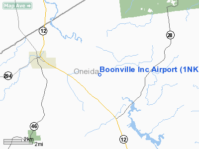
Location & QuickFacts
| FAA Information Effective: | 2008-09-25 |
| Airport Identifier: | 1NK7 |
| Airport Status: | Operational |
| Longitude/Latitude: | 075-14-58.6060W/43-28-00.2470N
-75.249613/43.466735 (Estimated) |
| Elevation: | 1200 ft / 365.76 m (Surveyed) |
| Land: | 155 acres |
| From nearest city: | 3 nautical miles SE of Boonville, NY |
| Location: | Oneida County, NY |
| Magnetic Variation: | 13W (1985) |
Owner & Manager
| Ownership: | Privately owned |
| Owner: | Jerry And Elsa Schweizer |
| Address: | Box 66
Constableville, NY 13325 |
| Phone number: | 315-942-2880 |
| Address: |
|
| Phone number: | 315-942-3579 |
Airport Operations and Facilities
| Airport Use: | Private |
| Wind indicator: | Yes |
| Segmented Circle: | No |
| Control Tower: | No |
| Landing fee charge: | No |
| Sectional chart: | New York |
| Region: | AEA - Eastern |
| Boundary ARTCC: | ZBW - Boston |
| Tie-in FSS: | BUF - Buffalo |
| FSS on Airport: | No |
| FSS Toll Free: | 1-800-WX-BRIEF |
Airport Communications
Airport Services
| Airframe Repair: | NONE |
| Power Plant Repair: | NONE |
Runway Information
Runway 15/33
| Dimension: | 2800 x 100 ft / 853.4 x 30.5 m |
| Surface: | TURF, Good Condition |
| |
Runway 15 |
Runway 33 |
| Traffic Pattern: | Left | Left |
| Obstruction: | | 30 ft pline, 70.0 ft from runway |
|
Radio Navigation Aids
| ID |
Type |
Name |
Ch |
Freq |
Var |
Dist |
| BK | NDB | Plein | | 329.00 | 12W | 17.9 nm |
| CJY | NDB | Clay | | 275.00 | 12W | 24.9 nm |
| GTB | NDB | Drum | | 257.00 | 13W | 41.9 nm |
| JJH | NDB | Johnstown | | 523.00 | 14W | 49.0 nm |
| GSS | TACAN | Griffiss | 057X | | 12W | 15.8 nm |
| UCA | VORTAC | Utica | 049X | 111.20 | 12W | 26.7 nm |
| SYR | VORTAC | Syracuse | 117X | 117.00 | 11W | 45.6 nm |
| ART | VORTAC | Watertown | 035X | 109.80 | 12W | 45.9 nm |
| GGT | VORTAC | Georgetown | 125X | 117.80 | 11W | 48.0 nm |
Remarks
Images and information placed above are from
http://www.airport-data.com/airport/1NK7/
We thank them for the data!
| General Info
|
| Country |
United States
|
| State |
NEW YORK
|
| FAA ID |
1NK7
|
| Latitude |
43-28-00.247N
|
| Longitude |
075-14-58.606W
|
| Elevation |
1200 feet
|
| Near City |
BOONVILLE
|
We don't guarantee the information is fresh and accurate. The data may
be wrong or outdated.
For more up-to-date information please refer to other sources.
|
|


