 |
|
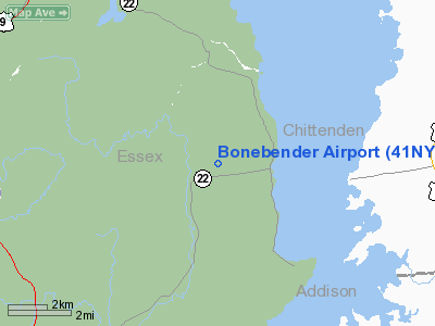
Location & QuickFacts
| FAA Information Effective: | 2008-09-25 |
| Airport Identifier: | 41NY |
| Airport Status: | Operational |
| Longitude/Latitude: | 073-23-05.6000W/44-18-44.6000N
-73.384889/44.312389 (Estimated) |
| Elevation: | 336 ft / 102.41 m (Estimated) |
| Land: | 100 acres |
| From nearest city: | 1 nautical miles W of Essex, NY |
| Location: | Essex County, NY |
| Magnetic Variation: | 15W (2000) |
Owner & Manager
| Ownership: | Privately owned |
| Owner: | Beth Schiller, Josh Schwartzberg |
| Address: | 607 Middle Rd
Essex, NY 12936 |
| Phone number: | 518-963-4355 |
| Manager: | Beth Schiller, Josh Schwartzberg |
| Address: | 607 Middle Rd
Essex, NY 12936 |
| Phone number: | 518-963-4355 |
Airport Operations and Facilities
| Airport Use: | Private |
| Wind indicator: | Yes |
| Segmented Circle: | No |
| Control Tower: | No |
| Sectional chart: | Montreal |
| Region: | AEA - Eastern |
| Boundary ARTCC: | ZBW - Boston |
| Tie-in FSS: | BTV - Burlington |
| FSS Toll Free: | 1-800-WX-BRIEF |
Airport Communications
Runway Information
Runway 01/19
| Dimension: | 1800 x 75 ft / 548.6 x 22.9 m |
| Surface: | TURF, |
| |
Runway 01 |
Runway 19 |
| Traffic Pattern: | Left | Left |
|
Radio Navigation Aids
| ID |
Type |
Name |
Ch |
Freq |
Var |
Dist |
| MPV | FAN MARKER | Brook | | | | 31.3 nm |
| R | FAN MARKER | Chitt | | | 14W | 44.3 nm |
| VKN | NDB | Mount Mansfield | | 268.00 | 16W | 30.0 nm |
| JRV | NDB | Morrisville/stowe | | 375.00 | 16W | 37.8 nm |
| DYO | NDB | Smuto | | 221.00 | 15W | 40.9 nm |
| SLK | VOR/DME | Saranac Lake | 029X | 109.20 | 14W | 35.5 nm |
| MPV | VOR/DME | Montpelier | 045X | 110.80 | 16W | 42.6 nm |
| BTV | VORTAC | Burlington | 122X | 117.50 | 15W | 10.1 nm |
| PLB | VORTAC | Plattsburgh | 116X | 116.90 | 15W | 23.2 nm |
| BTV | VOT | Burlington Intl | | 109.00 | | 13.7 nm |
Remarks
- PRVDD VFR, CLEAR 20:1 APCH PATH, LOA SHOULD BE MADE WITH OWNER OF RICHTER ARPT FOR COORDINATION OF TFC PATTERNS.
Images and information placed above are from
http://www.airport-data.com/airport/41NY/
We thank them for the data!
| General Info
|
| Country |
United States
|
| State |
NEW YORK
|
| FAA ID |
41NY
|
| Latitude |
44-18-44.600N
|
| Longitude |
073-23-05.600W
|
| Elevation |
336 feet
|
| Near City |
ESSEX
|
We don't guarantee the information is fresh and accurate. The data may
be wrong or outdated.
For more up-to-date information please refer to other sources.
|
|


