 |
|
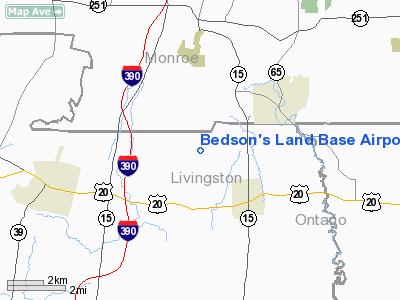
Bedson's Land Base Airport |
Location & QuickFacts
| FAA Information Effective: | 2008-09-25 |
| Airport Identifier: | 52NY |
| Airport Status: | Operational |
| Longitude/Latitude: | 077-38-38.9980W/42-55-50.2270N
-77.644166/42.930619 (Estimated) |
| Elevation: | 804 ft / 245.06 m (Surveyed) |
| Land: | 0 acres |
| From nearest city: | 3 nautical miles SW of Honeoye Falls, NY |
| Location: | Livingston County, NY |
| Magnetic Variation: | 11W (1985) |
Owner & Manager
| Ownership: | Privately owned |
| Owner: | Robert Henry Bedson |
| Address: | 6693 N Avon Rd
Honeoye Fall, NY 14472 |
| Phone number: | 716-624-4582 |
| Manager: | Robert Henry Bedson |
| Address: | 6693 N Avon Rd
Honeoye Falls, NY 14472 |
| Phone number: | 716-624-4582 |
Airport Operations and Facilities
| Airport Use: | Private |
| Wind indicator: | Yes |
| Segmented Circle: | No |
| Control Tower: | No |
| Landing fee charge: | No |
| Sectional chart: | Detroit |
| Region: | AEA - Eastern |
| Boundary ARTCC: | ZOB - Cleveland |
| Tie-in FSS: | BUF - Buffalo |
| FSS on Airport: | No |
| FSS Toll Free: | 1-800-WX-BRIEF |
Airport Services
| Airframe Repair: | NONE |
| Power Plant Repair: | NONE |
Runway Information
Runway 01/19
| Dimension: | 2000 x 80 ft / 609.6 x 24.4 m |
| Surface: | TURF, |
| |
Runway 01 |
Runway 19 |
| Traffic Pattern: | Left | Left |
|
Radio Navigation Aids
| ID |
Type |
Name |
Ch |
Freq |
Var |
Dist |
| AVN | NDB | Avon | | 344.00 | 09W | 7.3 nm |
| PYA | NDB | Penn Yan | | 260.00 | 12W | 31.1 nm |
| LYS | NDB | Olean | | 360.00 | 09W | 49.5 nm |
| GEE | VOR/DME | Geneseo | 019X | 108.20 | 09W | 7.0 nm |
| BUF | VOR/DME | Buffalo | 111X | 116.40 | 08W | 44.1 nm |
| ROC | VORTAC | Rochester | 037X | 110.00 | 09W | 11.5 nm |
| BUF | VOT | Buffalo | | 109.00 | | 48.0 nm |
Remarks
- ARPT EXISTED PRIOR TO MAY 15 1959.
Images and information placed above are from
http://www.airport-data.com/airport/52NY/
We thank them for the data!
| General Info
|
| Country |
United States
|
| State |
NEW YORK
|
| FAA ID |
52NY
|
| Latitude |
42-55-50.227N
|
| Longitude |
077-38-38.998W
|
| Elevation |
804 feet
|
| Near City |
HONEOYE FALLS
|
We don't guarantee the information is fresh and accurate. The data may
be wrong or outdated.
For more up-to-date information please refer to other sources.
|
|


