 |
|
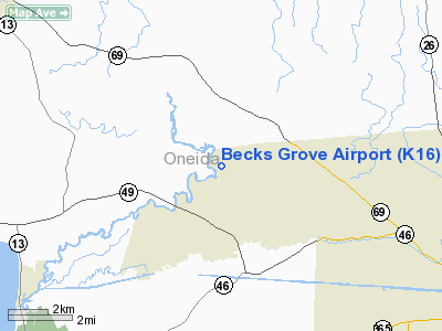
Location & QuickFacts
| FAA Information Effective: | 2008-09-25 |
| Airport Identifier: | K16 |
| Airport Status: | Operational |
| Longitude/Latitude: | 075-36-13.6500W/43-15-30.2490N
-75.603792/43.258403 (Estimated) |
| Elevation: | 450 ft / 137.16 m (Estimated) |
| Land: | 120 acres |
| From nearest city: | 8 nautical miles NW of Rome, NY |
| Location: | Oneida County, NY |
| Magnetic Variation: | 13W (1985) |
Owner & Manager
| Ownership: | Privately owned |
| Owner: | Robert E. Hoffman |
| Address: | Passer Rd,rd 1
Blossvale, NY 13308 |
| Phone number: | 315-337-3367 |
| Manager: | Robert E. Davidson |
| Address: | Passer Rd Rd1
Blossvale, NY 13308 |
| Phone number: | 315-337-3367 |
Airport Operations and Facilities
| Airport Use: | Open to public |
| Wind indicator: | Yes |
| Segmented Circle: | No |
| Control Tower: | No |
| Lighting Schedule: | PHONE-REQ
FOR NSTD LIRL RY 06/24 CALL 315-337-3367. |
| Landing fee charge: | No |
| Sectional chart: | New York |
| Region: | AEA - Eastern |
| Boundary ARTCC: | ZBW - Boston |
| Tie-in FSS: | BUF - Buffalo |
| FSS on Airport: | No |
| FSS Toll Free: | 1-800-WX-BRIEF |
| NOTAMs Facility: | BUF (NOTAM-d service avaliable) |
Airport Communications
| CTAF: | 122.800 |
| Unicom: | 122.800 |
Airport Services
| Bottled Oxygen: | NONE |
| Bulk Oxygen: | NONE |
Runway Information
Runway 06/24
| Dimension: | 3000 x 23 ft / 914.4 x 7.0 m |
| Surface: | ASPH, Good Condition |
| Weight Limit: | Single wheel: 12000 lbs. |
| Edge Lights: | Non-standard lighting system
NSTD LIRL RY 06/24 200 FT SPACING; FIRST LGT RY END 06 100 FT FM PAVEMENT END. FIRST LGT RY END 24 75 FT FM PAVEMENT END; REMOVED FM LATE OCT-MID APR DUE TO PLOWING. |
| |
Runway 06 |
Runway 24 |
| Traffic Pattern: | Left | Left |
| Obstruction: | 80 ft trees, 200.0 ft from runway
+80 FT TREES 0 FT FM RY END; 53 FT R & 127 FT L. | 50 ft trees, 200.0 ft from runway
+70' TREES 115' FROM RWY END 75' R. |
|
Radio Navigation Aids
| ID |
Type |
Name |
Ch |
Freq |
Var |
Dist |
| BK | NDB | Plein | | 329.00 | 12W | 5.7 nm |
| CJY | NDB | Clay | | 275.00 | 12W | 19.3 nm |
| GTB | NDB | Drum | | 257.00 | 13W | 49.0 nm |
| GSS | TACAN | Griffiss | 057X | | 12W | 8.6 nm |
| UCA | VORTAC | Utica | 049X | 111.20 | 12W | 23.8 nm |
| SYR | VORTAC | Syracuse | 117X | 117.00 | 11W | 27.0 nm |
| GGT | VORTAC | Georgetown | 125X | 117.80 | 11W | 29.9 nm |
| ART | VORTAC | Watertown | 035X | 109.80 | 12W | 46.3 nm |
Remarks
- LARGE BIRDS (TURKEYS) ON & INVOF RY 06/24.
- BLDG, BUSHES, ROCKS 45-55 FT NORTH OF RY CNTRLN 675 FT FM RY 24 THLD.
- EST PRIOR 1959
Images and information placed above are from
http://www.airport-data.com/airport/K16/
We thank them for the data!
| General Info
|
| Country |
United States
|
| State |
NEW YORK
|
| FAA ID |
K16
|
| Latitude |
43-15-30.249N
|
| Longitude |
075-36-13.650W
|
| Elevation |
450 feet
|
| Near City |
ROME
|
We don't guarantee the information is fresh and accurate. The data may
be wrong or outdated.
For more up-to-date information please refer to other sources.
|
|


