 |
|
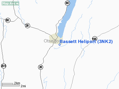
Location & QuickFacts
| FAA Information Effective: | 2008-09-25 |
| Airport Identifier: | 3NK2 |
| Airport Status: | Operational |
| Longitude/Latitude: | 074-55-17.5500W/42-41-22.2600N
-74.921542/42.689517 (Estimated) |
| Elevation: | 1243 ft / 378.87 m (Estimated) |
| Land: | 8 acres |
| From nearest city: | 1 nautical miles SE of Cooperstown, NY |
| Location: | Otsego County, NY |
| Magnetic Variation: | 13W (2000) |
Owner & Manager
| Ownership: | Privately owned |
| Owner: | Joe Middleton |
| Address: | 1 Atwell Rd
Cooperstown, NY 13326 |
| Phone number: | 607-547-6700 |
| Manager: | Clark Foundation |
| Address: | Po Box 510, 19 Main St
Cooperstown, NY 13326 |
| Phone number: | 607-547-2561 |
Airport Operations and Facilities
| Airport Use: | Private
MEDICAL USE. |
| Wind indicator: | Yes |
| Segmented Circle: | No |
| Control Tower: | No |
| Lighting Schedule: | RDO-CTL
ACTVT PERIMETER LGTS - 122.8. |
| Sectional chart: | New York |
| Region: | AEA - Eastern |
| Boundary ARTCC: | ZBW - Boston |
| Tie-in FSS: | BUF - Buffalo |
| FSS Toll Free: | 1-800-WX-BRIEF |
Airport Communications
Runway Information
Helipad H1
| Dimension: | 80 x 80 ft / 24.4 x 24.4 m |
| Surface: | CONC, Good Condition |
| |
Runway H1 |
Runway |
| Traffic Pattern: | Left | Left |
| Markings: | Basic, Good Condition | , |
|
Radio Navigation Aids
| ID |
Type |
Name |
Ch |
Freq |
Var |
Dist |
| CJY | NDB | Clay | | 275.00 | 12W | 26.5 nm |
| JJH | NDB | Johnstown | | 523.00 | 14W | 32.0 nm |
| BK | NDB | Plein | | 329.00 | 12W | 40.4 nm |
| HEU | NDB | Hunter | | 356.00 | 14W | 44.7 nm |
| GSS | TACAN | Griffiss | 057X | | 12W | 39.1 nm |
| RKA | VOR/DME | Rockdale | 073X | 112.60 | 11W | 19.4 nm |
| DNY | VOR/DME | De Lancey | 058X | 112.10 | 11W | 30.8 nm |
| HNK | VOR/DME | Hancock | 115X | 116.80 | 11W | 41.5 nm |
| UCA | VORTAC | Utica | 049X | 111.20 | 12W | 22.9 nm |
| GGT | VORTAC | Georgetown | 125X | 117.80 | 11W | 40.4 nm |
| ALB | VORTAC | Albany | 100X | 115.30 | 13W | 49.5 nm |
| ALB | VOT | Albany County | | 108.20 | | 48.7 nm |
Remarks
- PRVDD OVERFLIGHT OF SCHOOLS & OTHER AREAS OF PUBLIC ASSEMBLY BE AVOIDED, RECOMMEND COORDINATION WITH COOPERSTOWN ARPT ON APCHS & DEPARTURES, APPROPRIATE MKGS FOR INGRESS/EGRESS ON PAD, INSTALL LGTD WINDSOCK, VEHICULAR TFC AROUND SITE CONTROLLED DURG OPNS, NO IFR FLIGHT PLANS.
Images and information placed above are from
http://www.airport-data.com/airport/3NK2/
We thank them for the data!
| General Info
|
| Country |
United States
|
| State |
NEW YORK
|
| FAA ID |
3NK2
|
| Latitude |
42-41-22.260N
|
| Longitude |
074-55-17.550W
|
| Elevation |
1243 feet
|
| Near City |
COOPERSTOWN
|
We don't guarantee the information is fresh and accurate. The data may
be wrong or outdated.
For more up-to-date information please refer to other sources.
|
|


