 |
|
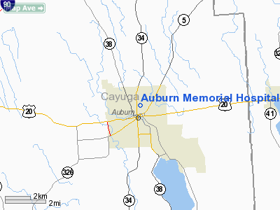
Auburn Memorial Hospital Heliport |
Location & QuickFacts
| FAA Information Effective: | 2008-09-25 |
| Airport Identifier: | NY12 |
| Airport Status: | Operational |
| Longitude/Latitude: | 076-33-47.7890W/42-56-27.2390N
-76.563275/42.940900 (Estimated) |
| Elevation: | 730 ft / 222.50 m (Estimated) |
| Land: | 0 acres |
| From nearest city: | 0 nautical miles N of Auburn, NY |
| Location: | Cayuga County, NY |
| Magnetic Variation: | 12W (1985) |
Owner & Manager
| Ownership: | Privately owned |
| Owner: | Auburn Memorial Hospital |
| Address: | Lansing St.
Auburn, NY 13021 |
| Phone number: | 315-255-7011 |
| Manager: | Hospital Security Dept. |
| Address: | Lansing St.
Auburn, NY 13021 |
| Phone number: | 315-255-7011 |
Airport Operations and Facilities
| Airport Use: | Private
MEDICAL USE. |
| Wind indicator: | Yes |
| Segmented Circle: | No |
| Control Tower: | No |
| Lighting Schedule: | PHONE REQ
FOR ROTG BCN & PERIMETER LGTS CALL 315-255-7011. |
| Beacon Color: | Clear-Green-Yellow (heliport) |
| Sectional chart: | Detroit |
| Region: | AEA - Eastern |
| Boundary ARTCC: | ZBW - Boston |
| Tie-in FSS: | BUF - Buffalo |
| FSS Toll Free: | 1-800-WX-BRIEF |
Runway Information
Helipad H1
| Dimension: | 40 x 40 ft / 12.2 x 12.2 m |
| Surface: | CONC, |
| |
Runway H1 |
Runway |
| Traffic Pattern: | Left | Left |
|
Radio Navigation Aids
| ID |
Type |
Name |
Ch |
Freq |
Var |
Dist |
| PYA | NDB | Penn Yan | | 260.00 | 12W | 28.1 nm |
| ALP | NDB | Alpine | | 245.00 | 12W | 43.1 nm |
| ITH | VOR/DME | Ithaca | 055X | 111.80 | 10W | 27.2 nm |
| SYR | VORTAC | Syracuse | 117X | 117.00 | 11W | 20.6 nm |
| GGT | VORTAC | Georgetown | 125X | 117.80 | 11W | 33.7 nm |
| ROC | VORTAC | Rochester | 037X | 110.00 | 09W | 50.0 nm |
Remarks
- PROVIDED SURROUNDING STRUCTURES ARE MARKED/LIGHTED; 2-WAY RADIO COMMUNICATIONS WITH PILOT.
Images and information placed above are from
http://www.airport-data.com/airport/NY12/
We thank them for the data!
| General Info
|
| Country |
United States
|
| State |
NEW YORK
|
| FAA ID |
NY12
|
| Latitude |
42-56-27.239N
|
| Longitude |
076-33-47.789W
|
| Elevation |
730 feet
|
| Near City |
AUBURN
|
We don't guarantee the information is fresh and accurate. The data may
be wrong or outdated.
For more up-to-date information please refer to other sources.
|
|


