 |
|
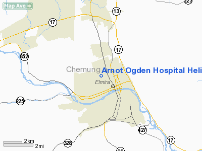
Arnot Ogden Hospital Heliport |
Location & QuickFacts
| FAA Information Effective: | 2008-09-25 |
| Airport Identifier: | 3NK9 |
| Airport Status: | Operational |
| Longitude/Latitude: | 076-49-31.8440W/42-06-03.2670N
-76.825512/42.100907 (Estimated) |
| Elevation: | 909 ft / 277.06 m (Surveyed) |
| Land: | 1 acres |
| From nearest city: | 0 nautical miles NW of Elmira, NY |
| Location: | Chemung County, NY |
| Magnetic Variation: | 11W (1985) |
Owner & Manager
| Ownership: | Privately owned |
| Owner: | Arnot-ogden Mem Hospital |
| Address: | 600 Roe Ave
Elmira, NY 14905 |
| Phone number: | 607-737-4236 |
| Manager: | Ed Fleming |
| Address: | 600 Roe Ave
Elmira, NY 14905 |
| Phone number: | 607-737-4158 |
Airport Operations and Facilities
| Airport Use: | Private
MEDICAL USE |
| Wind indicator: | Yes |
| Segmented Circle: | No |
| Control Tower: | No |
| Lighting Schedule: | PHONE REQ
FOR PERIMETER LGTS CALL 607-737-4158. |
| Sectional chart: | New York |
| Region: | AEA - Eastern |
| Boundary ARTCC: | ZNY - New York |
| Tie-in FSS: | BUF - Buffalo |
| FSS Toll Free: | 1-800-WX-BRIEF |
Runway Information
Helipad H1
| Dimension: | 110 x 66 ft / 33.5 x 20.1 m |
| Surface: | ASPH, |
| |
Runway H1 |
Runway |
| Traffic Pattern: | Left | Left |
|
Radio Navigation Aids
| ID |
Type |
Name |
Ch |
Freq |
Var |
Dist |
| ALP | NDB | Alpine | | 245.00 | 12W | 8.7 nm |
| PYA | NDB | Penn Yan | | 260.00 | 12W | 34.2 nm |
| EL | NDB | Halos | | 269.00 | 09W | 48.6 nm |
| PIX | NDB | Picture Rocks | | 344.00 | 09W | 49.8 nm |
| ULW | VOR/DME | Elmira | 033Y | 109.65 | 12W | 8.9 nm |
| ITH | VOR/DME | Ithaca | 055X | 111.80 | 10W | 28.7 nm |
| SFK | VOR/DME | Stonyfork | 023X | 108.60 | 08W | 36.1 nm |
| FQM | VOR/DME | Williamsport | 091X | 114.40 | 09W | 45.9 nm |
| CFB | VORTAC | Binghamton | 059X | 112.20 | 10W | 30.9 nm |
Remarks
- MEDICAL USE ONLY; RED OBSTRUCTION LGT IS PLACED ON ROOF OF FIRST HOUSE SW OF HELIPORT; REMOVE TOP 15' OF TREE LCTD 200' SW.
Images and information placed above are from
http://www.airport-data.com/airport/3NK9/
We thank them for the data!
| General Info
|
| Country |
United States
|
| State |
NEW YORK
|
| FAA ID |
3NK9
|
| Latitude |
42-06-03.267N
|
| Longitude |
076-49-31.844W
|
| Elevation |
909 feet
|
| Near City |
ELMIRA
|
We don't guarantee the information is fresh and accurate. The data may
be wrong or outdated.
For more up-to-date information please refer to other sources.
|
|


