 |
|
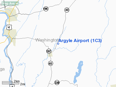
Location & QuickFacts
| FAA Information Effective: | 2008-09-25 |
| Airport Identifier: | 1C3 |
| Airport Status: | Operational |
| Longitude/Latitude: | 073-28-15.4040W/43-15-15.2660N
-73.470946/43.254241 (Estimated) |
| Elevation: | 330 ft / 100.58 m (Surveyed) |
| Land: | 13 acres |
| From nearest city: | 2 nautical miles NE of Argyle, NY |
| Location: | Washington County, NY |
| Magnetic Variation: | 15W (1985) |
Owner & Manager
| Ownership: | Privately owned |
| Owner: | Dick Bovey |
| Address: | 5292 Route 40
Argyle, NY 12809 |
| Phone number: | 518-638-9723 |
| Manager: | Dick Bovey |
| Address: | 5292 Route 40
Argyle, NY 12809 |
| Phone number: | 518-638-9723 |
Airport Operations and Facilities
| Airport Use: | Open to public |
| Wind indicator: | Yes |
| Segmented Circle: | No |
| Control Tower: | No |
| Landing fee charge: | No |
| Sectional chart: | New York |
| Region: | AEA - Eastern |
| Boundary ARTCC: | ZBW - Boston |
| Tie-in FSS: | BTV - Burlington |
| FSS on Airport: | No |
| FSS Toll Free: | 1-800-WX-BRIEF |
| NOTAMs Facility: | BTV (NOTAM-d service avaliable) |
Airport Communications
Airport Services
| Airframe Repair: | MAJOR |
| Power Plant Repair: | MAJOR |
Runway Information
Runway 03/21
| Dimension: | 2400 x 87 ft / 731.5 x 26.5 m
WIDTH VARIES FROM 87'-100' |
| Surface: | TURF, Good Condition |
| |
Runway 03 |
Runway 21 |
| Traffic Pattern: | Left | Left |
| Obstruction: | 15 ft trees, 40 ft right of centerline | 35 ft trees, 0.0 ft from runway, 60 ft right of centerline |
|
Radio Navigation Aids
| ID |
Type |
Name |
Ch |
Freq |
Var |
Dist |
| R | FAN MARKER | Chitt | | | 14W | 31.6 nm |
| PSF | FAN MARKER | Abyss | | | 13W | 49.3 nm |
| HEU | NDB | Hunter | | 356.00 | 14W | 31.6 nm |
| VWD | NDB | Mount Snow | | 224.00 | 15W | 33.1 nm |
| DYO | NDB | Smuto | | 221.00 | 15W | 35.2 nm |
| SXD | NDB | Springfield | | 265.00 | 15W | 38.7 nm |
| JJH | NDB | Johnstown | | 523.00 | 14W | 40.8 nm |
| IVV | NDB | White River | | 379.00 | 16W | 47.6 nm |
| CNH | NDB | Claremont | | 233.00 | 16W | 48.6 nm |
| DXT | NDB | Dalton | | 370.00 | 15W | 48.9 nm |
| CAM | VOR/DME | Cambridge | 097X | 115.00 | 14W | 16.6 nm |
| RUT | VOR/DME | Rutland | 47X | 111.00 | 15W | 28.0 nm |
| GFL | VORTAC | Glens Falls | 039X | 110.20 | 14W | 8.1 nm |
| ALB | VORTAC | Albany | 100X | 115.30 | 13W | 33.8 nm |
| ALB | VOT | Albany County | | 108.20 | | 34.4 nm |
Remarks
- ULTRALGTS ON & INVOF ARPT.
- HOT AIR BALLOONS OCCASIONALLY OPERATE FM ARPT.
- ARPT MAY BE CLSD WET WX CALL 518-638-9723.
- AEROBATICS BOX EAST OF RWY 3
Images and information placed above are from
http://www.airport-data.com/airport/1C3/
We thank them for the data!
| General Info
|
| Country |
United States
|
| State |
NEW YORK
|
| FAA ID |
1C3
|
| Latitude |
43-15-15.266N
|
| Longitude |
073-28-15.404W
|
| Elevation |
330 feet
|
| Near City |
ARGYLE
|
We don't guarantee the information is fresh and accurate. The data may
be wrong or outdated.
For more up-to-date information please refer to other sources.
|
|


