 |
|
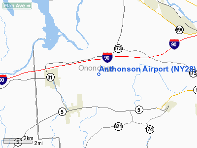
Location & QuickFacts
| FAA Information Effective: | 2008-09-25 |
| Airport Identifier: | NY28 |
| Airport Status: | Operational |
| Longitude/Latitude: | 076-24-28.7630W/43-04-15.2390N
-76.407990/43.070900 (Estimated) |
| Elevation: | 430 ft / 131.06 m (Estimated) |
| Land: | 12 acres |
| From nearest city: | 3 nautical miles E of Jordan, NY |
| Location: | Onondaga County, NY |
| Magnetic Variation: | 12W (1985) |
Owner & Manager
| Ownership: | Privately owned |
| Owner: | John Haggerty, Jr. |
| Address: | 3 Heather Woods Court
Skaneateles, NY 13152 |
| Phone number: | 315-685-8086 |
| Manager: | John Haggerty, Jr. |
| Address: | 3 Heather Woods Court
Skaneateles, NY 13152 |
| Phone number: | 315-685-8086 |
Airport Operations and Facilities
| Airport Use: | Private |
| Wind indicator: | Yes |
| Segmented Circle: | No |
| Control Tower: | No |
| Landing fee charge: | No |
| Sectional chart: | New York |
| Region: | AEA - Eastern |
| Boundary ARTCC: | ZBW - Boston |
| Tie-in FSS: | BUF - Buffalo |
| FSS on Airport: | No |
| FSS Toll Free: | 1-800-WX-BRIEF |
Airport Services
| Airframe Repair: | MAJOR |
| Power Plant Repair: | MAJOR |
Runway Information
Runway 09/27
| Dimension: | 1250 x 65 ft / 381.0 x 19.8 m |
| Surface: | TURF, Fair Condition |
| |
Runway 09 |
Runway 27 |
| Traffic Pattern: | Left | Left |
| Obstruction: | 15 ft road, 15.0 ft from runway, 1:1 slope to clear | 15 ft road, 0.0 ft from runway |
|
Radio Navigation Aids
| ID |
Type |
Name |
Ch |
Freq |
Var |
Dist |
| PYA | NDB | Penn Yan | | 260.00 | 12W | 38.4 nm |
| BK | NDB | Plein | | 329.00 | 12W | 41.6 nm |
| GSS | TACAN | Griffiss | 057X | | 12W | 44.8 nm |
| ITH | VOR/DME | Ithaca | 055X | 111.80 | 10W | 34.7 nm |
| SYR | VORTAC | Syracuse | 117X | 117.00 | 11W | 10.4 nm |
| GGT | VORTAC | Georgetown | 125X | 117.80 | 11W | 30.7 nm |
Remarks
Images and information placed above are from
http://www.airport-data.com/airport/NY28/
We thank them for the data!
| General Info
|
| Country |
United States
|
| State |
NEW YORK
|
| FAA ID |
NY28
|
| Latitude |
43-04-15.239N
|
| Longitude |
076-24-28.763W
|
| Elevation |
430 feet
|
| Near City |
JORDAN
|
We don't guarantee the information is fresh and accurate. The data may
be wrong or outdated.
For more up-to-date information please refer to other sources.
|
|


