 |
|
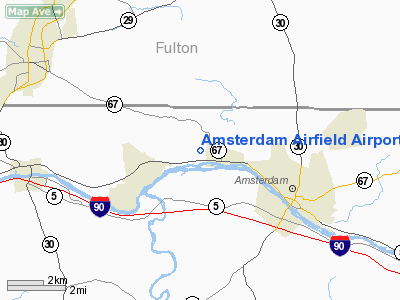
Amsterdam Airfield Airport |
Location & QuickFacts
| FAA Information Effective: | 2008-09-25 |
| Airport Identifier: | NY87 |
| Airport Status: | Operational |
| Longitude/Latitude: | 074-15-13.4750W/42-57-45.2660N
-74.253743/42.962574 (Estimated) |
| Elevation: | 340 ft / 103.63 m (Estimated) |
| Land: | 0 acres |
| From nearest city: | 1 nautical miles W of Fort Johnson, NY |
| Location: | Montgomery County, NY |
| Magnetic Variation: | 14W (1985) |
Owner & Manager
| Ownership: | Privately owned |
| Address: |
|
| Manager: | Charles J. Skee |
| Address: | 318 Guy Park Ave
Amsterdam, NY 12010 |
Airport Operations and Facilities
| Airport Use: | Private |
| Wind indicator: | Yes |
| Segmented Circle: | No |
| Control Tower: | No |
| Landing fee charge: | Yes
FEE ON UNAUTHORIZED LNDGS. |
| Sectional chart: | New York |
| Region: | AEA - Eastern |
| Boundary ARTCC: | ZBW - Boston |
| Tie-in FSS: | BTV - Burlington |
| FSS on Airport: | No |
| FSS Toll Free: | 1-800-WX-BRIEF |
Airport Services
| Airframe Repair: | NONE |
| Power Plant Repair: | NONE |
Runway Information
Runway E/W
| Dimension: | 1450 x 160 ft / 442.0 x 48.8 m |
| Surface: | TURF, |
| |
Runway E |
Runway W |
| Traffic Pattern: | Left | Left |
|
Radio Navigation Aids
| ID |
Type |
Name |
Ch |
Freq |
Var |
Dist |
| JJH | NDB | Johnstown | | 523.00 | 14W | 4.1 nm |
| HEU | NDB | Hunter | | 356.00 | 14W | 15.5 nm |
| CJY | NDB | Clay | | 275.00 | 12W | 44.7 nm |
| PFH | NDB | Philmont | | 272.00 | 13W | 48.7 nm |
| CAM | VOR/DME | Cambridge | 097X | 115.00 | 14W | 40.1 nm |
| ALB | VORTAC | Albany | 100X | 115.30 | 13W | 23.7 nm |
| GFL | VORTAC | Glens Falls | 039X | 110.20 | 14W | 36.2 nm |
| UCA | VORTAC | Utica | 049X | 111.20 | 12W | 40.2 nm |
| ALB | VOT | Albany County | | 108.20 | | 23.2 nm |
Remarks
- RADIO TOWER 80' NORTH OF HNGRS.
- UNAUZD LNDG OR USE WILL BE CHRGD $950.00 FEE FIRST TIME, $1300.00 SECOND, $2600.00 THIRD.
- EXISTED PRIOR TO 5/59.
Images and information placed above are from
http://www.airport-data.com/airport/NY87/
We thank them for the data!
| General Info
|
| Country |
United States
|
| State |
NEW YORK
|
| FAA ID |
NY87
|
| Latitude |
42-57-45.266N
|
| Longitude |
074-15-13.475W
|
| Elevation |
340 feet
|
| Near City |
FORT JOHNSON
|
We don't guarantee the information is fresh and accurate. The data may
be wrong or outdated.
For more up-to-date information please refer to other sources.
|
|


