 |
|
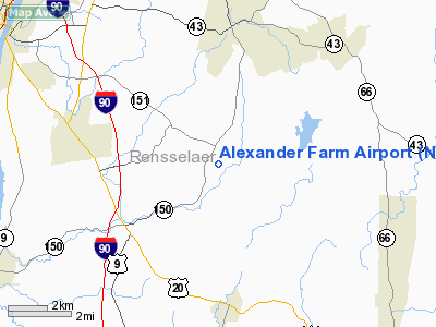
Location & QuickFacts
| FAA Information Effective: | 2008-09-25 |
| Airport Identifier: | NY82 |
| Airport Status: | Operational |
| Longitude/Latitude: | 073-36-58.4180W/42-34-50.2890N
-73.616227/42.580636 (Estimated) |
| Elevation: | 525 ft / 160.02 m (Estimated) |
| Land: | 20 acres |
| From nearest city: | 2 nautical miles NE of East Schodack, NY |
| Location: | Rensselaer County, NY |
| Magnetic Variation: | 14W (1985) |
Owner & Manager
| Ownership: | Privately owned |
| Owner: | Warren G. Alexander |
| Address: | Rd 1, Box 183, Morris Rd
East Greenbush, NY 12061 |
| Phone number: | 518-477-9577 |
| Address: |
|
Airport Operations and Facilities
| Airport Use: | Private |
| Wind indicator: | Yes |
| Segmented Circle: | No |
| Control Tower: | No |
| Sectional chart: | New York |
| Region: | AEA - Eastern |
| Boundary ARTCC: | ZBW - Boston |
| Tie-in FSS: | BTV - Burlington |
| FSS on Airport: | No |
| FSS Toll Free: | 1-800-WX-BRIEF |
Runway Information
Runway 18/36
| Dimension: | 3380 x 100 ft / 1030.2 x 30.5 m |
| Surface: | TURF, Good Condition |
| |
Runway 18 |
Runway 36 |
| Traffic Pattern: | Left | Left |
| Displaced threshold: | 600.00 ft | 0.00 ft |
| Obstruction: | 25 ft trees, 50.0 ft from runway | |
|
Radio Navigation Aids
| ID |
Type |
Name |
Ch |
Freq |
Var |
Dist |
| PSF | FAN MARKER | Abyss | | | 13W | 19.4 nm |
| GBR | FAN MARKER | Sheffield | | | 13W | 29.4 nm |
| PFH | NDB | Philmont | | 272.00 | 13W | 20.3 nm |
| DXT | NDB | Dalton | | 370.00 | 15W | 20.8 nm |
| HEU | NDB | Hunter | | 356.00 | 14W | 21.6 nm |
| GBR | NDB | Great Barrington | | 395.00 | 14W | 25.7 nm |
| VWD | NDB | Mount Snow | | 224.00 | 15W | 39.2 nm |
| JJH | NDB | Johnstown | | 523.00 | 14W | 40.4 nm |
| CAM | VOR/DME | Cambridge | 097X | 115.00 | 14W | 27.6 nm |
| CTR | VOR/DME | Chester | 098X | 115.10 | 13W | 34.3 nm |
| PWL | VOR/DME | Pawling | 090X | 114.30 | 12W | 48.7 nm |
| ALB | VORTAC | Albany | 100X | 115.30 | 13W | 13.0 nm |
| GFL | VORTAC | Glens Falls | 039X | 110.20 | 14W | 45.7 nm |
| BAF | VORTAC | Barnes | 077X | 113.00 | 14W | 47.2 nm |
| ALB | VOT | Albany County | | 108.20 | | 13.3 nm |
Images and information placed above are from
http://www.airport-data.com/airport/NY82/
We thank them for the data!
| General Info
|
| Country |
United States
|
| State |
NEW YORK
|
| FAA ID |
NY82
|
| Latitude |
42-34-50.289N
|
| Longitude |
073-36-58.418W
|
| Elevation |
525 feet
|
| Near City |
EAST SCHODACK
|
We don't guarantee the information is fresh and accurate. The data may
be wrong or outdated.
For more up-to-date information please refer to other sources.
|
|


