 |
|
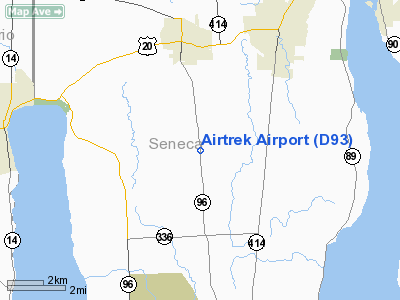
Location & QuickFacts
| FAA Information Effective: | 2008-09-25 |
| Airport Identifier: | D93 |
| Airport Status: | Operational |
| Longitude/Latitude: | 076-50-58.8470W/42-51-00.2420N
-76.849680/42.850067 (Estimated) |
| Elevation: | 590 ft / 179.83 m (Estimated) |
| Land: | 17 acres |
| From nearest city: | 3 nautical miles S of Waterloo, NY |
| Location: | Seneca County, NY |
| Magnetic Variation: | 12W (1985) |
Owner & Manager
| Ownership: | Privately owned |
| Owner: | Robert Harwood |
| Address: | 3656 Rt 96 S
Waterloo, NY 13165 |
| Phone number: | 315-539-3670 |
| Manager: | Robert Harwood |
| Address: | 3656 Rt 96 S
Waterloo, NY 13165 |
| Phone number: | 315-539-3670 |
Airport Operations and Facilities
| Airport Use: | Open to public |
| Wind indicator: | Yes |
| Segmented Circle: | No |
| Control Tower: | No |
| Lighting Schedule: | PHONE REQ
FOR LIRL RY 10/28 CALL 315-539-3670. |
| Landing fee charge: | No |
| Sectional chart: | New York |
| Region: | AEA - Eastern |
| Boundary ARTCC: | ZOB - Cleveland |
| Tie-in FSS: | BUF - Buffalo |
| FSS on Airport: | No |
| FSS Toll Free: | 1-800-WX-BRIEF |
| NOTAMs Facility: | BUF (NOTAM-d service avaliable) |
Airport Communications
Airport Services
| Airframe Repair: | MAJOR |
| Power Plant Repair: | MAJOR |
Runway Information
Runway 10/28
| Dimension: | 2275 x 85 ft / 693.4 x 25.9 m |
| Surface: | TURF, Good Condition |
| Edge Lights: | Low
NSTD DSPLCD THLD MKGS RY 28 MKD WITH ONE WHITE & TWO GREEN LGTS EACH SIDE. |
| |
Runway 10 |
Runway 28 |
| Traffic Pattern: | Left | Left |
| Markings: | , | Nonstandard,
RWY 10/28 NSTD DSPLCD THLD MKGS RWY 28 MKD WITH ONE WHITE AND TWO GREEN LIGHTS EACH SIDE |
| Displaced threshold: | 0.00 ft | 541.00 ft |
| Obstruction: | 23 ft tree, 13.0 ft from runway, 122 ft left of centerline | 15 ft road, 20.0 ft from runway, 1:1 slope to clear
RWY 28, +22 FT. P-LINE, 31 FT PAST THR. (OVER RWY), OB (ACROSS RWY), 23:1 BASED ON DSPLCD THR. |
|
Radio Navigation Aids
| ID |
Type |
Name |
Ch |
Freq |
Var |
Dist |
| PYA | NDB | Penn Yan | | 260.00 | 12W | 15.4 nm |
| ALP | NDB | Alpine | | 245.00 | 12W | 36.9 nm |
| AVN | NDB | Avon | | 344.00 | 09W | 41.6 nm |
| ITH | VOR/DME | Ithaca | 055X | 111.80 | 10W | 27.4 nm |
| GEE | VOR/DME | Geneseo | 019X | 108.20 | 09W | 38.9 nm |
| ULW | VOR/DME | Elmira | 033Y | 109.65 | 12W | 46.1 nm |
| SYR | VORTAC | Syracuse | 117X | 117.00 | 11W | 33.9 nm |
| ROC | VORTAC | Rochester | 037X | 110.00 | 09W | 39.7 nm |
| GGT | VORTAC | Georgetown | 125X | 117.80 | 11W | 45.2 nm |
Remarks
- RY SOFT IN SPRING.
- ULTRALGT ON & INVOF ARPT.
- RY 10: +30 FT TO 47 FT POWERLINE, 450 FT FRM THRHLD, ACROSS RY CENTERLINE,; +50 FT HIGH TREE, 134 FT RT.,369 FT FRM THRHLD.
- RY 28: +22 FT. P-LINE, 31 FT PAST (INTO) RY BEG.
- EXISTED PRIOR TO 1959
Images and information placed above are from
http://www.airport-data.com/airport/D93/
We thank them for the data!
| General Info
|
| Country |
United States
|
| State |
NEW YORK
|
| FAA ID |
D93
|
| Latitude |
42-51-00.242N
|
| Longitude |
076-50-58.847W
|
| Elevation |
590 feet
|
| Near City |
WATERLOO
|
We don't guarantee the information is fresh and accurate. The data may
be wrong or outdated.
For more up-to-date information please refer to other sources.
|
|


