 |
|
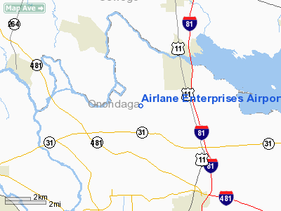
Airlane Enterprises Airport |
Location & QuickFacts
| FAA Information Effective: | 2008-09-25 |
| Airport Identifier: | 1H1 |
| Airport Status: | Operational |
| Longitude/Latitude: | 076-10-43.7320W/43-12-18.2450N
-76.178814/43.205068 (Estimated) |
| Elevation: | 385 ft / 117.35 m (Surveyed) |
| Land: | 100 acres |
| From nearest city: | 1 nautical miles N of Clay, NY |
| Location: | Onondaga County, NY |
| Magnetic Variation: | 12W (1985) |
Owner & Manager
| Ownership: | Privately owned |
| Owner: | Raymond Florczyk |
| Address: | 4885 Ver Plank Rd
Clay, NY 13041 |
| Phone number: | 315-699-5734 |
| Manager: | Raymond Florczyk |
| Address: | 4885 Ver Plank Rd
Clay, NY 13041 |
| Phone number: | 315-699-5734 |
Airport Operations and Facilities
| Airport Use: | Open to public |
| Wind indicator: | Yes |
| Segmented Circle: | No |
| Control Tower: | No |
| Landing fee charge: | No |
| Sectional chart: | New York |
| Region: | AEA - Eastern |
| Boundary ARTCC: | ZBW - Boston |
| Tie-in FSS: | BUF - Buffalo |
| FSS on Airport: | No |
| FSS Toll Free: | 1-800-WX-BRIEF |
| NOTAMs Facility: | BUF (NOTAM-d service avaliable) |
Airport Communications
Airport Services
| Airframe Repair: | NONE |
| Power Plant Repair: | NONE |
Runway Information
Runway 01/19
| Dimension: | 2220 x 75 ft / 676.7 x 22.9 m
RY 01/19 WIDTH VARIES 75 FT -90 FT.
RY 10/28 WIDTH VARIES 97 FT-136 FT. |
| Surface: | TURF, Fair Condition |
| |
Runway 01 |
Runway 19 |
| Traffic Pattern: | Left | Left |
| Obstruction: | 35 ft trees, 205.0 ft from runway, 67 ft left of centerline, 5:1 slope to clear | 45 ft trees, 0.0 ft from runway, 72 ft left of centerline |
|
Runway 10/28
| Dimension: | 1550 x 97 ft / 472.4 x 29.6 m
RY 01/19 WIDTH VARIES 75 FT -90 FT.
RY 10/28 WIDTH VARIES 97 FT-136 FT. |
| Surface: | TURF, Fair Condition |
| |
Runway 10 |
Runway 28 |
| Traffic Pattern: | Left | Left |
| Obstruction: | 76 ft trees, 93 ft right of centerline | 33 ft trees, 37.0 ft from runway, 51 ft right of centerline, 1:1 slope to clear |
|
Radio Navigation Aids
| ID |
Type |
Name |
Ch |
Freq |
Var |
Dist |
| BK | NDB | Plein | | 329.00 | 12W | 30.5 nm |
| CJY | NDB | Clay | | 275.00 | 12W | 41.1 nm |
| GSS | TACAN | Griffiss | 057X | | 12W | 33.7 nm |
| ITH | VOR/DME | Ithaca | 055X | 111.80 | 10W | 44.4 nm |
| SYR | VORTAC | Syracuse | 117X | 117.00 | 11W | 2.9 nm |
| GGT | VORTAC | Georgetown | 125X | 117.80 | 11W | 29.4 nm |
| ART | VORTAC | Watertown | 035X | 109.80 | 12W | 45.2 nm |
| UCA | VORTAC | Utica | 049X | 111.20 | 12W | 45.8 nm |
Remarks
-
- FIELD SOFT LATE FALL & EARLY SPRING.
- PARA PLANE ACTIVITY - EVENINGS & WEEKENDS.
- RY 01 30 FT PLINE 260 FT FM THLD.
- DEER ON & INVOF ARPT.
- NON COMPLIANCE WITH FAR 157.
Images and information placed above are from
http://www.airport-data.com/airport/1H1/
We thank them for the data!
| General Info
|
| Country |
United States
|
| State |
NEW YORK
|
| FAA ID |
1H1
|
| Latitude |
43-12-18.245N
|
| Longitude |
076-10-43.732W
|
| Elevation |
385 feet
|
| Near City |
CLAY
|
We don't guarantee the information is fresh and accurate. The data may
be wrong or outdated.
For more up-to-date information please refer to other sources.
|
|


