|
 |
|
||||
|
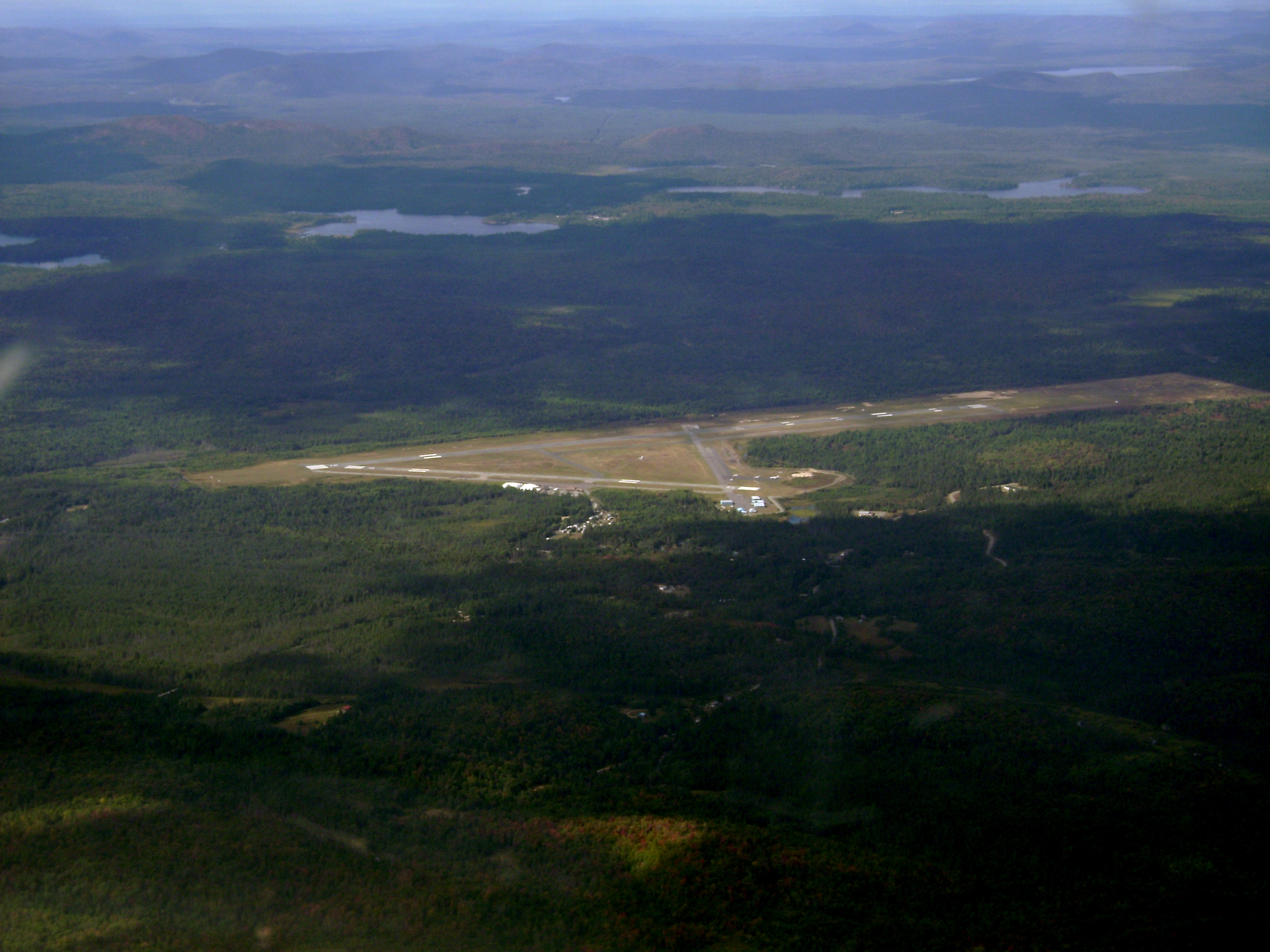
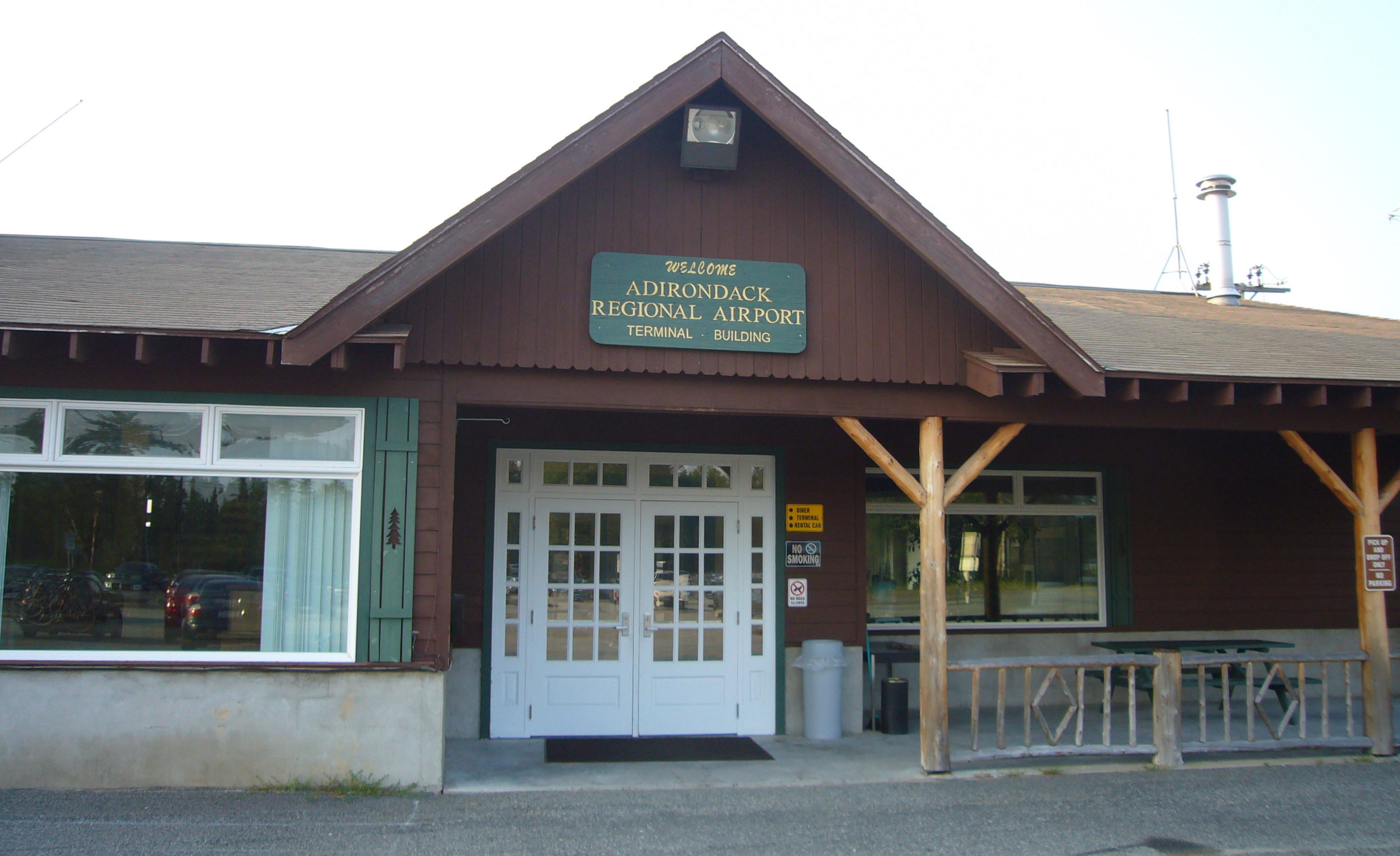
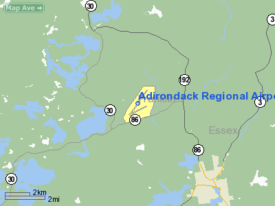
Adirondack Regional Airport (IATA: SLK, ICAO: KSLK, FAA LID: SLK) is a public use airport located four nautical miles (7 km) northwest of the central business district of Saranac Lake, in Franklin County, New York, United States. The airport is owned by the Town of Harrietstown. It is situated in the north-central Adirondacks two miles (3 km) from Lake Clear, in Harrietstown. As per Federal Aviation Administration records, the airport had 2,597 passenger boardings (enplanements) in calendar year 2004 and 2,682 enplanements in 2005. According to the FAA's National Plan of Integrated Airport Systems for 2007–2011, Adirondack is classified as commercial service - non-primary because it has between 2,500 and 10,000 passenger boardings per year. HistoryIn the autumn of 1940, a group of local men from the Saranac Lake Planning board got together to discuss the possibility of an airport in the Adirondack Mountains, near Saranac Lake. Their thinking was that such a development would play an important part in the future development of the Adirondaks. Due to the mountainous nature of the region many thought such a development would not be likely. However, after countless reviews of area maps, a plateau large enough for airport purposes was identified within a few miles of Saranac Lake Village. The Planning Board's search for an airport site had been prompted by an announcement from Washington, DC that Congress had appropriated funds for the building of a system of airports throughout the country. There was, among other problems, however, one restriction. The land for an airport site, to be acceptable to the federal government, had to be publicly owned. The ideal site which these men had spotted on the map was part of the holdings of the Paul Smith's Electric Company. Since no other tract of suitable terrain was to be found within a radius of some 40 miles (64 km), the whole effort might have bogged down but for the public-spirited cooperation of the Paul Smith's Electric Company which, in the interests of regional development, immediately deeded the 1,200-acre (4.9 km) tract to the Town of Harrietstown without cost. With the requirement of public ownership thus complied with, events moved swiftly toward the realization of an airport for the Adirondacks. Through persistent effort on the part of various citizens, who maintained close contact with Washington, DC, the site was inspected and federal expenditures for construction of a Class III airport were approved. Step by step, the Town of Harrietstown Town Board and the Saranac Lake Airport Commission worked closely with state and federal agencies in the building process. Construction of the airfield was completed in 1942. The Town of Harrietstown issued bonds to augment the available funds and erected a terminal building in 1948 and a 100 by 100-foot (30 m) hangar in 1950. At the time, the airport was rated as one of the best built Class III airports in the country. Two commercial airlines, Colonial Airlines and Resort Airlines, served the region at that time. Airmail service was provided by Colonial Airlines. The volume of air express business handled by Railway Express increased steadily, as did the number of privately owned aircraft using the field. Resort traffic response was immediate and increased steadily. The airport was officially dedicated to the service of the people of the Adirondacks on July 10, 1949. Since 1960, the Town of Harrietstown has operated the airport. The Saranac Lake Airport was renamed in 1989 to the Adirondack Regional Airport. Day to day operations are under the jurisdiction of the airport manager who is appointed by the Town Board. The airport manager supervises a staff of five full-time and one part-time employee. The airport is open 365 days per year. Cape Air currently serves the airport and offers flights to Boston. Facilities and aircraftAdirondack Regional Airport covers an area of 1,499 acres (607 ha) at an elevation of 1,663 feet (507 m) above mean sea level. It has two asphalt paved runways: 5/23 is 6,573 by 150 feet (2,003 x 46 m) and 9/27 is 3,998 by 100 feet (1,219 x 30 m). In the 1960s, the Adirondack Airport had three runways. Runway 16/34 was 4,000 feet (1,200 m) long and 100 feet (30 m) wide, but was abandoned sometime between the mid 1970s and early 1980s. The main runway was lengthened from approximately 5,000 feet (1,500 m) to its present length during the early 1970s or thereabouts and an instrument landing system and approach lighting system was installed on the southwest-facing runway 23. Also, a parallel taxiway was added to almost the full length of runway 9-27 and a partial parallel taxiway was added between the abandoned northwest-southeast runway - part of which was converted into a taxiway and the approach end of runway 23. For the 12-month period ending July 14, 2009, the airport had 8,100 aircraft operations, an average of 22 per day: 56% general aviation, 43% air taxi, and 1% military. At that time there were 15 aircraft based at this airport: 73% single-engine, 7% multi-engine, 13% helicopter and 7% ultralight. Airlines and destinations
The above content comes from Wikipedia and is published under free licenses – click here to read more.
Location & QuickFacts
Owner & Manager
Airport Operations and Facilities
Airport Communications
Airport Services
Runway InformationRunway 05/23
Runway 09/27
Radio Navigation Aids
Remarks
Images and information placed above are from We thank them for the data!
We don't guarantee the information is fresh and accurate. The data may
be wrong or outdated.
|
|||||||||||||||||||||||||||||||||||||||||||||||||||||||||||||||||||||||||||||||||||||||||||||||||||||||||||||||||||||||||||||||||||||||||||||||||||||||||||||||||||||||||||||||||||||||||||||||||||||||||||||||||||||||||||||||||||||||||||||||||||||||||||||||||||||||||||||||||||||||||||||||||||||||||||||||||||||||||||||||||||||||||||||||||||||||||||||||||

 |
|
Copyright 2004-2026 © by Airports-Worldwide.com, Vyshenskoho st. 36, Lviv 79010, Ukraine Legal Disclaimer |