 |
|
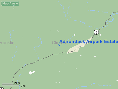
Adirondack Airpark Estates Airport |
Location & QuickFacts
| FAA Information Effective: | 2008-09-25 |
| Airport Identifier: | NY17 |
| Airport Status: | Operational |
| Longitude/Latitude: | 073-51-28.5100W/44-36-33.1600N
-73.857919/44.609211 (Estimated) |
| Elevation: | 1352 ft / 412.09 m (Estimated) |
| Land: | 110 acres |
| From nearest city: | 6 nautical miles SW of Plattsburgh, NY |
| Location: | Clinton County, NY |
| Magnetic Variation: | 15W (1995) |
Owner & Manager
| Ownership: | Privately owned |
| Owner: | Adirondack Airpark Estates Ass'n |
| Address: | 980 Broadway #142
Thornwood, NY 10594 |
| Phone number: | 212-967-7711
X3144 |
| Manager: | Bruce Francisco |
| Address: | Po Box 270
Westbrook, CT 06498 |
| Phone number: | 212-967-7711
X3144 |
Airport Operations and Facilities
| Airport Use: | Private |
| Wind indicator: | Yes |
| Segmented Circle: | No |
| Control Tower: | No |
| Sectional chart: | New York |
| Region: | AEA - Eastern |
| Boundary ARTCC: | ZBW - Boston |
| Tie-in FSS: | BTV - Burlington |
| FSS Toll Free: | 1-800-WX-BRIEF |
Airport Communications
Runway Information
Runway 09/27
| Dimension: | 2050 x 20 ft / 624.8 x 6.1 m |
| Surface: | ASPH, |
| |
Runway 09 |
Runway 27 |
| Traffic Pattern: | Left | Left |
|
Radio Navigation Aids
| ID |
Type |
Name |
Ch |
Freq |
Var |
Dist |
| PTD | NDB | Potsdam | | 400.00 | 14W | 44.3 nm |
| SLK | VOR/DME | Saranac Lake | 029X | 109.20 | 14W | 20.1 nm |
| PLB | VORTAC | Plattsburgh | 116X | 116.90 | 15W | 15.0 nm |
| BTV | VORTAC | Burlington | 122X | 117.50 | 15W | 31.6 nm |
| MSS | VORTAC | Massena | 088X | 114.10 | 14W | 41.2 nm |
| YJN | VORTAC | St Jean | 105X | 115.80 | 16W | 45.1 nm |
| BTV | VOT | Burlington Intl | | 109.00 | | 31.5 nm |
Remarks
- PRVDD VFR DAY OPNS ONLY, CUT TREES 40 FT ON S END OF RY, MARK PLINES & TELEPHONE POLES, RESTRICT USE TO SNGL ENG ACFT, DISPLACE RY 27 THLD 300 FT, REMOVE TEMPORARY LGT POLES & CONSTRUCTION TRAILER.
Images and information placed above are from
http://www.airport-data.com/airport/NY17/
We thank them for the data!
| General Info
|
| Country |
United States
|
| State |
NEW YORK
|
| FAA ID |
NY17
|
| Latitude |
44-36-33.160N
|
| Longitude |
073-51-28.510W
|
| Elevation |
1352 feet
|
| Near City |
PLATTSBURGH
|
We don't guarantee the information is fresh and accurate. The data may
be wrong or outdated.
For more up-to-date information please refer to other sources.
|
|


