 |
|
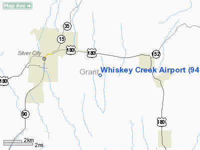
Location & QuickFacts
| FAA Information Effective: | 2008-09-25 |
| Airport Identifier: | 94E |
| Airport Status: | Operational |
| Longitude/Latitude: | 108-12-30.1670W/32-45-43.2710N
-108.208380/32.762020 (Estimated) |
| Elevation: | 6126 ft / 1867.20 m (Surveyed) |
| Land: | 0 acres |
| From nearest city: | 4 nautical miles E of Silver City, NM |
| Location: | Grant County, NM |
| Magnetic Variation: | 11E (1985) |
Owner & Manager
| Ownership: | Privately owned |
| Owner: | Bert & D'aun West
AIRPORT LEASED TO BRANDON CRISP. |
| Address: | P.o. Box 2535
Silver City, NM 88061 |
| Phone number: | 575-590-0461 |
| Manager: | Brandon Crisp |
| Address: | P.o. Box 1485
Silver City, NM 88062 |
| Phone number: | 575-534-2984 |
Airport Operations and Facilities
| Airport Use: | Open to public |
| Wind indicator: | Yes |
| Segmented Circle: | No |
| Control Tower: | No |
| Lighting Schedule: | DUSK-DAWN
FOR LIRL RY 17/35 KEY - 123.0 6 TIMES. |
| Beacon Color: | Clear-Green (lighted land airport) |
| Landing fee charge: | No |
| Sectional chart: | Albuquerque |
| Region: | ASW - Southwest |
| Boundary ARTCC: | ZAB - Albuquerque |
| Tie-in FSS: | ABQ - Albuquerque |
| FSS on Airport: | No |
| FSS Toll Free: | 1-800-WX-BRIEF |
| NOTAMs Facility: | ABQ (NOTAM-d service avaliable) |
Airport Communications
| CTAF: | 122.800 |
| Unicom: | 122.800 |
Airport Services
| Fuel available: | 100LLA |
| Airframe Repair: | MAJOR |
| Power Plant Repair: | MAJOR |
| Bottled Oxygen: | LOW |
Runway Information
Runway 17/35
| Dimension: | 5400 x 50 ft / 1645.9 x 15.2 m |
| Surface: | ASPH, Good Condition |
| Edge Lights: | Non-standard lighting system
NSTD LIRL; NON-FRANGIBLE POSTS. |
| |
Runway 17 |
Runway 35 |
| Traffic Pattern: | Left | Left |
| Runway End Identifier: | | Yes
SINGLE NON-STANDARD LIGHT. |
| Obstruction: | , 50:1 slope to clear | 6 ft brush, 300.0 ft from runway, 16:1 slope to clear
+4 FT FENCE 150 FT FM RY END; +4 FT RED LGTS ON POSTS 140 FT FM RY END. |
|
Radio Navigation Aids
| ID |
Type |
Name |
Ch |
Freq |
Var |
Dist |
| SVC | VORTAC | Silver City | 045X | 110.80 | 13E | 7.8 nm |
| DMN | VORTAC | Deming | 023X | 108.60 | 12E | 42.3 nm |
Remarks
- CATTLE & WILDLIFE ON & INVOF ARPT.
- ACFT MAY BE PARKED NEAR RY 17.
- DITCH ON EAST SIDE OF RY 18 FT FROM EDGE AND 2 FT LOWER.
- DROP OFF AT RY 17 END 18 FT FROM END OF PAVEMENT.
Images and information placed above are from
http://www.airport-data.com/airport/94E/
We thank them for the data!
| General Info
|
| Country |
United States
|
| State |
NEW MEXICO
|
| FAA ID |
94E
|
| Latitude |
32-45-43.271N
|
| Longitude |
108-12-30.167W
|
| Elevation |
6126 feet
|
| Near City |
SILVER CITY
|
We don't guarantee the information is fresh and accurate. The data may
be wrong or outdated.
For more up-to-date information please refer to other sources.
|
|


