 |
|
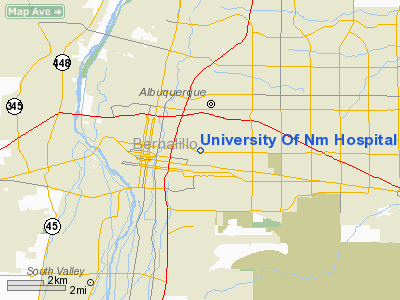
University Of Nm Hospital Heliport |
Location & QuickFacts
| FAA Information Effective: | 2008-09-25 |
| Airport Identifier: | NM11 |
| Airport Status: | Operational |
| Longitude/Latitude: | 106-37-04.0880W/35-05-19.1670N
-106.617802/35.088658 (Estimated) |
| Elevation: | 5212 ft / 1588.62 m (Surveyed) |
| Land: | 0 acres |
| From nearest city: | 0 nautical miles N of Albuquerque, NM |
| Location: | Bernalillo County, NM |
| Magnetic Variation: | 12E (1985) |
Owner & Manager
| Ownership: | Publicly owned |
| Owner: | University Of Nm Hospital |
| Address: | 2211 Lomas Blvd Ne
Albuquerque, NM 87106 |
| Phone number: | 505-843-2121 |
| Manager: | Amy Boule |
| Address: | 2211 Lomas Blvd Ne
Albuquerque, NM 87106 |
| Phone number: | 505-843-2121 |
Airport Operations and Facilities
| Airport Use: | Private
MEDICAL. |
| Wind indicator: | Yes |
| Segmented Circle: | No |
| Control Tower: | No |
| Lighting Schedule: | DUSK-DAWN |
| Beacon Color: | Clear-Green-Yellow (heliport) |
| Sectional chart: | Albuquerque |
| Region: | ASW - Southwest |
| Boundary ARTCC: | ZAB - Albuquerque |
| Tie-in FSS: | ABQ - Albuquerque |
| FSS on Airport: | No |
| FSS Toll Free: | 1-800-WX-BRIEF |
Airport Services
| Fuel available: | A
FUEL PVT USE ONLY. |
Runway Information
Helipad H1
| Dimension: | 28 x 28 ft / 8.5 x 8.5 m |
| Surface: | CONC,
ROOFTOP. |
| |
Runway H1 |
Runway |
| Traffic Pattern: | Left | Left |
|
Radio Navigation Aids
| ID |
Type |
Name |
Ch |
Freq |
Var |
Dist |
| ILT | NDB | Isleta | | 247.00 | 11E | 6.1 nm |
| OTO | VOR | Otto | | 114.00 | 13E | 33.5 nm |
| ABQ | VORTAC | Albuquerque | 079X | 113.20 | 13E | 10.1 nm |
| SAF | VORTAC | Santa Fe | 043X | 110.60 | 13E | 38.4 nm |
| ONM | VORTAC | Socorro | 115X | 116.80 | 13E | 46.2 nm |
| ABQ | VOT | Albuquerque Intl | | 111.00 | | 2.9 nm |
Images and information placed above are from
http://www.airport-data.com/airport/NM11/
We thank them for the data!
| General Info
|
| Country |
United States
|
| State |
NEW MEXICO
|
| FAA ID |
NM11
|
| Latitude |
35-05-19.167N
|
| Longitude |
106-37-04.088W
|
| Elevation |
5212 feet
|
| Near City |
ALBUQUERQUE
|
We don't guarantee the information is fresh and accurate. The data may
be wrong or outdated.
For more up-to-date information please refer to other sources.
|
|


