 |
|
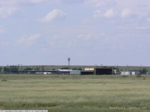 |
(Click on the photo to enlarge) |
 |
(Click on the photo to enlarge) |
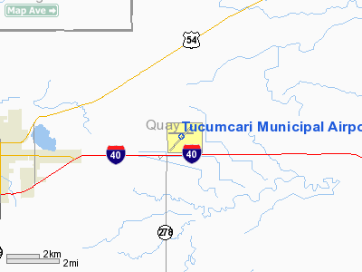
Location & QuickFacts
| FAA Information Effective: | 2008-09-25 |
| Airport Identifier: | TCC |
| Airport Status: | Operational |
| Longitude/Latitude: | 103-36-11.4670W/35-10-58.0010N
-103.603185/35.182778 (Estimated) |
| Elevation: | 4065 ft / 1239.01 m (Surveyed) |
| Land: | 1160 acres |
| From nearest city: | 6 nautical miles E of Tucumcari, NM |
| Location: | Quay County, NM |
| Magnetic Variation: | 12E (1965) |
Owner & Manager
| Ownership: | Publicly owned |
| Owner: | City Of Tucumcari |
| Address: | Box 1188
Tucumcari, NM 88401 |
| Phone number: | 575-461-3451 |
| Manager: | Steve Stephenson |
| Address: | Box 1188
Tucumcari, NM 88401 |
| Phone number: | 575-461-3229 |
Airport Operations and Facilities
| Airport Use: | Open to public |
| Wind indicator: | Yes |
| Segmented Circle: | Yes |
| Control Tower: | No |
| Lighting Schedule: | DUSK-DAWN
AFT 2200 ACTVT MIRL RYS 03/21 & 08/26 - CTAF. ACTVT VASI RY 21 - CTAF. |
| Beacon Color: | Clear-Green (lighted land airport) |
| Landing fee charge: | No |
| Sectional chart: | Albuquerque |
| Region: | ASW - Southwest |
| Boundary ARTCC: | ZAB - Albuquerque |
| Tie-in FSS: | ABQ - Albuquerque |
| FSS on Airport: | No |
| FSS Toll Free: | 1-800-WX-BRIEF |
| NOTAMs Facility: | TCC (NOTAM-d service avaliable) |
| Federal Agreements: | NGY3 |
Airport Communications
| CTAF: | 122.950 |
| Unicom: | 122.950 |
Airport Services
| Fuel available: | 100LLA |
| Bottled Oxygen: | NONE |
| Bulk Oxygen: | NONE |
Runway Information
Runway 03/21
| Dimension: | 7102 x 100 ft / 2164.7 x 30.5 m |
| Surface: | ASPH, Good Condition |
| Weight Limit: | Single wheel: 25000 lbs. |
| Edge Lights: | Medium |
| |
Runway 03 |
Runway 21 |
| Longitude: | 103-36-40.1500W | 103-35-39.6220W |
| Latitude: | 35-10-29.5690N | 35-11-19.1890N |
| Elevation: | 4040.00 ft | 4047.00 ft |
| Alignment: | 45 | 127 |
| Traffic Pattern: | Left | Left |
| Markings: | Non-precision instrument, Good Condition | Non-precision instrument, Good Condition |
| Crossing Height: | 0.00 ft | 52.00 ft |
| VASI: | | 4-box on left side |
| Visual Glide Angle: | 0.00° | 3.00° |
|
Runway 08/26
| Dimension: | 4599 x 60 ft / 1401.8 x 18.3 m |
| Surface: | ASPH, Good Condition |
| Weight Limit: | Single wheel: 12000 lbs. |
| Edge Lights: | Medium |
| |
Runway 08 |
Runway 26 |
| Longitude: | 103-36-41.7450W | 103-35-46.3490W |
| Latitude: | 35-11-03.5480N | 35-11-03.5360N |
| Elevation: | 4065.00 ft | 4036.00 ft |
| Alignment: | 90 | 127 |
| Traffic Pattern: | Left | Left |
| Markings: | Basic, Good Condition | Non-precision instrument, Good Condition |
| Obstruction: | 10 ft road, 250.0 ft from runway, 5:1 slope to clear | , 50:1 slope to clear
+3 FT BRUSH 100 FT FM THLD ON CNTRLN; +6 FT BRUSH 50 FT FM THLD 90 FT LEFT. |
|
Radio Navigation Aids
| ID |
Type |
Name |
Ch |
Freq |
Var |
Dist |
| TCC | VORTAC | Tucumcari | 083X | 113.60 | 12E | 0.2 nm |
Images and information placed above are from
http://www.airport-data.com/airport/TCC/
We thank them for the data!
| General Info
|
| Country |
United States
|
| State |
NEW MEXICO
|
| FAA ID |
TCC
|
| Latitude |
35-10-58.001N
|
| Longitude |
103-36-11.467W
|
| Elevation |
4065 feet
|
| Near City |
TUCUMCARI
|
We don't guarantee the information is fresh and accurate. The data may
be wrong or outdated.
For more up-to-date information please refer to other sources.
|
|


