|
|
Truth Or Consequences Muni Airport |
| Truth or Consequences Municipal Airport |
| IATA: TCS – ICAO: KTCS – FAA LID: TCS |
| Summary |
| Airport type |
Public |
| Operator |
City of Truth or Consequences |
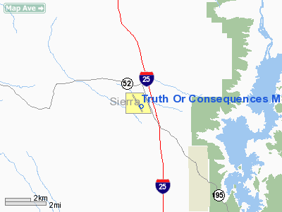
| Location |
Truth or Consequences, New Mexico |
| Elevation AMSL |
4,853 ft / 1,479 m |
| Coordinates |
33°14′13″N 107°16′18″W / 33.23694°N 107.27167°W / 33.23694; -107.27167Coordinates: 33°14′13″N 107°16′18″W / 33.23694°N 107.27167°W / 33.23694; -107.27167 |
| Runways |
| Direction |
Length |
Surface |
| ft |
m |
| 13/31 |
7,200 |
2,195 |
Asphalt |
| 11/29 |
7,000 |
2,134 |
Dirt |
| 1/19 |
3,250 |
991 |
Dirt |
| 15/33 |
3,200 |
975 |
Dirt |
| 7/25 |
2,900 |
884 |
Dirt |
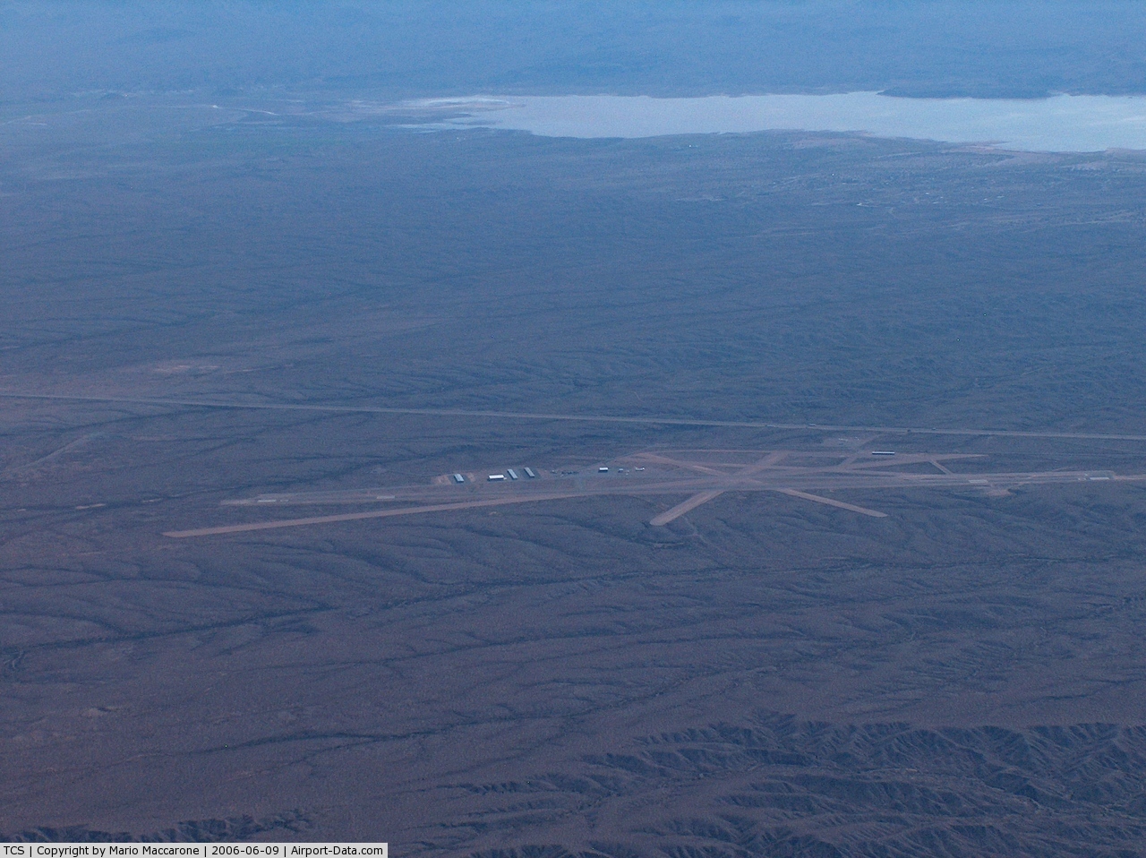
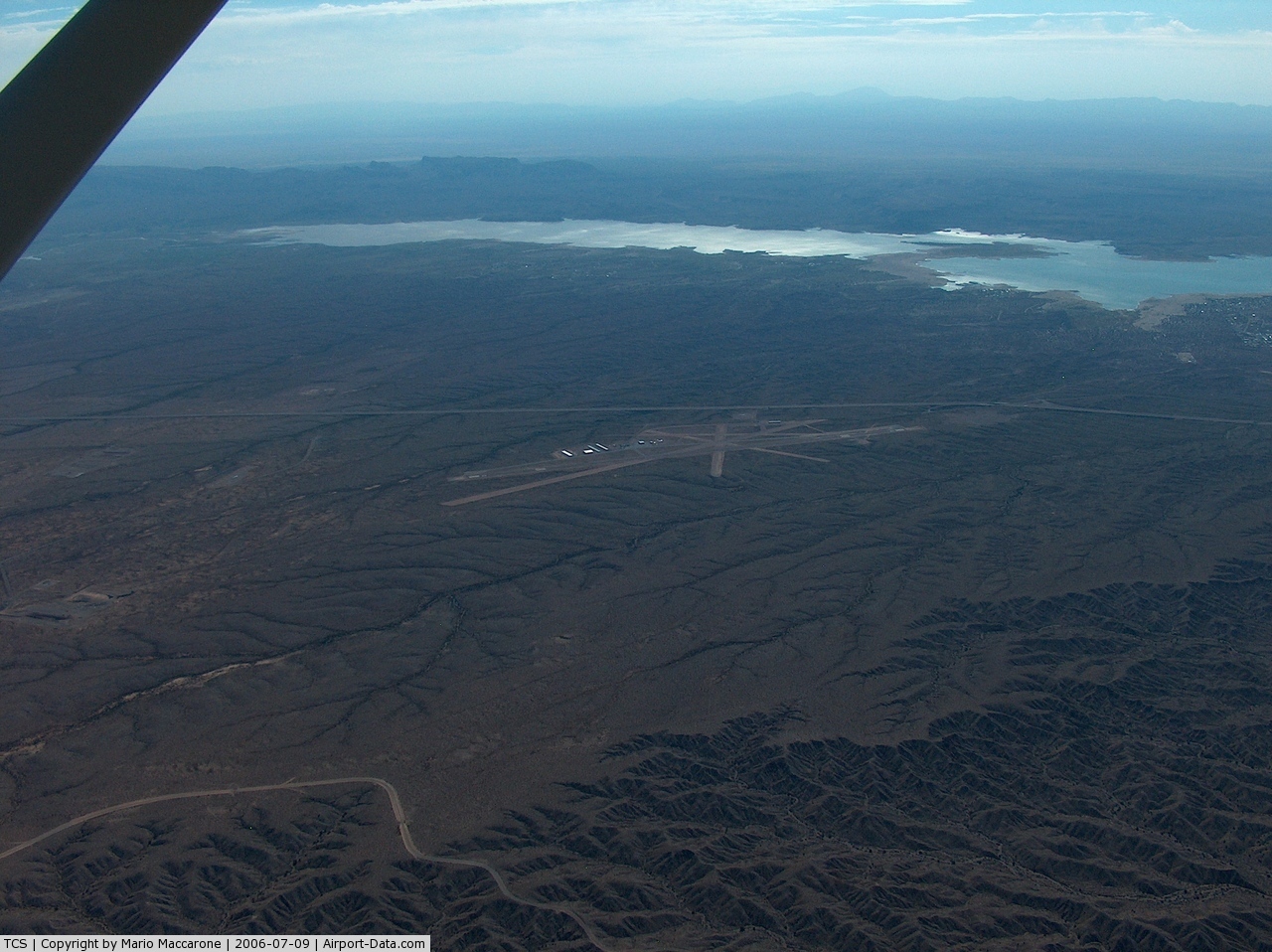
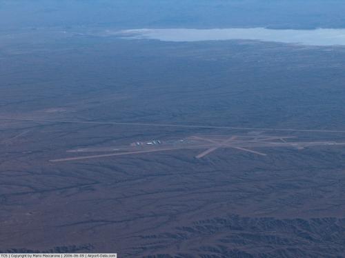
Truth or Consequences Municipal Airport (IATA: TCS, ICAO: KTCS, FAA LID: TCS) is a public-use airport located six miles (10 km) north of Truth or Consequences, a city in Sierra County, New Mexico, United States. This general aviation airport is publicly owned by the city of Truth or Consequences. It has 5 runways, only one of which is paved. The paved runway (13/31) is used the majority of the time.
The above content comes from Wikipedia and is published under free licenses – click here to read more.
 |
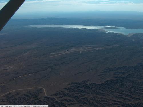
(Click on the photo to enlarge) |
 |
(Click on the photo to enlarge) |
Location & QuickFacts
| FAA Information Effective: | 2008-09-25 |
| Airport Identifier: | TCS |
| Airport Status: | Operational |
| Longitude/Latitude: | 107-16-18.3000W/33-14-13.0000N
-107.271750/33.236944 (Estimated) |
| Elevation: | 4853 ft / 1479.19 m (Surveyed) |
| Land: | 751 acres |
| From nearest city: | 6 nautical miles N of Truth Or Consequences, NM |
| Location: | Sierra County, NM |
| Magnetic Variation: | 13E (1965) |
Owner & Manager
| Ownership: | Publicly owned |
| Owner: | City Of Truth Or Conseque |
| Address: | 505 Sims
Truth Or Consequence, NM 87901 |
| Phone number: | 575-894-6673 |
| Manager: | Dan Dickson |
| Address: | 505 Sims
Truth Or Consequence, NM 87901 |
| Phone number: | 575-894-6199 |
Airport Operations and Facilities
| Airport Use: | Open to public |
| Wind indicator: | Yes |
| Segmented Circle: | No |
| Control Tower: | No |
| Lighting Schedule: | DUSK-DAWN
ACTIVATE MIRL RY 13/31 - CTAF. |
| Beacon Color: | Clear-Green (lighted land airport) |
| Landing fee charge: | No |
| Sectional chart: | Albuquerque |
| Region: | ASW - Southwest |
| Boundary ARTCC: | ZAB - Albuquerque |
| Tie-in FSS: | ABQ - Albuquerque |
| FSS on Airport: | No |
| FSS Toll Free: | 1-800-WX-BRIEF |
| NOTAMs Facility: | TCS (NOTAM-d service avaliable) |
| Federal Agreements: | NGSY |
Airport Communications
| CTAF: | 122.800 |
| Unicom: | 122.800 |
Airport Services
| Fuel available: | 100LLA1+
FOR FUEL AFTER HRS CALL 575-894-6199. |
| Airframe Repair: | MINOR |
| Power Plant Repair: | MINOR |
| Bottled Oxygen: | NONE |
| Bulk Oxygen: | NONE |
Runway Information
Runway 01/19
| Dimension: | 3301 x 130 ft / 1006.1 x 39.6 m |
| Surface: | GRVL, Fair Condition
SURFACE IS ROUGH CONTAINING LARGE ROCKS. |
| |
Runway 01 |
Runway 19 |
| Longitude: | 107-16-13.1180W | 107-15-58.9210W |
| Latitude: | 33-13-48.2590N | 33-14-18.6590N |
| Elevation: | 4810.00 ft | 4810.00 ft |
| Alignment: | 21 | 127 |
| Traffic Pattern: | Left | Left |
| Obstruction: | , 50:1 slope to clear | 15 ft road, 90.0 ft from runway, 6:1 slope to clear |
|
Runway 07/25
| Dimension: | 2932 x 130 ft / 893.7 x 39.6 m |
| Surface: | GRVL, Good Condition
SURFACE IS ROUGH CONTAINING LARGE ROCKS. |
| |
Runway 07 |
Runway 25 |
| Longitude: | 107-16-27.1190W | 107-15-53.1210W |
| Latitude: | 33-14-01.2590N | 33-14-06.2600N |
| Elevation: | 4830.00 ft | 4810.00 ft |
| Alignment: | 80 | 127 |
| Traffic Pattern: | Left | Left |
| Obstruction: | , 50:1 slope to clear | 15 ft road, 200.0 ft from runway, 13:1 slope to clear |
|
Runway 11/29
| Dimension: | 7108 x 150 ft / 2166.5 x 45.7 m |
| Surface: | GRVL, Good Condition
SURFACE IS ROUGH CONTAINING LARGE ROCKS. |
| |
Runway 11 |
Runway 29 |
| Longitude: | 107-16-59.0000W | 107-15-51.0000W |
| Latitude: | 33-14-38.0000N | 33-13-57.0000N |
| Alignment: | 126 | 127 |
| Traffic Pattern: | Left | Left |
| Obstruction: | 6 ft brush, 2.0 ft from runway | , 50:1 slope to clear |
|
Runway 13/31
| Dimension: | 7200 x 75 ft / 2194.6 x 22.9 m |
| Surface: | ASPH, Good Condition
SURFACE IS ROUGH CONTAINING LARGE ROCKS. |
| Weight Limit: | Single wheel: 12500 lbs. |
| Edge Lights: | Medium |
| |
Runway 13 |
Runway 31 |
| Longitude: | 107-16-37.3950W | 107-15-48.2400W |
| Latitude: | 33-14-35.5773N | 33-13-37.5500N |
| Elevation: | 4853.00 ft | 4794.00 ft |
| Alignment: | 127 | 127 |
| Traffic Pattern: | Left | Left |
| Markings: | Non-precision instrument, Good Condition | Non-precision instrument, Good Condition |
| Crossing Height: | 31.00 ft | 31.00 ft |
| VASI: | 2-light PAPI on left side | 2-light PAPI on left side |
| Visual Glide Angle: | 3.00° | 3.00° |
| Obstruction: | , 50:1 slope to clear | 4 ft fence, 385.0 ft from runway, 46:1 slope to clear |
|
Runway 15/33
| Dimension: | 2900 x 140 ft / 883.9 x 42.7 m |
| Surface: | GRVL, Good Condition
SURFACE IS ROUGH CONTAINING LARGE ROCKS. |
| |
Runway 15 |
Runway 33 |
| Longitude: | 107-16-03.1190W | 107-15-55.2653W |
| Latitude: | 33-14-19.2600N | 33-13-51.3382N |
| Elevation: | 4820.00 ft | 4805.00 ft |
| Alignment: | 127 | 127 |
| Traffic Pattern: | Left | Left |
| Obstruction: | 15 ft road, 45.0 ft from runway, 3:1 slope to clear | 15 ft acft, 20.0 ft from runway, 1:1 slope to clear |
|
Radio Navigation Aids
| ID |
Type |
Name |
Ch |
Freq |
Var |
Dist |
| TCS | VORTAC | Truth Or Consequences | 074X | 112.70 | 13E | 2.8 nm |
Remarks
- TFC ON OTHER RYS MAY NOT BE VISIBLE DUE TO BRUSH.
- SHARP DROP-OFFS APCH END RY 07 AND RY 01.
- ULTRALIGHT OPNS 5 NMR OF ARPT.
Images and information placed above are from
http://www.airport-data.com/airport/TCS/
We thank them for the data!
| General Info
|
| Country |
United States
|
| State |
NEW MEXICO
|
| FAA ID |
TCS
|
| Latitude |
33-14-13.000N
|
| Longitude |
107-16-18.300W
|
| Elevation |
4853 feet
|
| Near City |
TRUTH OR CONSEQUENCES
|
We don't guarantee the information is fresh and accurate. The data may
be wrong or outdated.
For more up-to-date information please refer to other sources.
|
|