 |
|
Location & QuickFacts
| FAA Information Effective: | 2008-09-25 |
| Airport Identifier: | NM92 |
| Airport Status: | Operational |
| Longitude/Latitude: | 105-36-41.4000W/35-17-44.7600N
-105.611500/35.295767 (Estimated) |
| Elevation: | 7050 ft / 2148.84 m (Estimated) |
| Land: | 0 acres |
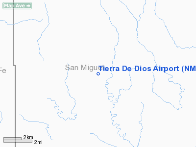
| From nearest city: | 12 nautical miles SS of Rowe, NM |
| Location: | San Miguel County, NM |
| Magnetic Variation: | () |
Owner & Manager
| Ownership: | Privately owned |
| Owner: | Jnb Llc |
| Address: | 7 Camino De Verdad
Santa Fe, NM 87508 |
| Phone number: | 505-690-0308 |
| Manager: | Doug Baltzlet |
| Address: | 301 Wicarrilla Ridge
Santa Fe, NM 87508 |
| Phone number: | 505-466-2941 |
Airport Operations and Facilities
| Airport Use: | Private |
| Wind indicator: | Yes |
| Control Tower: | No |
| Sectional chart: | Albuquerque |
| Region: | ASW - Southwest |
| Boundary ARTCC: | ZAB - Albuquerque |
| Tie-in FSS: | ABQ - Albuquerque |
| FSS Toll Free: | 1-800-WX-BRIEF |
Runway Information
Runway 08/26
| Dimension: | 2900 x 70 ft / 883.9 x 21.3 m |
| Surface: | TURF, |
| |
Runway 08 |
Runway 26 |
| Traffic Pattern: | Left | Left |
| Displaced threshold: | 400.00 ft | 0.00 ft |
| Obstruction: | 50 ft trees, 20.0 ft from runway | |
|
Radio Navigation Aids
| ID |
Type |
Name |
Ch |
Freq |
Var |
Dist |
| OTO | VOR | Otto | | 114.00 | 13E | 20.8 nm |
| SAF | VORTAC | Santa Fe | 043X | 110.60 | 13E | 26.6 nm |
| ACH | VORTAC | Anton Chico | 125X | 117.80 | 12E | 30.2 nm |
| FTI | VORTAC | Fort Union | 120X | 117.30 | 13E | 31.9 nm |
Remarks
- RISING TERRAIN 30-100 FT WEST OF RY.
- PRVDD VFR OPNS AND PRIVATE USE.
Images and information placed above are from
http://www.airport-data.com/airport/NM92/
We thank them for the data!
|
|


