 |
|
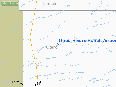
Three Rivers Ranch Airport |
Location & QuickFacts
| FAA Information Effective: | 2008-09-25 |
| Airport Identifier: | NM71 |
| Airport Status: | Operational |
| Longitude/Latitude: | 106-01-33.9700W/33-19-58.2800N
-106.026103/33.332856 (Estimated) |
| Elevation: | 4807 ft / 1465.17 m (Estimated) |
| Land: | 0 acres |
| From nearest city: | 1 nautical miles E of Three Rivers, NM |
| Location: | Otero County, NM |
| Magnetic Variation: | 10E (2000) |
Owner & Manager
| Ownership: | Privately owned |
| Owner: | Three Rivers Cattle Ltd, Co. |
| Address: | 118 West First Street
Roswell, NM 88201 |
| Phone number: | 505-623-1225 |
| Manager: | Colin Mc Millan |
| Address: | 118 West First Street
Roswell, NM 88201 |
| Phone number: | 505-623-1225 |
Airport Operations and Facilities
| Airport Use: | Private |
| Segmented Circle: | No |
| Control Tower: | No |
| Sectional chart: | Albuquerque |
| Region: | ASW - Southwest |
| Boundary ARTCC: | ZAB - Albuquerque |
| Tie-in FSS: | ABQ - Albuquerque |
| FSS Toll Free: | 1-800-WX-BRIEF |
Runway Information
Runway 06/24
| Dimension: | 5000 x 50 ft / 1524.0 x 15.2 m |
| Surface: | TURF, |
| |
Runway 06 |
Runway 24 |
| Traffic Pattern: | Left | Left |
| Obstruction: | 100 ft hill | |
|
Radio Navigation Aids
| ID |
Type |
Name |
Ch |
Freq |
Var |
Dist |
| ALM | NDB | Alamogordo | | 341.00 | 11E | 29.1 nm |
| CEP | NDB | Capitan | | 278.00 | 10E | 32.6 nm |
| HMN | TACAN | Holloman | 092X | | 10E | 28.6 nm |
| BWS | VOR/DME | Boles | 033X | 109.60 | 11E | 30.8 nm |
Images and information placed above are from
http://www.airport-data.com/airport/NM71/
We thank them for the data!
| General Info
|
| Country |
United States
|
| State |
NEW MEXICO
|
| FAA ID |
NM71
|
| Latitude |
33-19-58.280N
|
| Longitude |
106-01-33.970W
|
| Elevation |
4807 feet
|
| Near City |
THREE RIVERS
|
We don't guarantee the information is fresh and accurate. The data may
be wrong or outdated.
For more up-to-date information please refer to other sources.
|
|


