 |
|
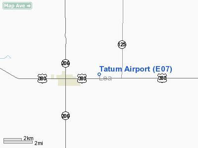
Location & QuickFacts
| FAA Information Effective: | 2008-09-25 |
| Airport Identifier: | E07 |
| Airport Status: | Operational |
| Longitude/Latitude: | 103-16-36.8180W/33-15-40.4020N
-103.276894/33.261223 (Estimated) |
| Elevation: | 3986 ft / 1214.93 m (Surveyed) |
| Land: | 320 acres |
| From nearest city: | 3 nautical miles E of Tatum, NM |
| Location: | Lea County, NM |
| Magnetic Variation: | 10E (1985) |
Owner & Manager
| Ownership: | Publicly owned |
| Owner: | Nm Dot- Aviation Division |
| Address: | Po Box 1149
Santa Fe, NM 87504 |
| Phone number: | 505-827-1525 |
| Manager: | Tom Baca |
| Address: | Po Box 1149
Santa Fe, NM 87504 |
| Phone number: | 505-244-1790 |
Airport Operations and Facilities
| Airport Use: | Open to public |
| Wind indicator: | Yes |
| Segmented Circle: | Yes |
| Control Tower: | No |
| Landing fee charge: | No |
| Sectional chart: | Albuquerque |
| Region: | ASW - Southwest |
| Boundary ARTCC: | ZFW - Fort Worth |
| Tie-in FSS: | ABQ - Albuquerque |
| FSS on Airport: | No |
| FSS Toll Free: | 1-800-WX-BRIEF |
| NOTAMs Facility: | ABQ (NOTAM-d service avaliable) |
| Federal Agreements: | N |
Airport Communications
Airport Services
Runway Information
Runway 05/23
| Dimension: | 2990 x 75 ft / 911.4 x 22.9 m |
| Surface: | ASPH, Fair Condition |
| |
Runway 05 |
Runway 23 |
| Traffic Pattern: | Left | Left |
| Markings: | Basic, Poor Condition
PAINT IS BADLY FADED AND FLAKING. | Basic, Poor Condition
PAINT IS BADLY FADED AND FLAKING. |
| Obstruction: | 30 ft pline, 830.0 ft from runway, 20:1 slope to clear | , 50:1 slope to clear
BRUSH 1-3 FT LEFT AND RIGHT IN PRIMARY SURFACE. |
|
Runway 12/30
| Dimension: | 2920 x 60 ft / 890.0 x 18.3 m |
| Surface: | ASPH, Good Condition |
| Weight Limit: | Single wheel: 10000 lbs. |
| |
Runway 12 |
Runway 30 |
| Traffic Pattern: | Left | Left |
| Markings: | Basic, Good Condition | Basic, Good Condition |
| Approach lights: | NSTD
NSTD ODALS - 3 NSTD LGTS ON EXTDD RY CNTRLN ON LESS THAN STD SPACING. | NSTD
NSTD ODALS - 3 NSTD LGTS ON EXTDD RY CNTRLN ON LESS THAN STD SPACING. |
| Obstruction: | 5 ft fence, 275.0 ft from runway, 125 ft right of centerline, 15:1 slope to clear | 10 ft road, 390.0 ft from runway, 150 ft left of centerline, 19:1 slope to clear |
|
Radio Navigation Aids
| ID |
Type |
Name |
Ch |
Freq |
Var |
Dist |
| GNC | NDB | Gaines County | | 344.00 | 09E | 47.6 nm |
| LLN | NDB | Levelland | | 266.00 | 09E | 48.6 nm |
| HOB | VORTAC | Hobbs | 047X | 111.00 | 11E | 37.4 nm |
Remarks
- GATE ALWAYS LOCKED; COMBINATION SET TO FIELD ELEVATION.
- CATTLE ON & INVOF RYS.
Images and information placed above are from
http://www.airport-data.com/airport/E07/
We thank them for the data!
| General Info
|
| Country |
United States
|
| State |
NEW MEXICO
|
| FAA ID |
E07
|
| Latitude |
33-15-40.402N
|
| Longitude |
103-16-36.818W
|
| Elevation |
3986 feet
|
| Near City |
TATUM
|
We don't guarantee the information is fresh and accurate. The data may
be wrong or outdated.
For more up-to-date information please refer to other sources.
|
|


