 |
|
| Taos Regional Airport |
| IATA: TSM – ICAO: KSKX – FAA LID: SKX |
| Summary |
| Airport type |
Public |
| Owner |
Town of Taos |
| Serves |
Taos, New Mexico |
| Elevation AMSL |
7,095 ft / 2,163 m |
| Coordinates |
36°27′29″N 105°40′21″W / 36.45806°N 105.6725°W / 36.45806; -105.6725 |
| Runways |
| Direction |
Length |
Surface |
| ft |
m |
| 4/22 |
5,803 |
1,769 |
Asphalt |
| Statistics (2009) |
| Aircraft operations |
13,250 |
| Based aircraft |
43 |
| Source: Federal Aviation Administration |
Taos Regional Airport (IATA: TSM, ICAO: KSKX, FAA LID: SKX) is a public use airport located eight nautical miles (15 km) northwest of the central business district of Taos, in Taos County, New Mexico, United States. It is owned by the Town of Taos. According to the FAA's National Plan of Integrated Airport Systems for 2009–2013, it is classified as a general aviation airport.
Although many U.S. airports use the same three-letter location identifier for the FAA and IATA, this airport is assigned SKX by the FAA and TSM by the IATA (which assigned SKX to Saransk Airport in Saransk, Russia). Facilities and aircraft
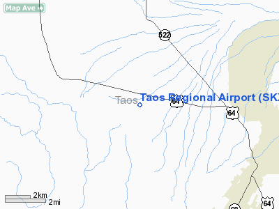
Taos Regional Airport covers an area of 180 acres (73 ha) at an elevation of 7,095 feet (2,163 m) above mean sea level. It has one runway designated 4/22 with an asphalt surface measuring 5,803 by 75 feet (1,769 x 23 m).
- The runway is oriented from NE to SW; about 75% of airport traffic departs on Runway 22 (towards the southwest) due to prevailing winds. Traffic departing Runway 22 is pointed towards the Rio Grande Gorge and Three Peaks until turning on course. Traffic departing Runway 4 (to the northeast) is pointed at Arroyo Seco until turning on course.
- Length of the runway is important for safety reasons: If a pilot must abort a takeoff near takeoff speed (100-150 mph), he or she needs to have enough runway remaining to bring the airplane safely to a stop. Aircraft engines produce less power the higher the elevation of the airport. Aircraft wings and propellers also are less efficient at developing lift for takeoff at higher elevations. Tao’s current runway would be of sufficient length if Taos was at sea level, but at 7,100 feet (2,200 m), it needs to be 2,000-3,000 longer to more safely accommodate current users. Pilots routinely use up to 80-90% of the available Taos runway length for takeoff and landing, leaving very little margin of safety if a problem (such as ice or wet pavement) occurs.
- Taos has the shortest runway of any city in northern New Mexico and of any city located above 5,000 feet (1,500 m) above sea level in New Mexico.
- The Taos area is the largest population in New Mexico not served by a runway of 6,500 feet (2,000 m) or longer.
- The existing runway is rated for aircraft having weights up 24,000 pounds per wheel. This is a recommendation only; pilots may land heavier aircraft, but would then have trouble departing the airport due to existing runway being too short. (If the runway is damaged by a pilot landing an aircraft which is too heavy, the aircraft’s owner would be liable. Such events are extremely rare nationwide and have never occurred at Taos.)
For the 12-month period ending April 7, 2009, the airport had 13,250 aircraft operations, an average of 36 per day: 95% general aviation, 3% air taxi, and 2% military. At that time there were 43 aircraft based at this airport: 88% single-engine, 5% multi-engine and 7% ultralight.
A small public terminal, owned by the Town of Taos, is located mid-field. It features free wireless Internet, bathrooms, meeting area, and seating for up to 15 people.
A fixed base operator (FBO) operates from a hangar and office complex 100 yd (91 m) southwest of the terminal. The FBO operates on a lease with the Town of Taos.
Services
- Taos Aviation Services provides fuel, parking and rental car services from the large tan hangar 100 yards (91 m) southwest of the terminal.
- There is no aircraft pre-heating service available at the airport.
- There is no aircraft maintenance facility or mechanic on the field.
- There is no place at which a pilot may rent an airport on the field. Taos pilots and student pilots typically co-own aircraft in groups of 2-5. This allows a pilot to start flying for about $3,500 down, $350/mo., and $90 per flight hour, including fuel.
- There is no flight school at the airport. However, there are 3 instructors on the field for students who own or co-own aircraft
- There is no airline which currently serves the airport. The last airline to serve Taos was Westward Air, now-defunct, which tried using 9-seat Pilatus PC-12 turboprops to and from Albuquerque for a few months in the mid-2000s under subsidy from the US Department of Transportation. Before that, Rio Grande Air provided service to Albuquerque for several years, 9-seat Cessna Caravan turboprops, from their facilities in the Taos Aviation Services hangar, 100 yards (91 m) southwest of the terminal.
- The nearest airports which have airline service to Taos are Alamosa, CO (a 1:45 drive to the north) and Santa Fe, NM (a 1:30 drive to the southeast).
- Great Lakes was invited in 2006 to participate in serving Taos but did not respond to requests for proposals. Based on fares-per-mile currently charged for their routes between Alamosa, Gunnison, and Telluride, CO and Denver, the fare for service from Taos to Denver would range from $150 to $250, each way (Note: An air fare analysis is listed in the files section of the Taos Airport Forum. See External Links section below.)
- The Experimental Aircraft Assn. has an active branch at Taos Regional Airport. The Taos Mountain Flyers branch holds an annual fly-in for tourists and also gives rides to children under 17 the 3rd weekend in June. In June 2007, the Young Eagles event gave rides to 100 Taos area children.
Future
- A longer, crosswind Runway, 12/30, has been proposed for the airport. It would measure 8,600 x 100 ft (30 m). The Draft Environmental Impact Statement was released in Fall, 2006; the final EIS is expected in late 2007 or 2008. Traffic departing Runway 12 (towards the southeast) would be pointed at approximately Ranchos de Taos until turning on course. Traffic departing Runway 30 (towards the northwest) would be pointed at approximately Tres Piedres until turning on course.
- The new runway will be rated for aircraft having weights up to 60,000 pounds per wheel.
- After the new runway is built, the “main” existing runway will remain in service, but will be shortened by approx. 400 feet (120 m).
- While prevailing winds will only favor the new runway 6% of the time, almost all jets and most turboprop aircraft will use the longer runway because it affords a better margin of safety. However, small propeller aircraft, which don’t need the added length, will likely use the existing runway except for the 6% of the time wind conditions favor the new runway.
- After FAA approval of the Environmental Impact Statement, it could take 1-3 years for the FAA to allocate the funds needed to construct the runway. Construction would then take 6-9 months.
- The following government officials have sent letters of support for the project to the FAA: Taos Mayor, Director of the NM Dept. of Aviation, Governor Bill Richardson, both New Mexico US Senators, and US Rep. Tom Udall.
- Estimates for construction of the new runway range from $12-20 million.
- The FAA paid for the EIS. It will pay 95% of the cost of building the runway because it will be part of the National Airspace System. (Most of the funding for such projects comes from aviation fuel and airline ticket taxes.) The State of New Mexico will contribute 2.5% of the project. The Town of Taos will likely contribute land for the runway as its matching 2.5%.
The above content comes from Wikipedia and is published under free licenses – click here to read more.
Location & QuickFacts
| FAA Information Effective: | 2008-09-25 |
| Airport Identifier: | SKX |
| Airport Status: | Operational |
| Longitude/Latitude: | 105-40-20.7000W/36-27-29.4000N
-105.672417/36.458167 (Estimated) |
| Elevation: | 7095 ft / 2162.56 m (Surveyed) |
| Land: | 180 acres |
| From nearest city: | 8 nautical miles NW of Taos, NM |
| Location: | Taos County, NM |
| Magnetic Variation: | 11E (1985) |
Owner & Manager
| Ownership: | Publicly owned |
| Owner: | Town Of Taos |
| Address: | 400 Camino De La Placita
Taos, NM 87571 |
| Phone number: | 575-751-2000 |
| Manager: | Mark G. Fratrick |
| Address: | 400 Camino De La Placita
Taos, NM 87571 |
| Phone number: | 575-758-4995
EMERGENCY PHONE: 575-751-9320. |
Airport Operations and Facilities
| Airport Use: | Open to public |
| Wind indicator: | Yes |
| Segmented Circle: | Yes |
| Control Tower: | No |
| Lighting Schedule: | DUSK-DAWN
ACTVT MIRL RY 04/22 - CTAF. |
| Beacon Color: | Clear-Green (lighted land airport) |
| Landing fee charge: | No |
| Sectional chart: | Denver |
| Region: | ASW - Southwest |
| Boundary ARTCC: | ZAB - Albuquerque |
| Tie-in FSS: | ABQ - Albuquerque |
| FSS on Airport: | No |
| FSS Toll Free: | 1-800-WX-BRIEF |
| NOTAMs Facility: | SKX (NOTAM-d service avaliable) |
| Federal Agreements: | NGY |
Airport Communications
| CTAF: | 122.800 |
| Unicom: | 122.800 |
Airport Services
| Fuel available: | 100LLA1+
FOR FUEL AFTER HRS CALL 575-737-9320. |
Runway Information
Runway 04/22
| Dimension: | 5803 x 75 ft / 1768.8 x 22.9 m |
| Surface: | ASPH, |
| Surface Treatment: | Porous Friction Course |
| Weight Limit: | Single wheel: 24000 lbs. |
| Edge Lights: | Medium |
| |
Runway 04 |
Runway 22 |
| Longitude: | 105-40-50.1948W | 105-39-51.2469W |
| Latitude: | 36-27-13.4566N | 36-27-45.4296N |
| Elevation: | 7049.00 ft | 7094.00 ft |
| Alignment: | 56 | 127 |
| Traffic Pattern: | Left | Left |
| Markings: | Basic, Good Condition | Basic, Good Condition |
| Crossing Height: | 0.00 ft | 30.00 ft |
| VASI: | 2-light PAPI on left side | 2-light PAPI on left side |
| Visual Glide Angle: | 0.00° | 3.50° |
| Runway End Identifier: | Yes | |
|
Radio Navigation Aids
| ID |
Type |
Name |
Ch |
Freq |
Var |
Dist |
| SKX | NDB | Ski | | 414.00 | 11E | 0.2 nm |
| TAS | VORTAC | Taos | 123X | 117.60 | 13E | 14.5 nm |
| CIM | VORTAC | Cimarron | 111X | 116.40 | 13E | 38.7 nm |
Remarks
- AVOID OVERFLIGHT OF TAOS PUEBLO WORLD HERITAGE SITE 5 NM EAST OF ARPT.
- RY 04/22 PARALLEL TWY HAS RETRO-REFLECTORS.
Images and information placed above are from
http://www.airport-data.com/airport/SKX/
We thank them for the data!
| General Info
|
| Country |
United States
|
| State |
NEW MEXICO
|
| FAA ID |
SKX
|
| Latitude |
36-27-29.484N
|
| Longitude |
105-40-20.744W
|
| Elevation |
7091 feet
|
| Near City |
TAOS
|
We don't guarantee the information is fresh and accurate. The data may
be wrong or outdated.
For more up-to-date information please refer to other sources.
|
|


