 |
|
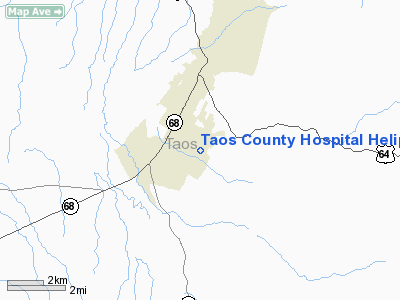
Taos County Hospital Heliport |
Location & QuickFacts
| FAA Information Effective: | 2008-09-25 |
| Airport Identifier: | NM65 |
| Airport Status: | Operational |
| Longitude/Latitude: | 105-34-20.0000W/36-22-09.0000N
-105.572222/36.369167 (Estimated) |
| Elevation: | 7064 ft / 2153.11 m (Estimated) |
| Land: | 0 acres |
| From nearest city: | 0 nautical miles N of Taos, NM |
| Location: | Taos County, NM |
| Magnetic Variation: | 10E (1995) |
Owner & Manager
| Ownership: | Publicly owned |
| Owner: | Taos County |
| Address: | 1397 Weimer Road
Taos, NM 87571 |
| Phone number: | 505-751-5700 |
| Manager: | Rita Campbell |
| Address: | 1397 Weimer Road
Taos, NM 87571 |
| Phone number: | 505-751-5700 |
Airport Operations and Facilities
| Airport Use: | Private
MEDICAL. |
| Segmented Circle: | No |
| Control Tower: | No |
| Lighting Schedule: | PHONE REQ
FOR PERIMETER LGTS CALL 505-751-5700. |
| Sectional chart: | Denver |
| Region: | ASW - Southwest |
| Boundary ARTCC: | ZAB - Albuquerque |
| Tie-in FSS: | ABQ - Albuquerque |
| FSS on Airport: | No |
| FSS Toll Free: | 1-800-WX-BRIEF |
Runway Information
Helipad H1
| Dimension: | 46 x 46 ft / 14.0 x 14.0 m |
| Surface: | CONC, |
| |
Runway H1 |
Runway |
| Traffic Pattern: | Left | Left |
|
Radio Navigation Aids
| ID |
Type |
Name |
Ch |
Freq |
Var |
Dist |
| SKX | NDB | Ski | | 414.00 | 11E | 7.3 nm |
| TAS | VORTAC | Taos | 123X | 117.60 | 13E | 21.6 nm |
| CIM | VORTAC | Cimarron | 111X | 116.40 | 13E | 34.7 nm |
| FTI | VORTAC | Fort Union | 120X | 117.30 | 13E | 47.8 nm |
Images and information placed above are from
http://www.airport-data.com/airport/NM65/
We thank them for the data!
| General Info
|
| Country |
United States
|
| State |
NEW MEXICO
|
| FAA ID |
NM65
|
| Latitude |
36-22-09.000N
|
| Longitude |
105-34-20.000W
|
| Elevation |
7064 feet
|
| Near City |
TAOS
|
We don't guarantee the information is fresh and accurate. The data may
be wrong or outdated.
For more up-to-date information please refer to other sources.
|
|


