 |
|
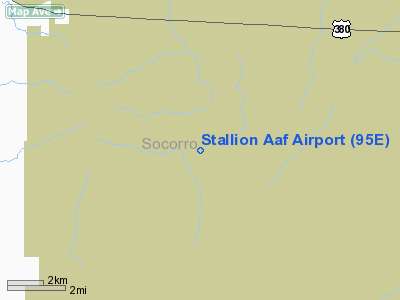
Location & QuickFacts
| FAA Information Effective: | 2008-09-25 |
| Airport Identifier: | 95E |
| Airport Status: | Operational |
| Longitude/Latitude: | 106-38-42.0510W/33-49-08.2430N
-106.645014/33.818956 (Estimated) |
| Elevation: | 4925 ft / 1501.14 m (Estimated) |
| Land: | 0 acres |
| From nearest city: | 18 nautical miles SE of Socorro, NM |
| Location: | Socorro County, NM |
| Magnetic Variation: | 11E (1985) |
Owner & Manager
| Ownership: | Army owned |
| Owner: | U S Army Atca-aso |
| Address: | Cameron Station
Alexandria, VA 22314 |
| Address: |
|
Airport Operations and Facilities
| Airport Use: | Private |
| Segmented Circle: | No |
| Control Tower: | No |
| Lighting Schedule: | RDO-CTL
ACTIVATE - MIRL RWY 14-32, KEY 122.8 5 TIMES. |
| Sectional chart: | Albuquerque |
| Region: | ASW - Southwest |
| Boundary ARTCC: | ZAB - Albuquerque |
| Tie-in FSS: | ABQ - Albuquerque |
| FSS on Airport: | No |
| FSS Toll Free: | 1-800-WX-BRIEF |
Airport Communications
Runway Information
Runway 14/32
| Dimension: | 4000 x 100 ft / 1219.2 x 30.5 m |
| Surface: | ASPH, |
| Edge Lights: | Medium |
| |
Runway 14 |
Runway 32 |
| Traffic Pattern: | Left | Left |
|
Radio Navigation Aids
| ID |
Type |
Name |
Ch |
Freq |
Var |
Dist |
| FIA | NDB | Florida | | 329.00 | 12E | 21.2 nm |
| ONM | VORTAC | Socorro | 115X | 116.80 | 13E | 32.4 nm |
| TCS | VORTAC | Truth Or Consequences | 074X | 112.70 | 13E | 45.3 nm |
Remarks
- CAUTION: RNG MISL FRNG E AND S OF FLD.
- RSTD: PPR DSN 349-1315 C575-679-1315.
- RSTD: ACFT LDG RQR TO MAKE LO APCH TO INSURE RWY CLEAR OF OBST AND WILD GAME.
- RSTD: CIV OPR MUST HAVE DA FORM 5206-R ON FILE AT WSMR.
- RSTD: CTC AND CLNC FR RNG CTL MANDATORY PRIOR TO ENTERING R5107B.
- FUEL: LTD FUEL AVBL 1445-2300Z++ MON-FRI. - J8
- CAUTION: RWY 14-32 SLIPPERY WHEN DRY AND EXTREMELY SLIPPERY WHEN WET DUE TO RUBBERIZED ACRYLIC SEALANT APPLIED TO RWY. EXP POSSIBLE WATER POOLS ON RWY DUR WET COND.
Images and information placed above are from
http://www.airport-data.com/airport/95E/
We thank them for the data!
| General Info
|
| Country |
United States
|
| State |
NEW MEXICO
|
| FAA ID |
95E
|
| Latitude |
33-49-08.243N
|
| Longitude |
106-38-42.051W
|
| Elevation |
4925 feet
|
| Near City |
SOCORRO
|
We don't guarantee the information is fresh and accurate. The data may
be wrong or outdated.
For more up-to-date information please refer to other sources.
|
|


