 |
|
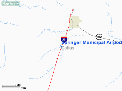
| Springer Municipal Airport |
| IATA: none – ICAO: none – FAA LID: S42 |
| Summary |
| Airport type |
Public |
| Owner/Operator |
Town of Springer |
| Serves |
Springer, New Mexico |
| Location |
1 mile S of Springer, New Mexico |
| Elevation AMSL |
5,891 ft / 1,795 m |
| Coordinates |
36°19′37.12″N 104°37′10.96″W / 36.3269778°N 104.6197111°W / 36.3269778; -104.6197111 |
| Runways |
| Direction |
Length |
Surface |
| ft |
m |
| 01/19 |
5,000 |
1,524 |
Asphalt |
| Source: Federal Aviation Administration |
Springer Municipal Airport (FAA LID: S42) is a general aviation airport located 1-mile (1.6 km) south of Springer, New Mexico, USA.
Facilities
Springer Municipal Airport covers 108 acres (44 ha) and has one runway:
- Runway 01/19: 5,000 x 60 ft (18 m). Surface: Asphalt
The above content comes from Wikipedia and is published under free licenses – click here to read more.
Location & QuickFacts
| FAA Information Effective: | 2008-09-25 |
| Airport Identifier: | S42 |
| Airport Status: | Operational |
| Longitude/Latitude: | 104-37-10.9620W/36-19-37.1210N
-104.619712/36.326978 (Estimated) |
| Elevation: | 5891 ft / 1795.58 m (Surveyed) |
| Land: | 108 acres |
| From nearest city: | 1 nautical miles S of Springer, NM |
| Location: | Colfax County, NM |
| Magnetic Variation: | 11E (1985) |
Owner & Manager
| Ownership: | Publicly owned |
| Owner: | Town Of Springer |
| Address: | Po Box 488
Springer, NM 87747 |
| Phone number: | 575-483-2682 |
| Manager: | Johnny Chavez
MAYOR. |
| Address: | Box 488
Springer, NM 87747 |
| Phone number: | 575-483-2682 |
Airport Operations and Facilities
| Airport Use: | Open to public |
| Wind indicator: | Yes |
| Segmented Circle: | Yes |
| Control Tower: | No |
| Lighting Schedule: | DUSK-DAWN
MIRL RY 01/19 PRESET LOW INTST; TO INCR INTST ACTVT - 122.8. |
| Beacon Color: | Clear-Green (lighted land airport) |
| Landing fee charge: | No |
| Sectional chart: | Denver |
| Region: | ASW - Southwest |
| Boundary ARTCC: | ZAB - Albuquerque |
| Tie-in FSS: | ABQ - Albuquerque
ALBUQUERQUE AFSS TOLL FREE CALL DIAL 1-800-525-9963. |
| FSS on Airport: | No |
| FSS Toll Free: | 1-800-WX-BRIEF |
| NOTAMs Facility: | ABQ (NOTAM-d service avaliable) |
| Federal Agreements: | NGY |
Airport Communications
Airport Services
| Airframe Repair: | NONE |
| Power Plant Repair: | NONE |
| Bottled Oxygen: | NONE |
| Bulk Oxygen: | NONE |
Runway Information
Runway 01/19
| Dimension: | 5000 x 60 ft / 1524.0 x 18.3 m |
| Surface: | ASPH, Good Condition |
| Weight Limit: | Single wheel: 14500 lbs. |
| Edge Lights: | Medium
MIRL OTS INDEFLY. |
| |
Runway 01 |
Runway 19 |
| Traffic Pattern: | Left | Left |
| Markings: | Basic, Good Condition | Basic, Good Condition |
| Obstruction: | 18 ft hill, 1000.0 ft from runway, 44:1 slope to clear | , 50:1 slope to clear |
|
Radio Navigation Aids
| ID |
Type |
Name |
Ch |
Freq |
Var |
Dist |
| MXR | NDB | Maxwell | | 284.00 | 10E | 22.8 nm |
| CIM | VORTAC | Cimarron | 111X | 116.40 | 13E | 15.7 nm |
| FTI | VORTAC | Fort Union | 120X | 117.30 | 13E | 47.4 nm |
Remarks
- ARPT ROAD GATES LOCKED; FOR ENTRY & EXIT CALL 575-483-2404.
Images and information placed above are from
http://www.airport-data.com/airport/S42/
We thank them for the data!
| General Info
|
| Country |
United States
|
| State |
NEW MEXICO
|
| FAA ID |
S42
|
| Latitude |
36.326977
36° 19' 37.12" N
|
| Longitude |
-104.619710
104° 37' 10.96" W
|
| Elevation |
5891 feet
1796 meters
|
| Magnetic Variation |
009° E (01/06)
|
| Beacon |
Yes
|
| Operating Agency |
U.S.CIVIL AIRPORT WHEREIN PERMIT COVERS USE BY TRANSIT MILITARY AIRCRAFT
|
| Daylight Saving Time |
Second Sunday in March at 0200 to first Sunday in November at 0200 local time (Exception Arizona and that portion of Indiana in the Eastern Time Zone)
|
We don't guarantee the information is fresh and accurate. The data may
be wrong or outdated.
For more up-to-date information please refer to other sources.
|
|


