 |
|
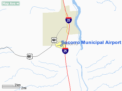
Location & QuickFacts
| FAA Information Effective: | 2008-09-25 |
| Airport Identifier: | ONM |
| Airport Status: | Operational |
| Longitude/Latitude: | 106-54-11.3000W/34-01-20.9000N
-106.903139/34.022472 (Estimated) |
| Elevation: | 4875 ft / 1485.90 m (Surveyed) |
| Land: | 670 acres |
| From nearest city: | 3 nautical miles S of Socorro, NM |
| Location: | Socorro County, NM |
| Magnetic Variation: | 12E (1980) |
Owner & Manager
| Ownership: | Publicly owned |
| Owner: | City Of Socorro |
| Address: | Po Box K
Socorro, NM 87801 |
| Phone number: | 575-838-6357 |
| Manager: | David R. Chavez |
| Address: | Po Box K
Socorro, NM 87801 |
| Phone number: | 575-835-4477 |
Airport Operations and Facilities
| Airport Use: | Open to public |
| Wind indicator: | Yes |
| Segmented Circle: | Yes |
| Control Tower: | No |
| Lighting Schedule: | DUSK-DAWN
MIRL RY 15/33 PRESET LOW INTST; TO INCR INTST & ACTVT MIRL RY 06/24 & VASI RYS 15 & 33 - CTAF. |
| Beacon Color: | Clear-Green (lighted land airport) |
| Landing fee charge: | No |
| Sectional chart: | Albuquerque |
| Region: | ASW - Southwest |
| Boundary ARTCC: | ZAB - Albuquerque |
| Tie-in FSS: | ABQ - Albuquerque |
| FSS on Airport: | No |
| FSS Toll Free: | 1-800-WX-BRIEF |
| NOTAMs Facility: | ABQ (NOTAM-d service avaliable) |
| Federal Agreements: | NGSY3 |
Airport Communications
| CTAF: | 122.800 |
| Unicom: | 122.800 |
Airport Services
| Fuel available: | 100LL |
| Bottled Oxygen: | NONE |
| Bulk Oxygen: | NONE |
Runway Information
Runway 06/24
| Dimension: | 4590 x 60 ft / 1399.0 x 18.3 m |
| Surface: | ASPH, Good Condition |
| Edge Lights: | Medium |
| |
Runway 06 |
Runway 24 |
| Longitude: | 106-54-51.6820W | 106-53-59.4160W |
| Latitude: | 34-01-17.9250N | 34-01-30.7980N |
| Elevation: | 4875.00 ft | 4785.00 ft |
| Alignment: | 74 | 127 |
| Traffic Pattern: | Left | Left |
| Markings: | Basic, Fair Condition | Basic, Fair Condition |
| Obstruction: | 70 ft gnd, 2300.0 ft from runway, 30:1 slope to clear | , 50:1 slope to clear |
|
Runway 15/33
| Dimension: | 5841 x 100 ft / 1780.3 x 30.5 m |
| Surface: | ASPH, |
| Weight Limit: | Single wheel: 50000 lbs.
Dual wheel: 75000 lbs. |
| Edge Lights: | Medium |
| |
Runway 15 |
Runway 33 |
| Longitude: | 106-54-09.9390W | 106-53-50.2550W |
| Latitude: | 34-01-45.8650N | 34-00-50.4720N |
| Elevation: | 4798.00 ft | 4744.00 ft |
| Alignment: | 127 | 127 |
| Traffic Pattern: | Left | Left |
| Markings: | Non-precision instrument, Good Condition | Non-precision instrument, Good Condition |
| Crossing Height: | 25.00 ft | 26.00 ft |
| Displaced threshold: | 186.00 ft | 182.00 ft |
| VASI: | 2-box on left side
VASI OTS INDEFLY. | 2-box on left side
VASI OTS INDEFLY. |
| Visual Glide Angle: | 4.00° | 4.00° |
|
Radio Navigation Aids
| ID |
Type |
Name |
Ch |
Freq |
Var |
Dist |
| FIA | NDB | Florida | | 329.00 | 12E | 4.7 nm |
| ONM | VORTAC | Socorro | 115X | 116.80 | 13E | 19.5 nm |
| TCS | VORTAC | Truth Or Consequences | 074X | 112.70 | 13E | 48.3 nm |
Images and information placed above are from
http://www.airport-data.com/airport/ONM/
We thank them for the data!
| General Info
|
| Country |
United States
|
| State |
NEW MEXICO
|
| FAA ID |
ONM
|
| Latitude |
34-01-20.900N
|
| Longitude |
106-54-11.300W
|
| Elevation |
4875 feet
|
| Near City |
SOCORRO
|
We don't guarantee the information is fresh and accurate. The data may
be wrong or outdated.
For more up-to-date information please refer to other sources.
|
|


