 |
|
Location & QuickFacts
| FAA Information Effective: | 2008-09-25 |
| Airport Identifier: | NM62 |
| Airport Status: | Operational |
| Longitude/Latitude: | 108-13-05.2700W/36-43-27.0100N
-108.218131/36.724169 (Estimated) |
| Elevation: | 5280 ft / 1609.34 m (Estimated) |
| Land: | 0 acres |
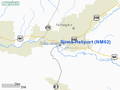
| From nearest city: | 0 nautical miles N of Farmington, NM |
| Location: | San Juan County, NM |
| Magnetic Variation: | 12E (1990) |
Owner & Manager
| Ownership: | Privately owned |
| Owner: | San Juan Regional Medical Ctr |
| Address: | 505-599-6046
801 W. Maple Street |
| Phone number: | 505-599-6046 |
| Manager: | Mike Berve |
| Address: | 801 W. Maple Street
Farmington, NM 87401 |
| Phone number: | 800-452-9990 |
Airport Operations and Facilities
| Airport Use: | Private
MEDICAL USE. |
| Wind indicator: | Yes |
| Segmented Circle: | No |
| Control Tower: | No |
| Lighting Schedule: | PHONE REQ
FOR PERIMETER LGTS CALL 505-599-6046. |
| Sectional chart: | Denver |
| Region: | ASW - Southwest |
| Boundary ARTCC: | ZDV - Denver |
| Tie-in FSS: | ABQ - Albuquerque |
| FSS on Airport: | No |
| FSS Toll Free: | 1-800-WX-BRIEF |
Airport Services
Runway Information
Helipad H1
| Dimension: | 40 x 40 ft / 12.2 x 12.2 m |
| Surface: | CONC, |
| |
Runway H1 |
Runway |
| Traffic Pattern: | Left | Left |
|
Radio Navigation Aids
| ID |
Type |
Name |
Ch |
Freq |
Var |
Dist |
| DRO | VOR/DME | Durango | 019X | 108.20 | 14E | 34.2 nm |
| CEZ | VOR/DME | Cortez | 021X | 108.40 | 14E | 43.3 nm |
| RSK | VORTAC | Rattlesnake | 100X | 115.30 | 14E | 5.9 nm |
Images and information placed above are from
http://www.airport-data.com/airport/NM62/
We thank them for the data!
| General Info
|
| Country |
United States
|
| State |
NEW MEXICO
|
| FAA ID |
NM62
|
| Latitude |
36-43-27.010N
|
| Longitude |
108-13-05.270W
|
| Elevation |
5280 feet
|
| Near City |
FARMINGTON
|
We don't guarantee the information is fresh and accurate. The data may
be wrong or outdated.
For more up-to-date information please refer to other sources.
|
|


