 |
|
Sierra Blanca Rgnl Airport |
| Sierra Blanca Regional Airport |
| IATA: RUI – ICAO: KSRR – FAA LID: SRR |
| Summary |
| Airport type |
Public |
| Owner |
Village of Ruidoso |
| Serves |
Ruidoso, New Mexico |
| Elevation AMSL |
6,814 ft / 2,077 m |
| Coordinates |
33°27′46″N 105°32′05″W / 33.46278°N 105.53472°W / 33.46278; -105.53472 |
| Runways |
| Direction |
Length |
Surface |
| ft |
m |
| 6/24 |
8,099 |
2,469 |
Asphalt |
| 12/30 |
6,500 |
1,981 |
Asphalt |
| Statistics (2009) |
| Aircraft operations |
7,002 |
| Based aircraft |
37 |
| Source: Federal Aviation Administration |
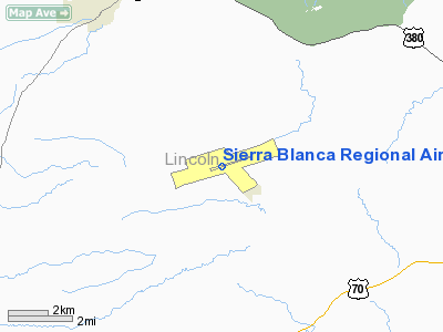
Sierra Blanca Regional Airport (IATA: RUI, ICAO: KSRR, FAA LID: SRR) is a public use airport located 15 nautical miles (28 km) northeast of the central business district of Ruidoso, a village in Lincoln County, New Mexico, United States. It is owned by the Village of Ruidoso. According to the FAA's National Plan of Integrated Airport Systems for 2009–2013, it is classified as a general aviation airport.
New Mexico Airlines used to serve the Sierra Blanca Regional Airport but no longer does so.
Although many U.S. airports use the same three-letter location identifier for the FAA and IATA, this airport is assigned SRR by the FAA and RUI by the IATA.
Facilities and aircraft
Sierra Blanca Regional Airport covers an area of 1,665 acres (674 ha) at an elevation of 6,814 feet (2,077 m) above mean sea level. It has two asphalt paved runways: 6/24 is 8,099 by 100 feet (2,469 x 30 m) and 12/30 is 6,500 by 75 feet (1,981 x 23 m).
For the 12-month period ending March 31, 2009, the airport had 7,002 aircraft operations, an average of 19 per day: 83.6% general aviation, 11.5% air taxi, 3.5% scheduled commercial, and 1.4% military. At that time there were 37 aircraft based at this airport: 86.5% single-engine, 8.1% multi-engine, 2.7% jet and 2.7% helicopter.
The above content comes from Wikipedia and is published under free licenses – click here to read more.
Location & QuickFacts
| FAA Information Effective: | 2008-09-25 |
| Airport Identifier: | SRR |
| Airport Status: | Operational |
| Longitude/Latitude: | 105-32-05.1030W/33-27-46.2600N
-105.534751/33.462850 (Estimated) |
| Elevation: | 6814 ft / 2076.91 m (Surveyed) |
| Land: | 1665 acres |
| From nearest city: | 15 nautical miles NE of Ruidoso, NM |
| Location: | Lincoln County, NM |
| Magnetic Variation: | 10E (1990) |
Owner & Manager
| Ownership: | Publicly owned |
| Owner: | Village Of Ruidoso |
| Address: | 313 Cree Meadows Dr
Ruidoso, NM 88345 |
| Phone number: | 575-258-4014 |
| Manager: | Tim Morris
ACTING AIRPORT MANGER. |
| Address: | 313 Cree Meadows Dr
Ruidoso, NM 88345 |
| Phone number: | 575-336-8111 |
Airport Operations and Facilities
| Airport Use: | Open to public |
| Wind indicator: | Yes |
| Segmented Circle: | Yes |
| Control Tower: | No |
| Lighting Schedule: | DUSK-DAWN
ACTVT MIRL RYS 06/24 & 12/30 - CTAF. |
| Beacon Color: | Clear-Green (lighted land airport) |
| Sectional chart: | Albuquerque |
| Region: | ASW - Southwest |
| Boundary ARTCC: | ZAB - Albuquerque |
| Tie-in FSS: | ABQ - Albuquerque |
| FSS Toll Free: | 1-800-WX-BRIEF |
| NOTAMs Facility: | SRR (NOTAM-d service avaliable) |
| Certification type/date: | II A U 06/198
CLSD TO ACR USING ACFT WITH MORE THAN 30 PSGR SEATS EXCP 24 HOURS PPR; CTC AMGR 575-336-8111. |
| Federal Agreements: | NGSY |
Airport Communications
| CTAF: | 122.800 |
| Unicom: | 122.800 |
Airport Services
| Fuel available: | 100LLA |
| Power Plant Repair: | MAJOR |
| Bottled Oxygen: | HIGH |
Runway Information
Runway 06/24
| Dimension: | 8099 x 100 ft / 2468.6 x 30.5 m |
| Surface: | ASPH, Fair Condition |
| Surface Treatment: | Porous Friction Course |
| Weight Limit: | Single wheel: 60000 lbs.
Dual wheel: 115000 lbs. |
| Edge Lights: | Medium |
| |
Runway 06 |
Runway 24 |
| Longitude: | 105-32-50.3950W | 105-31-19.8220W |
| Latitude: | 33-27-33.4780N | 33-27-59.0370N |
| Elevation: | 6814.00 ft | 6751.00 ft |
| Alignment: | 71 | 127 |
| ILS Type: | | ILS/DME
|
| Traffic Pattern: | Left | Left |
| Markings: | Non-precision instrument, Good Condition | Non-precision instrument, Good Condition |
| VASI: | 2-box on left side | pulsating/steady burning on left side |
| Visual Glide Angle: | 2.50° | 2.50° |
| Decleard distances: | Take off run available 8099.00 ft
Take off distance available 8099.00 ft
Actual stop distance available 8099.00 ft
Landing distance available 8099.00 ft
| Take off run available 8099.00 ft
Take off distance available 8099.00 ft
Actual stop distance available 8099.00 ft
Landing distance available 8099.00 ft
|
|
Runway 12/30
| Dimension: | 6500 x 75 ft / 1981.2 x 22.9 m |
| Surface: | ASPH, Good Condition |
| Weight Limit: | Single wheel: 12500 lbs. |
| Edge Lights: | Medium |
| |
Runway 12 |
Runway 30 |
| Traffic Pattern: | Left | Left |
| Markings: | Basic, Fair Condition | Non-precision instrument, Fair Condition |
| Decleard distances: | Take off run available 6500.00 ft
Take off distance available 6500.00 ft
Actual stop distance available 6500.00 ft
Landing distance available 6500.00 ft
| Take off run available 6500.00 ft
Take off distance available 6500.00 ft
Actual stop distance available 6500.00 ft
Landing distance available 6500.00 ft
|
|
Radio Navigation Aids
| ID |
Type |
Name |
Ch |
Freq |
Var |
Dist |
| CEP | NDB | Capitan | | 278.00 | 10E | 6.7 nm |
| ALM | NDB | Alamogordo | | 341.00 | 11E | 43.1 nm |
| HMN | TACAN | Holloman | 092X | | 10E | 46.2 nm |
| BWS | VOR/DME | Boles | 033X | 109.60 | 11E | 45.5 nm |
| CME | VORTAC | Chisum | 108X | 116.10 | 12E | 46.5 nm |
Remarks
- RY 12/30 NOT AVBL FOR ACR OPNS WITH MORE THAN 30 PSGR SEATS.
Images and information placed above are from
http://www.airport-data.com/airport/SRR/
We thank them for the data!
| General Info
|
| Country |
United States
|
| State |
NEW MEXICO
|
| FAA ID |
SRR
|
| Latitude |
33-27-46.260N
|
| Longitude |
105-32-05.103W
|
| Elevation |
6814 feet
|
| Near City |
RUIDOSO
|
We don't guarantee the information is fresh and accurate. The data may
be wrong or outdated.
For more up-to-date information please refer to other sources.
|
|


