 |
|
Location & QuickFacts
| FAA Information Effective: | 2008-09-25 |
| Airport Identifier: | NM79 |
| Airport Status: | Operational |
| Longitude/Latitude: | 106-40-47.0070W/32-26-35.3250N
-106.679724/32.443146 (Estimated) |
| Elevation: | 4440 ft / 1353.31 m (Estimated) |
| Land: | 25 acres |
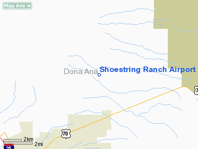
| From nearest city: | 4 nautical miles W of Organ, NM |
| Location: | Dona Ana County, NM |
| Magnetic Variation: | 11E (1985) |
Owner & Manager
| Ownership: | Privately owned |
| Owner: | Donald L. Hoihjelle |
| Address: | 9200 Holman Road
Las Cruces, NM 88012 |
| Phone number: | 505-382-5639 |
| Manager: | Donald L. Hoihjelle |
| Address: | 9200 Holman Road
Las Cruces, NM 88012 |
| Phone number: | 505-382-5639 |
Airport Operations and Facilities
| Airport Use: | Private |
| Wind indicator: | Yes |
| Segmented Circle: | No |
| Control Tower: | No |
| Landing fee charge: | No |
| Sectional chart: | Albuquerque |
| Region: | ASW - Southwest |
| Boundary ARTCC: | ZAB - Albuquerque |
| Tie-in FSS: | ABQ - Albuquerque |
| FSS on Airport: | No |
| FSS Toll Free: | 1-800-WX-BRIEF |
Airport Services
| Airframe Repair: | MAJOR |
| Power Plant Repair: | MAJOR |
Runway Information
Runway 08/26
| Dimension: | 2500 x 25 ft / 762.0 x 7.6 m |
| Surface: | DIRT, |
| |
Runway 08 |
Runway 26 |
| Traffic Pattern: | Left | Right |
| Obstruction: | 30 ft pline, 115.0 ft from runway | , 0.0 ft from runway |
|
Radio Navigation Aids
| ID |
Type |
Name |
Ch |
Freq |
Var |
Dist |
| EL | NDB | Valtr | | 242.00 | 11E | 39.6 nm |
| ALM | NDB | Alamogordo | | 341.00 | 11E | 43.0 nm |
| HMN | TACAN | Holloman | 092X | | 10E | 38.3 nm |
| BWS | VOR/DME | Boles | 033X | 109.60 | 11E | 40.7 nm |
| EWM | VORTAC | Newman | 071X | 112.40 | 12E | 36.1 nm |
| ELP | VORTAC | El Paso | 099X | 115.20 | 12E | 42.8 nm |
| DMN | VORTAC | Deming | 023X | 108.60 | 12E | 48.1 nm |
| ELP | VOT | El Paso Intl | | 111.00 | | 41.0 nm |
Images and information placed above are from
http://www.airport-data.com/airport/NM79/
We thank them for the data!
| General Info
|
| Country |
United States
|
| State |
NEW MEXICO
|
| FAA ID |
NM79
|
| Latitude |
32-26-35.325N
|
| Longitude |
106-40-47.007W
|
| Elevation |
4440 feet
|
| Near City |
ORGAN
|
We don't guarantee the information is fresh and accurate. The data may
be wrong or outdated.
For more up-to-date information please refer to other sources.
|
|


