|
|
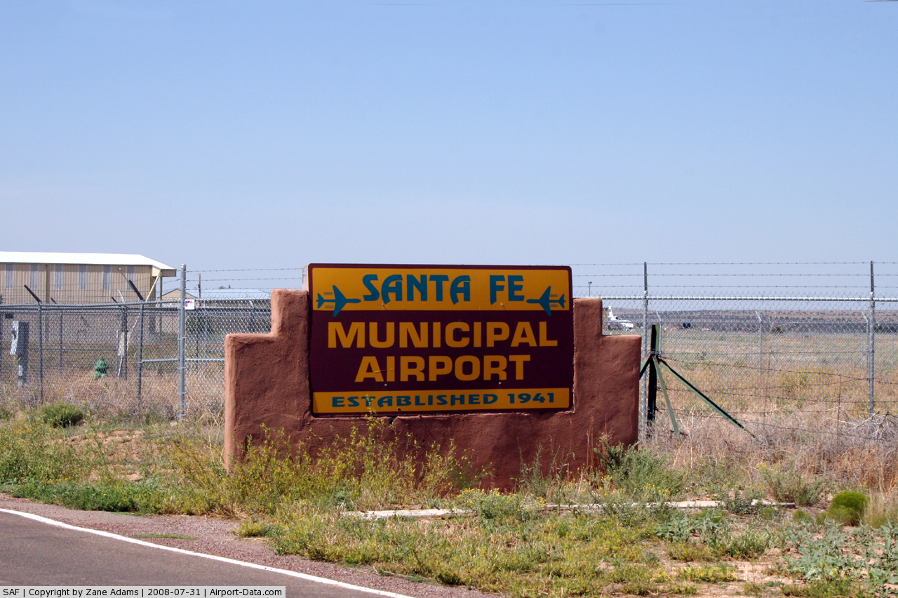
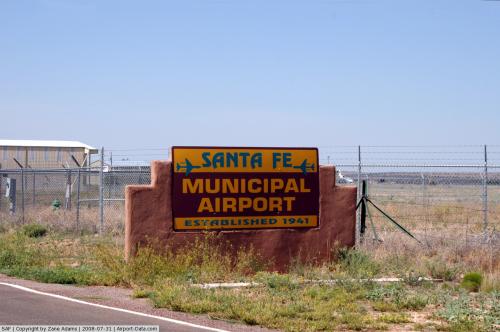
| Santa Fe Municipal Airport |
| IATA: SAF – ICAO: KSAF – FAA LID: SAF |
| Summary |
| Airport type |
Public |
| Operator |
City of Santa Fe |
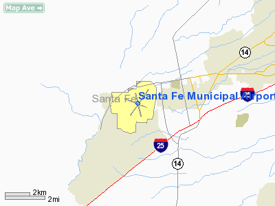
| Location |
Santa Fe, New Mexico |
| Elevation AMSL |
6,348 ft / 1934.9 m |
| Coordinates |
35°37′02″N 106°05′22″W / 35.61722°N 106.08944°W / 35.61722; -106.08944Coordinates: 35°37′02″N 106°05′22″W / 35.61722°N 106.08944°W / 35.61722; -106.08944 |
| Runways |
| Direction |
Length |
Surface |
| ft |
m |
| 2/20 |
8,342 |
2,543 |
Asphalt |
| 15/33 |
6,307 |
1,922 |
Asphalt |
| 10/28 |
6,300 |
1,920 |
Asphalt |
Santa Fe Municipal Airport (IATA: SAF, ICAO: KSAF) is a public airport located nine miles (14 km) southwest of the central business district (CBD) of Santa Fe, a city in Santa Fe County, New Mexico, USA. It covers 2,120 acres (858 ha) and has three runways.
Historically, the airport had non-stop Douglas DC-9 jet service to Dallas Love Field on Texas International Airlines. Period without commercial airline service
In June 2007, the airport was upgraded to Class 1 status to allow regional jet service. The city's government and interested airlines entered negotiations to split the cost of necessary upgrades to the facility to cope with increased passengers. In July 2007, Delta Air Lines announced new regional jet service would commence between Santa Fe and Los Angeles International Airport, as well as Salt Lake City International Airport; this would have been the first regional jet service for the Santa Fe Municipal Airport. All scheduled services, including planned American Airlines flights to Dallas-Fort Worth International Airport and Los Angeles International Airport announced shortly after Delta, were suspended indefinitely pending federal approval of an environmental assessment. Both Delta and American removed all flights to Santa Fe from their schedules and it was unknown if or when flights would begin. The completion of the environmental impact statement was announced on February 26, 2009, but neither Delta or American Airlines immediately announced any resumption of their intentions to serve the facility, citing changed economic conditions. On March 12, 2009 the City of Santa Fe announced that American Airlines' regional affiliate American Eagle would begin one daily flight to Dallas-Fort Worth International Airport on June 11, 2009. On the same day service began, American Eagle also announced additional service to Los Angeles International Airport beginning November 19, 2009.
On July 27, 2009, American Eagle announced a second daily flight to Dallas-Fort Worth International Airport. Service began on November 19, 2009. On December 14, 2009, a third daily flight to Dallas-Fort Worth was announced. Service began on February 11, 2010. However, on June 18, 2010, it was announced that service would temporarily revert to two daily flights to Dallas-Fort Worth in August 2010, with the third flight expected to return in April 2011.
Airlines and destinations
| Airlines |
Destinations |
| American Eagle |
Dallas/Fort Worth, Los Angeles |
The above content comes from Wikipedia and is published under free licenses – click here to read more.
 |
(Click on the photo to enlarge) |
 |
(Click on the photo to enlarge) |
 |
(Click on the photo to enlarge) |
 |
(Click on the photo to enlarge) |
Location & QuickFacts
| FAA Information Effective: | 2008-09-25 |
| Airport Identifier: | SAF |
| Airport Status: | Operational |
| Longitude/Latitude: | 106-05-21.9220W/35-37-01.5910N
-106.089423/35.617109 (Estimated) |
| Elevation: | 6348 ft / 1934.87 m (Surveyed) |
| Land: | 2128 acres |
| From nearest city: | 9 nautical miles SW of Santa Fe, NM |
| Location: | Santa Fe County, NM |
| Magnetic Variation: | 12E (1980) |
Owner & Manager
| Ownership: | Publicly owned |
| Owner: | City Of Santa Fe |
| Address: | Po Box 909
Santa Fe, NM 87504-0909 |
| Phone number: | 505-955-6509 |
| Manager: | James H. Montman |
| Address: | Po Box 909
Santa Fe, NM 87504-0909 |
| Phone number: | 505-955-2900 |
Airport Operations and Facilities
| Airport Use: | Open to public |
| Wind indicator: | Yes |
| Segmented Circle: | Yes |
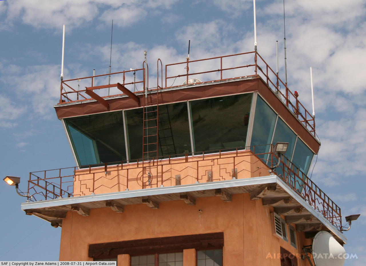
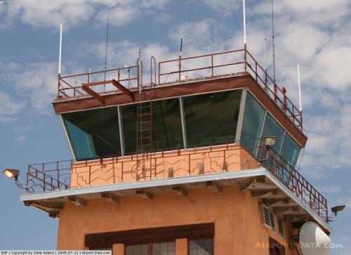
| Control Tower: | Yes |
| Lighting Schedule: | DUSK-DAWN
WHEN ATCT CLSD MIRL RY 02/20 PRESET LOW INTST; TO INCR INTST AND ACTVT MIRL RY 15/33 - CTAF. |
| Beacon Color: | Clear-Green (lighted land airport) |
| Landing fee charge: | No |
| Sectional chart: | Albuquerque |
| Region: | ASW - Southwest |
| Boundary ARTCC: | ZAB - Albuquerque |
| Tie-in FSS: | ABQ - Albuquerque |
| FSS on Airport: | No |
| FSS Toll Free: | 1-800-WX-BRIEF |
| NOTAMs Facility: | SAF (NOTAM-d service avaliable) |
| Certification type/date: | I A U 11/2005
PPR 24 HRS FOR ACR OPNS WITH MORE THAN 30 PSGR SEATS CALL AMGR AT 505-955-2900. |
| Federal Agreements: | NGY3 |
Airport Communications
| CTAF: | 119.500 |
| Unicom: | 122.950 |
Airport Services
| Fuel available: | 100LLA1 A1+ |
| Airframe Repair: | MINOR |
| Power Plant Repair: | MAJOR |
| Bottled Oxygen: | HIGH/LOW |
| Bulk Oxygen: | HIGH/LOW |
Runway Information
Runway 02/20
| Dimension: | 8342 x 150 ft / 2542.6 x 45.7 m |
| Surface: | ASPH, Good Condition |
| Surface Treatment: | Porous Friction Course |
| Weight Limit: | Single wheel: 48000 lbs.
Dual wheel: 65000 lbs.
Dual tandem wheel: 105000 lbs. |
| Edge Lights: | Medium |
| |
Runway 02 |
Runway 20 |
| Longitude: | 106-05-46.0620W | 106-04-47.9650W |
| Latitude: | 35-36-30.2400N | 35-37-37.7040N |
| Elevation: | 6274.00 ft | 6348.00 ft |
| Alignment: | 35 | 127 |
| ILS Type: | ILS/DME
| |
| Traffic Pattern: | Left | Left |
| Markings: | Precision instrument, Good Condition | Precision instrument, Good Condition |
| Crossing Height: | 54.00 ft | 54.00 ft |
| VASI: | 4-box on left side | 4-box on left side |
| Visual Glide Angle: | 3.00° | 3.00° |
| Runway End Identifier: | | Yes |
| Obstruction: | 6 ft hill, 225.0 ft from runway, 226 ft left of centerline, 4:1 slope to clear | , 50:1 slope to clear |
|
Runway 10/28
| Dimension: | 6300 x 75 ft / 1920.2 x 22.9 m |
| Surface: | ASPH, Good Condition |
| Surface Treatment: | Porous Friction Course |
| Weight Limit: | Single wheel: 30000 lbs. |
| |
Runway 10 |
Runway 28 |
| Longitude: | 106-06-04.9880W | 106-04-54.0840W |
| Latitude: | 35-37-14.0160N | 35-36-50.9950N |
| Elevation: | 6281.00 ft | 6297.00 ft |
| Alignment: | 112 | 127 |
| Traffic Pattern: | Left | Left |
| Markings: | Non-precision instrument, Good Condition | Non-precision instrument, Good Condition |
| Obstruction: | , 50:1 slope to clear | 11 ft road, 250.0 ft from runway, 260 ft right of centerline, 4:1 slope to clear |
|
Runway 15/33
| Dimension: | 6307 x 100 ft / 1922.4 x 30.5 m |
| Surface: | ASPH, |
| Surface Treatment: | Saw-cut or plastic Grooved |
| Weight Limit: | Single wheel: 48000 lbs.
Dual wheel: 65000 lbs.
Dual tandem wheel: 105000 lbs. |
| Edge Lights: | Medium |
| |
Runway 15 |
Runway 33 |
| Longitude: | 106-05-29.5910W | 106-05-12.0230W |
| Latitude: | 35-37-27.8700N | 35-36-27.1850N |
| Elevation: | 6317.00 ft | 6270.00 ft |
| Alignment: | 127 | 127 |
| Traffic Pattern: | Left | Left |
| Markings: | Non-precision instrument, Good Condition | Non-precision instrument, Good Condition |
| Crossing Height: | 33.00 ft | 62.00 ft |
| VASI: | pulsating/steady burning on left side | 4-box on right side
VASI OTS INDEFLY. |
| Visual Glide Angle: | 3.00° | 3.00° |
| Runway End Identifier: | Yes | Yes |
|
Radio Navigation Aids
| ID |
Type |
Name |
Ch |
Freq |
Var |
Dist |
| ILT | NDB | Isleta | | 247.00 | 11E | 46.0 nm |
| OTO | VOR | Otto | | 114.00 | 13E | 33.6 nm |
| SAF | VORTAC | Santa Fe | 043X | 110.60 | 13E | 4.8 nm |
| FTI | VORTAC | Fort Union | 120X | 117.30 | 13E | 46.7 nm |
| ABQ | VORTAC | Albuquerque | 079X | 113.20 | 13E | 49.6 nm |
| ABQ | VOT | Albuquerque Intl | | 111.00 | | 42.9 nm |
Remarks
- ARMY NATIONAL GUARD AVIATION ON FIELD.
- DOGS & WILDLIFE ACTIVITY ON & INVOF ARPT.
Images and information placed above are from
http://www.airport-data.com/airport/SAF/
We thank them for the data!
| General Info
|
| Country |
United States
|
| State |
NEW MEXICO
|
| FAA ID |
SAF
|
| Latitude |
35-37-00.400N
|
| Longitude |
106-05-17.300W
|
| Elevation |
6348 feet
|
| Near City |
SANTA FE
|
We don't guarantee the information is fresh and accurate. The data may
be wrong or outdated.
For more up-to-date information please refer to other sources.
|
|