 |
|
Location & QuickFacts
| FAA Information Effective: | 2008-09-25 |
| Airport Identifier: | NM27 |
| Airport Status: | Operational |
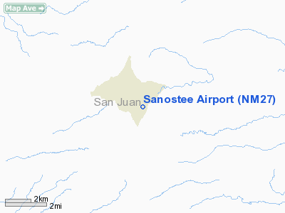
| Longitude/Latitude: | 108-51-41.3280W/36-25-21.0110N
-108.861480/36.422503 (Estimated) |
| Elevation: | 5950 ft / 1813.56 m (Estimated) |
| Land: | 0 acres |
| From nearest city: | 43 nautical miles N of Gallup, NM |
| Location: | Mc Kinley County, NM |
| Magnetic Variation: | 12E (1985) |
Owner & Manager
| Ownership: | Publicly owned |
| Owner: | Navajo Tribe |
| Address: | Box 706
Window Rock, AZ 86515 |
| Phone number: | 602-871-6466 |
| Manager: | James Pomeroy |
| Address: | Box 706
Window Rock, AZ 86515 |
| Phone number: | 602-871-6466 |
Airport Operations and Facilities
| Airport Use: | Private |
| Wind indicator: | No |
| Segmented Circle: | No |
| Control Tower: | No |
| Landing fee charge: | No |
| Sectional chart: | Denver |
| Region: | ASW - Southwest |
| Boundary ARTCC: | ZDV - Denver |
| Tie-in FSS: | ABQ - Albuquerque |
| FSS on Airport: | No |
| FSS Toll Free: | 1-800-WX-BRIEF |
Runway Information
Runway 02/20
| Dimension: | 3500 x 50 ft / 1066.8 x 15.2 m |
| Surface: | DIRT, |
| |
Runway 02 |
Runway 20 |
| Traffic Pattern: | Left | Left |
|
Radio Navigation Aids
| ID |
Type |
Name |
Ch |
Freq |
Var |
Dist |
| AWR | NDB | Window Rock | | 254.00 | 12E | 46.7 nm |
| RSK | VORTAC | Rattlesnake | 100X | 115.30 | 14E | 41.7 nm |
Remarks
- POSSIBLE STOCK GRAZING AREA
- NOT ADVISEABLE TO USE UNLESS ACQUAINTED WITH AREA
- CAUTION DURING RAINY SEASON & WINTER
Images and information placed above are from
http://www.airport-data.com/airport/NM27/
We thank them for the data!
| General Info
|
| Country |
United States
|
| State |
NEW MEXICO
|
| FAA ID |
NM27
|
| Latitude |
36-25-21.011N
|
| Longitude |
108-51-41.328W
|
| Elevation |
5950 feet
|
| Near City |
GALLUP
|
We don't guarantee the information is fresh and accurate. The data may
be wrong or outdated.
For more up-to-date information please refer to other sources.
|
|


