 |
|
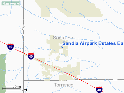
Sandia Airpark Estates East Airport |
Location & QuickFacts
| FAA Information Effective: | 2008-09-25 |
| Airport Identifier: | 1N1 |
| Airport Status: | Operational |
| Longitude/Latitude: | 106-10-02.0890W/35-05-40.1660N
-106.167247/35.094491 (Estimated) |
| Elevation: | 6550 ft / 1996.44 m (Estimated) |
| Land: | 160 acres |
| From nearest city: | 2 nautical miles NE of Edgewood, NM |
| Location: | Santa Fe County, NM |
| Magnetic Variation: | 11E (1985) |
Owner & Manager
| Ownership: | Privately owned |
| Owner: | Sandia Airpark Inc |
| Address: | 2627 Coors Blvd Sw
Albuquerque, NM 87121 |
| Phone number: | 505-269-2998 |
| Manager: | Tina Chapa |
| Address: | 71 Rainbow Road
Edgewood, NM 87105 |
| Phone number: | 505-281-0322 |
Airport Operations and Facilities
| Airport Use: | Open to public |
| Wind indicator: | Yes |
| Control Tower: | No |
| Lighting Schedule: | PHONE REQ
FOR ROTG BCN CALL 505-281-0322. |
| Beacon Color: | Clear-Green (lighted land airport) |
| Landing fee charge: | No |
| Sectional chart: | Albuquerque |
| Region: | ASW - Southwest |
| Boundary ARTCC: | ZAB - Albuquerque |
| Tie-in FSS: | ABQ - Albuquerque |
| FSS on Airport: | No |
| FSS Toll Free: | 1-800-WX-BRIEF |
| NOTAMs Facility: | ABQ (NOTAM-d service avaliable) |
Airport Communications
| CTAF: | 122.800 |
| Unicom: | 122.800 |
Airport Services
| Fuel available: | 100LL |
| Airframe Repair: | MAJOR |
| Power Plant Repair: | MAJOR |
Runway Information
Runway 09/27
| Dimension: | 4830 x 30 ft / 1472.2 x 9.1 m |
| Surface: | ASPH, Fair Condition |
| Edge Lights: | Low |
| |
Runway 09 |
Runway 27 |
| Traffic Pattern: | Left | Left |
| Markings: | Basic, Fair Condition | Basic, Fair Condition |
| Displaced threshold: | 705.00 ft | 0.00 ft |
|
Radio Navigation Aids
| ID |
Type |
Name |
Ch |
Freq |
Var |
Dist |
| ILT | NDB | Isleta | | 247.00 | 11E | 23.2 nm |
| OTO | VOR | Otto | | 114.00 | 13E | 11.5 nm |
| SAF | VORTAC | Santa Fe | 043X | 110.60 | 13E | 27.3 nm |
| ABQ | VORTAC | Albuquerque | 079X | 113.20 | 13E | 32.1 nm |
| CNX | VORTAC | Corona | 102X | 115.50 | 13E | 50.0 nm |
| ABQ | VOT | Albuquerque Intl | | 111.00 | | 21.9 nm |
Images and information placed above are from
http://www.airport-data.com/airport/1N1/
We thank them for the data!
| General Info
|
| Country |
United States
|
| State |
NEW MEXICO
|
| FAA ID |
1N1
|
| Latitude |
35-05-40.166N
|
| Longitude |
106-10-02.089W
|
| Elevation |
6550 feet
|
| Near City |
EDGEWOOD
|
We don't guarantee the information is fresh and accurate. The data may
be wrong or outdated.
For more up-to-date information please refer to other sources.
|
|


