 |
|
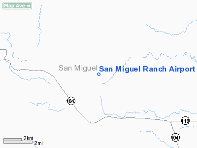
Location & QuickFacts
| FAA Information Effective: | 2008-09-25 |
| Airport Identifier: | NM53 |
| Airport Status: | Operational |
| Longitude/Latitude: | 104-35-01.9500W/35-30-36.1620N
-104.583875/35.510045 (Estimated) |
| Elevation: | 6300 ft / 1920.24 m (Estimated) |
| Land: | 0 acres |
| From nearest city: | 60 nautical miles E of Las Vegas, NM |
| Location: | San Miguel County, NM |
| Magnetic Variation: | 11E (1985) |
Owner & Manager
| Ownership: | Privately owned |
| Owner: | San Miguel Ranch |
| Address: | Po Box 2534
Las Vegas, NM 87701 |
| Phone number: | 505-641-5340 |
| Manager: | Charles Dunagin |
| Address: | Po Box 2534
Las Vegas, NM 87701 |
| Phone number: | 505-641-5340 |
Airport Operations and Facilities
| Airport Use: | Private |
| Wind indicator: | Yes |
| Segmented Circle: | No |
| Control Tower: | No |
| Sectional chart: | Albuquerque |
| Region: | ASW - Southwest |
| Boundary ARTCC: | ZAB - Albuquerque |
| Tie-in FSS: | ABQ - Albuquerque |
| FSS on Airport: | No |
| FSS Toll Free: | 1-800-WX-BRIEF |
Runway Information
Runway 03/21
| Dimension: | 5600 x 100 ft / 1706.9 x 30.5 m |
| Surface: | GRVL, |
| |
Runway 03 |
Runway 21 |
| Traffic Pattern: | Left | Left |
| Obstruction: | 10 ft trees, 100.0 ft from runway | |
|
Radio Navigation Aids
| ID |
Type |
Name |
Ch |
Freq |
Var |
Dist |
| FTI | VORTAC | Fort Union | 120X | 117.30 | 13E | 28.4 nm |
| ACH | VORTAC | Anton Chico | 125X | 117.80 | 12E | 32.8 nm |
Remarks
- OWNER DESIRES ARPT NOT BE CHARTED.
Images and information placed above are from
http://www.airport-data.com/airport/NM53/
We thank them for the data!
| General Info
|
| Country |
United States
|
| State |
NEW MEXICO
|
| FAA ID |
NM53
|
| Latitude |
35-30-36.162N
|
| Longitude |
104-35-01.950W
|
| Elevation |
6300 feet
|
| Near City |
LAS VEGAS
|
We don't guarantee the information is fresh and accurate. The data may
be wrong or outdated.
For more up-to-date information please refer to other sources.
|
|


