 |
|
| Ohkay Owingeh Airport |
| IATA: ESO – ICAO: none – FAA LID: E14 |
| Summary |
| Airport type |
Public |
| Owner |
Ohkay Owingeh Tribal Council |
| Serves |
Española, New Mexico |
| Elevation AMSL |
5,790 ft / 1,765 m |
| Coordinates |
36°01′34″N 106°02′43″W / 36.02611°N 106.04528°W / 36.02611; -106.04528 |
| Runways |
| Direction |
Length |
Surface |
| ft |
m |
| 16/34 |
5,007 |
1,526 |
Asphalt |
| 6/24 |
3,100 |
945 |
Dirt |
| Statistics (2009) |
| Aircraft operations |
1,000 |
| Source: Federal Aviation Administration |
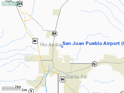
Ohkay Owingeh Airport (IATA: ESO, FAA LID: E14, formerly Q14) is a public use airport located in Rio Arriba County, New Mexico, United States. It is three nautical miles (6 km) northeast of the central business district of the city of Española. The airport is owned by the Ohkay Owingeh Tribal Council.
The airport was known as the San Juan Pueblo Airport until 2008. The name change occurred due to the San Juan Pueblo returning to its pre-Spanish name in November 2005. The Tewa name Ohkay Owingeh means "place of the strong people".
Facilities and aircraft
The airport covers an area of 236 acres (96 ha) at an elevation of 5,790 feet (1,765 m) above mean sea level. It has two runways: 16/34 is 5,007 by 75 feet (1,526 x 23 m) with an asphalt pavement; 6/24 is 3,100 by 35 feet (945 x 11 m) with a dirt surface. For the 12-month period ending April 8, 2009, the airport had 1,000 general aviation aircraft operations, an average of 83 per month.
The above content comes from Wikipedia and is published under free licenses – click here to read more.
Location & QuickFacts
| FAA Information Effective: | 2008-09-25 |
| Airport Identifier: | E14 |
| Airport Status: | Operational |
| Longitude/Latitude: | 106-02-45.0000W/36-01-48.0000N
-106.045833/36.030000 (Estimated) |
| Elevation: | 5790 ft / 1764.79 m (Surveyed) |
| Land: | 236 acres |
| From nearest city: | 3 nautical miles NE of Espanola, NM |
| Location: | Rio Arriba County, NM |
| Magnetic Variation: | 11E (1985) |
Owner & Manager
| Ownership: | Publicly owned |
| Owner: | San Juan Pueblo |
| Address: | P.o. Box 1079
San Juan Pueblo, NM 87566 |
| Phone number: | 505-747-0700 |
| Manager: | Ron Lovato |
| Address: | Po Box 1079
San Juan Pueblo, NM 87566 |
| Phone number: | 505-660-6113 |
Airport Operations and Facilities
| Airport Use: | Open to public |
| Wind indicator: | Yes |
| Segmented Circle: | Yes |
| Control Tower: | No |
| Lighting Schedule: | DUSK-DAWN |
| Beacon Color: | Clear-Green (lighted land airport) |
| Landing fee charge: | No |
| Sectional chart: | Denver |
| Region: | ASW - Southwest |
| Boundary ARTCC: | ZAB - Albuquerque |
| Tie-in FSS: | ABQ - Albuquerque |
| FSS on Airport: | No |
| FSS Toll Free: | 1-800-WX-BRIEF |
| NOTAMs Facility: | ABQ (NOTAM-d service avaliable) |
| Federal Agreements: | N1 |
Airport Communications
Airport Services
| Airframe Repair: | NONE |
| Power Plant Repair: | NONE |
| Bottled Oxygen: | NONE |
| Bulk Oxygen: | NONE |
Runway Information
Runway 06/24
| Dimension: | 3100 x 35 ft / 944.9 x 10.7 m |
| Surface: | DIRT, Good Condition |
| |
Runway 06 |
Runway 24 |
| Traffic Pattern: | Left | Left |
| Obstruction: | , 50:1 slope to clear | 4 ft fence, 0.0 ft from runway |
|
Runway 16/34
| Dimension: | 5000 x 75 ft / 1524.0 x 22.9 m |
| Surface: | ASPH, |
| Weight Limit: | Single wheel: 18000 lbs. |
| Edge Lights: | Medium |
| |
Runway 16 |
Runway 34 |
| Traffic Pattern: | Left | Left |
| Markings: | Basic, Good Condition | Basic, Good Condition |
| Obstruction: | , 50:1 slope to clear | 5 ft fence, 300.0 ft from runway, 20:1 slope to clear |
|
Radio Navigation Aids
| ID |
Type |
Name |
Ch |
Freq |
Var |
Dist |
| SKX | NDB | Ski | | 414.00 | 11E | 31.3 nm |
| SAF | VORTAC | Santa Fe | 043X | 110.60 | 13E | 29.4 nm |
| TAS | VORTAC | Taos | 123X | 117.60 | 13E | 35.4 nm |
| FTI | VORTAC | Fort Union | 120X | 117.30 | 13E | 49.7 nm |
Remarks
- AIRPORT ACCESS GATE COMBINATION - 4751.
- MAIN GATE LOCKED AT ALL TIMES. CALL PUEBLO OR AMGR TO ENTER/EXIT 505-747-0700 OR 505-660-6113.
Images and information placed above are from
http://www.airport-data.com/airport/E14/
We thank them for the data!
| General Info
|
| Country |
United States
|
| State |
NEW MEXICO
|
| FAA ID |
E14
|
| Latitude |
36.030000
36° 01' 48.00" N
|
| Longitude |
-106.045833
106° 02' 45.00" W
|
| Elevation |
5790 feet
1765 meters
|
| Magnetic Variation |
009° E (01/06)
|
| Beacon |
Yes
|
| Operating Agency |
U.S.CIVIL AIRPORT WHEREIN PERMIT COVERS USE BY TRANSIT MILITARY AIRCRAFT
|
We don't guarantee the information is fresh and accurate. The data may
be wrong or outdated.
For more up-to-date information please refer to other sources.
|
|


