 |
|
Location & QuickFacts
| FAA Information Effective: | 2008-09-25 |
| Airport Identifier: | 98NM |
| Airport Status: | Operational |
| Longitude/Latitude: | 104-43-04.9700W/36-04-36.1290N
-104.718047/36.076703 (Estimated) |
| Elevation: | 6310 ft / 1923.29 m (Estimated) |
| Land: | 0 acres |
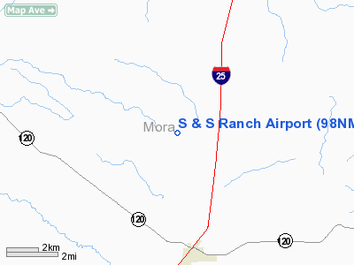
| From nearest city: | 4 nautical miles NW of Wagon Mound, NM |
| Location: | Mora County, NM |
| Magnetic Variation: | 11E (1985) |
Owner & Manager
| Ownership: | Privately owned |
| Owner: | S & S Ranch Co Inc |
| Address: |
|
| Manager: | Don W Schutz |
| Address: | Box 338
Wagon Mound, NM 87752 |
| Phone number: | 505-666-2456 |
Airport Operations and Facilities
| Airport Use: | Private |
| Segmented Circle: | No |
| Control Tower: | No |
| Landing fee charge: | No |
| Sectional chart: | Denver |
| Region: | ASW - Southwest |
| Boundary ARTCC: | ZAB - Albuquerque |
| Tie-in FSS: | ABQ - Albuquerque |
| FSS on Airport: | No |
| FSS Toll Free: | 1-800-WX-BRIEF |
Airport Services
| Airframe Repair: | NONE |
| Power Plant Repair: | NONE |
Runway Information
Runway 08/26
| Dimension: | 5200 x 50 ft / 1585.0 x 15.2 m |
| Surface: | TURF, |
| |
Runway 08 |
Runway 26 |
| Traffic Pattern: | Left | Left |
| Obstruction: | 15 ft hngr | |
|
Radio Navigation Aids
| ID |
Type |
Name |
Ch |
Freq |
Var |
Dist |
| MXR | NDB | Maxwell | | 284.00 | 10E | 38.5 nm |
| CIM | VORTAC | Cimarron | 111X | 116.40 | 13E | 26.0 nm |
| FTI | VORTAC | Fort Union | 120X | 117.30 | 13E | 32.4 nm |
Images and information placed above are from
http://www.airport-data.com/airport/98NM/
We thank them for the data!
| General Info
|
| Country |
United States
|
| State |
NEW MEXICO
|
| FAA ID |
98NM
|
| Latitude |
36-04-36.129N
|
| Longitude |
104-43-04.970W
|
| Elevation |
6310 feet
|
| Near City |
WAGON MOUND
|
We don't guarantee the information is fresh and accurate. The data may
be wrong or outdated.
For more up-to-date information please refer to other sources.
|
|


