 |
|
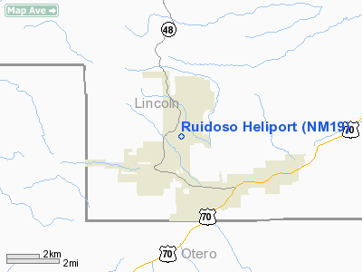
Location & QuickFacts
| FAA Information Effective: | 2008-09-25 |
| Airport Identifier: | NM19 |
| Airport Status: | Operational |
| Longitude/Latitude: | 105-39-46.9460W/33-21-05.2960N
-105.663041/33.351471 (Estimated) |
| Elevation: | 6838 ft / 2084.22 m (Estimated) |
| Land: | 1 acres |
| From nearest city: | 2 nautical miles SW of Ruidoso, NM |
| Location: | Lincoln County, NM |
| Magnetic Variation: | 11E (1985) |
Owner & Manager
| Ownership: | Publicly owned |
| Owner: | Village Of Ruidoso |
| Address: | P.o. Drawer 69
Ruidoso, NM 88345 |
| Phone number: | 505-336-8111 |
| Manager: | Tim Morris |
| Address: | P.o. Drawer 69
Ruidoso, NM 88345 |
| Phone number: | 505-336-8111 |
Airport Operations and Facilities
| Airport Use: | Private |
| Segmented Circle: | No |
| Control Tower: | No |
| Sectional chart: | Albuquerque |
| Region: | ASW - Southwest |
| Boundary ARTCC: | ZAB - Albuquerque |
| Tie-in FSS: | ABQ - Albuquerque |
| FSS on Airport: | No |
| FSS Toll Free: | 1-800-WX-BRIEF |
Runway Information
Helipad H1
| Dimension: | 100 x 100 ft / 30.5 x 30.5 m |
| Surface: | ASPH, |
| |
Runway H1 |
Runway |
| Traffic Pattern: | Left | Left |
|
Radio Navigation Aids
| ID |
Type |
Name |
Ch |
Freq |
Var |
Dist |
| CEP | NDB | Capitan | | 278.00 | 10E | 15.4 nm |
| ALM | NDB | Alamogordo | | 341.00 | 11E | 34.1 nm |
| HMN | TACAN | Holloman | 092X | | 10E | 37.0 nm |
| BWS | VOR/DME | Boles | 033X | 109.60 | 11E | 36.4 nm |
Images and information placed above are from
http://www.airport-data.com/airport/NM19/
We thank them for the data!
| General Info
|
| Country |
United States
|
| State |
NEW MEXICO
|
| FAA ID |
NM19
|
| Latitude |
33-21-05.296N
|
| Longitude |
105-39-46.946W
|
| Elevation |
6838 feet
|
| Near City |
RUIDOSO
|
We don't guarantee the information is fresh and accurate. The data may
be wrong or outdated.
For more up-to-date information please refer to other sources.
|
|


