 |
|
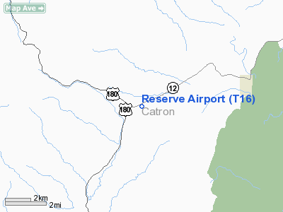
Location & QuickFacts
| FAA Information Effective: | 2008-09-25 |
| Airport Identifier: | T16 |
| Airport Status: | Operational |
| Longitude/Latitude: | 108-50-58.0000W/33-41-39.0000N
-108.849444/33.694167 (Estimated) |
| Elevation: | 6360 ft / 1938.53 m (Estimated) |
| Land: | 90 acres |
| From nearest city: | 5 nautical miles SW of Reserve, NM |
| Location: | Catron County, NM |
| Magnetic Variation: | 12E (1985) |
Owner & Manager
| Ownership: | Publicly owned |
| Owner: | U. S. Forest Service
LEASED BY CATRON COUNTY. |
| Address: | Federal Building
Albuquerque, NM 87102 |
| Phone number: | 575-766-2444 |
| Manager: | Bill Aymar |
| Address: | Po Box 507
Reserve, NM 87830 |
| Phone number: | 575-533-6423 |
Airport Operations and Facilities
| Airport Use: | Open to public |
| Wind indicator: | Yes |
| Segmented Circle: | Yes |
| Control Tower: | No |
| Lighting Schedule: | DUSK-DAWN
ACTVT MIRL RY 06/24 - CTAF. |
| Beacon Color: | Clear-Green (lighted land airport) |
| Landing fee charge: | No |
| Sectional chart: | Albuquerque |
| Region: | ASW - Southwest |
| Boundary ARTCC: | ZAB - Albuquerque |
| Tie-in FSS: | ABQ - Albuquerque |
| FSS on Airport: | No |
| FSS Toll Free: | 1-800-WX-BRIEF |
| NOTAMs Facility: | ABQ (NOTAM-d service avaliable) |
| Federal Agreements: | NGY |
Airport Communications
Airport Services
Runway Information
Runway 06/24
| Dimension: | 4800 x 50 ft / 1463.0 x 15.2 m |
| Surface: | ASPH, Good Condition |
| Weight Limit: | Single wheel: 12500 lbs. |
| Edge Lights: | Medium |
| |
Runway 06 |
Runway 24 |
| Traffic Pattern: | Left | Left |
| Markings: | Basic, Good Condition | Basic, Good Condition |
| Crossing Height: | 0.00 ft | 40.00 ft |
| VASI: | | pulsating/steady burning on left side |
| Visual Glide Angle: | 0.00° | 4.00° |
| Obstruction: | 54 ft tree, 372.0 ft from runway, 215 ft left of centerline, 3:1 slope to clear
ROAD 160 FT LEFT AT CONTROLLING POINT. | 51 ft trees, 1392.0 ft from runway, 245 ft right of centerline, 23:1 slope to clear
6 FT FENCE 105 FT FM RY END. |
|
Radio Navigation Aids
| ID |
Type |
Name |
Ch |
Freq |
Var |
Dist |
| SJN | VORTAC | St Johns | 070X | 112.30 | 12E | 46.3 nm |
Remarks
- RWY 06/24 GRADIENT TWO PERCENT UP WEST.
- OBST LGTS LCTD ON MTN PEAKS OPR DUSK-DAWN.
- ELK ON & INVOF ARPT.
- PENETRATION OF TRANS SFC BY TREES BYD BOUNDARY FENCE N & S SIDES OF RY 06/24.
- OBSTN LGTS ON MTN PEAKS OTS INDEFLY.
Images and information placed above are from
http://www.airport-data.com/airport/T16/
We thank them for the data!
| General Info
|
| Country |
United States
|
| State |
NEW MEXICO
|
| FAA ID |
T16
|
| Latitude |
33.694167
33° 41' 39.00" N
|
| Longitude |
-108.849444
108° 50' 58.00" W
|
| Elevation |
6360 feet
1939 meters
|
| Magnetic Variation |
010° E (01/06)
|
| Beacon |
Yes
|
| Operating Agency |
U.S.FORESTRY SERVICE
|
| Daylight Saving Time |
Second Sunday in March at 0200 to first Sunday in November at 0200 local time (Exception Arizona and that portion of Indiana in the Eastern Time Zone)
|
We don't guarantee the information is fresh and accurate. The data may
be wrong or outdated.
For more up-to-date information please refer to other sources.
|
|


