 |
|
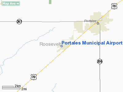
Location & QuickFacts
| FAA Information Effective: | 2008-09-25 |
| Airport Identifier: | PRZ |
| Airport Status: | Operational |
| Longitude/Latitude: | 103-24-37.2000W/34-08-43.7000N
-103.410333/34.145472 (Estimated) |
| Elevation: | 4078 ft / 1242.97 m (Surveyed) |
| Land: | 502 acres |
| From nearest city: | 4 nautical miles SW of Portales, NM |
| Location: | Roosevelt County, NM |
| Magnetic Variation: | 09E (2005) |
Owner & Manager
| Ownership: | Publicly owned |
| Owner: | City Of Portales |
| Address: | 100 W. 1st St.
Portales, NM 88130 |
| Phone number: | 575-356-6662 |
| Manager: | Mike Parkey
AMGR RESIDES ADJACENT TO ARPT. |
| Address: | 181 Airport Rd
Portales, NM 88130 |
| Phone number: | 575-478-2863 |
Airport Operations and Facilities
| Airport Use: | Open to public |
| Wind indicator: | Yes |
| Segmented Circle: | Yes |
| Control Tower: | No |
| Lighting Schedule: | DUSK-DAWN
MIRL RY 01/19 PRESET LOW INTST; TO INCR INTST AND ACTVT MIRL RY 08/26 - CTAF. |
| Beacon Color: | Clear-Green (lighted land airport) |
| Sectional chart: | Albuquerque |
| Region: | ASW - Southwest |
| Boundary ARTCC: | ZAB - Albuquerque |
| Tie-in FSS: | ABQ - Albuquerque |
| FSS on Airport: | No |
| FSS Toll Free: | 1-800-WX-BRIEF |
| NOTAMs Facility: | ABQ (NOTAM-d service avaliable) |
| Federal Agreements: | NGY |
Airport Communications
| CTAF: | 122.800 |
| Unicom: | 122.800 |
Airport Services
| Fuel available: | 100LLA |
| Airframe Repair: | MAJOR |
| Power Plant Repair: | MAJOR |
Runway Information
Runway 01/19
| Dimension: | 5700 x 60 ft / 1737.4 x 18.3 m |
| Surface: | ASPH, |
| Edge Lights: | Medium |
| |
Runway 01 |
Runway 19 |
| Longitude: | 103-24-55.5360W | 103-24-29.1850W |
| Latitude: | 34-08-17.2160N | 34-09-09.1570N |
| Elevation: | 4078.00 ft | 4044.00 ft |
| Alignment: | 23 | 127 |
| Traffic Pattern: | Left | Left |
| Markings: | Non-precision instrument, Good Condition | Non-precision instrument, Good Condition |
| Crossing Height: | 0.00 ft | 40.00 ft |
| VASI: | | pulsating/steady burning on left side |
| Visual Glide Angle: | 0.00° | 3.50° |
|
Runway 08/26
| Dimension: | 4560 x 60 ft / 1389.9 x 18.3 m |
| Surface: | ASPH, |
| Edge Lights: | Medium |
| |
Runway 08 |
Runway 26 |
| Longitude: | 103-24-57.8710W | 103-24-03.6300W |
| Latitude: | 34-08-44.3720N | 34-08-44.4570N |
| Elevation: | 4066.00 ft | 4058.00 ft |
| Alignment: | 90 | 127 |
| Traffic Pattern: | Left | Left |
| Markings: | Non-precision instrument, Good Condition | Non-precision instrument, Good Condition |
| Crossing Height: | 0.00 ft | 48.00 ft |
| VASI: | | pulsating/steady burning on left side |
| Visual Glide Angle: | 0.00° | 3.00° |
| Obstruction: | , 50:1 slope to clear | 30 ft pline, 1200.0 ft from runway, 34:1 slope to clear |
|
Radio Navigation Aids
| ID |
Type |
Name |
Ch |
Freq |
Var |
Dist |
| PRZ | NDB | Portales | | 407.00 | 09E | 0.4 nm |
| CVS | TACAN | Cannon | 053X | | 10E | 14.8 nm |
| TXO | VORTAC | Texico | 059X | 112.20 | 11E | 35.3 nm |
Images and information placed above are from
http://www.airport-data.com/airport/PRZ/
We thank them for the data!
| General Info
|
| Country |
United States
|
| State |
NEW MEXICO
|
| FAA ID |
PRZ
|
| Time |
UTC-7(-6DT)
|
| Latitude |
34.145472
34° 08' 43.70" N
|
| Longitude |
-103.410333
103° 24' 37.20" W
|
| Elevation |
4078 feet
1243 meters
|
| Type |
Civil
|
| Magnetic Variation |
008° E (01/06)
|
| Beacon |
Yes
|
| Operating Agency |
U.S.CIVIL AIRPORT WHEREIN PERMIT COVERS USE BY TRANSIT MILITARY AIRCRAFT
|
| Operating Hours |
SEE REMARKS FOR OPERATING HOURS OR COMMUNICATIONS FOR POSSIBLE HOURS
|
| Daylight Saving Time |
Second Sunday in March at 0200 to first Sunday in November at 0200 local time (Exception Arizona and that portion of Indiana in the Eastern Time Zone)
|
We don't guarantee the information is fresh and accurate. The data may
be wrong or outdated.
For more up-to-date information please refer to other sources.
|
|


