 |
|
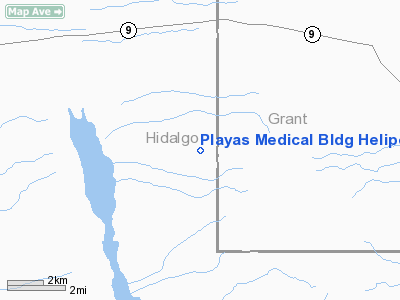
Playas Medical Bldg Heliport |
Location & QuickFacts
| FAA Information Effective: | 2008-09-25 |
| Airport Identifier: | 85NM |
| Airport Status: | Operational |
| Longitude/Latitude: | 108-32-04.1750W/31-54-52.3350N
-108.534493/31.914538 (Estimated) |
| Elevation: | 4506 ft / 1373.43 m (Estimated) |
| Land: | 0 acres |
| From nearest city: | 0 nautical miles N of Playas, NM |
| Location: | Hidalgo County, NM |
| Magnetic Variation: | 11E (1985) |
Owner & Manager
| Ownership: | Privately owned |
| Owner: | Nm Institute Of Mining & Technology |
| Address: | Po Box 9021
Playas, NM 88009 |
| Phone number: | 505-436-2224 |
| Manager: | David Manzano |
| Address: | Po Box 9021
Playas, NM 88009 |
| Phone number: | 505-436-2224 |
Airport Operations and Facilities
| Airport Use: | Private
MEDICAL. |
| Segmented Circle: | Yes |
| Control Tower: | No |
| Landing fee charge: | No |
| Sectional chart: | El Paso |
| Region: | ASW - Southwest |
| Boundary ARTCC: | ZAB - Albuquerque |
| Tie-in FSS: | ABQ - Albuquerque |
| FSS on Airport: | No |
| FSS Toll Free: | 1-800-WX-BRIEF |
Runway Information
Helipad H1
| Dimension: | 43 x 43 ft / 13.1 x 13.1 m |
| Surface: | ASPH, |
| |
Runway H1 |
Runway |
| Traffic Pattern: | Left | Left |
|
Radio Navigation Aids
| ID |
Type |
Name |
Ch |
Freq |
Var |
Dist |
| CUS | VOR/DME | Columbus | 049X | 111.20 | 12E | 49.3 nm |
| SSO | VORTAC | San Simon | 101X | 115.40 | 13E | 42.8 nm |
| SVC | VORTAC | Silver City | 045X | 110.80 | 13E | 47.4 nm |
Images and information placed above are from
http://www.airport-data.com/airport/85NM/
We thank them for the data!
| General Info
|
| Country |
United States
|
| State |
NEW MEXICO
|
| FAA ID |
85NM
|
| Latitude |
31-54-52.335N
|
| Longitude |
108-32-04.175W
|
| Elevation |
4506 feet
|
| Near City |
PLAYAS
|
We don't guarantee the information is fresh and accurate. The data may
be wrong or outdated.
For more up-to-date information please refer to other sources.
|
|


